Moorland Crosses 2

In my first blog on moorland crosses I mentioned the damage done to Young Ralph and the need for it to be repaired. I’d like to start this post with a similar tale.

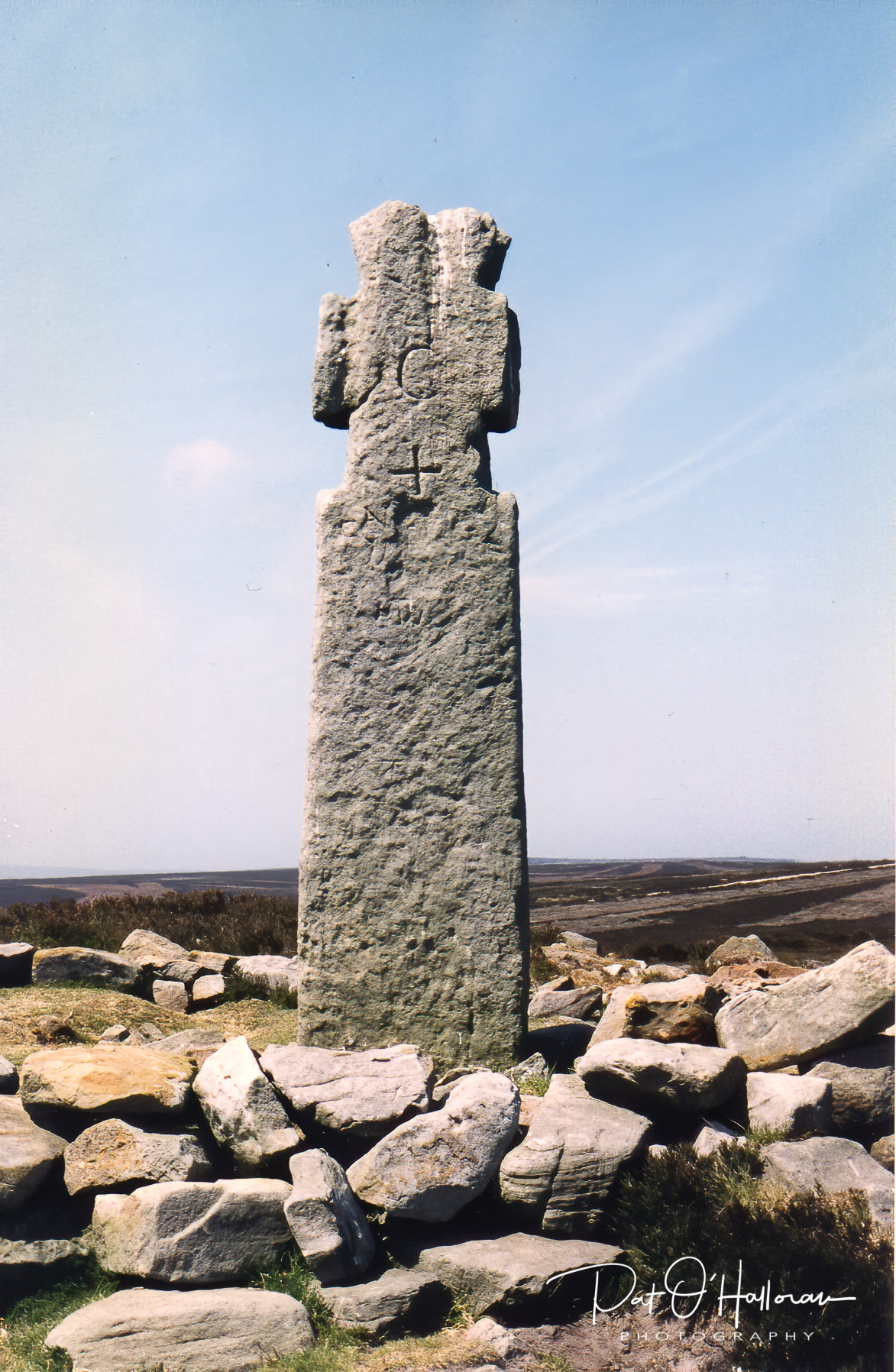
I first went to find Ainhowe or Ana Cross in 1997. It stands on Spaunton Moor not far from the top of Chimney Bank above Rosedale. I was very disappointed when I arrived to find only the base remaining and the shaft of the cross in pieces scattered around it. However, I later learnt it had collapsed in the winter of 1995 and was to be restored, this happened in 1998.

Ainhowe Cross in 1997

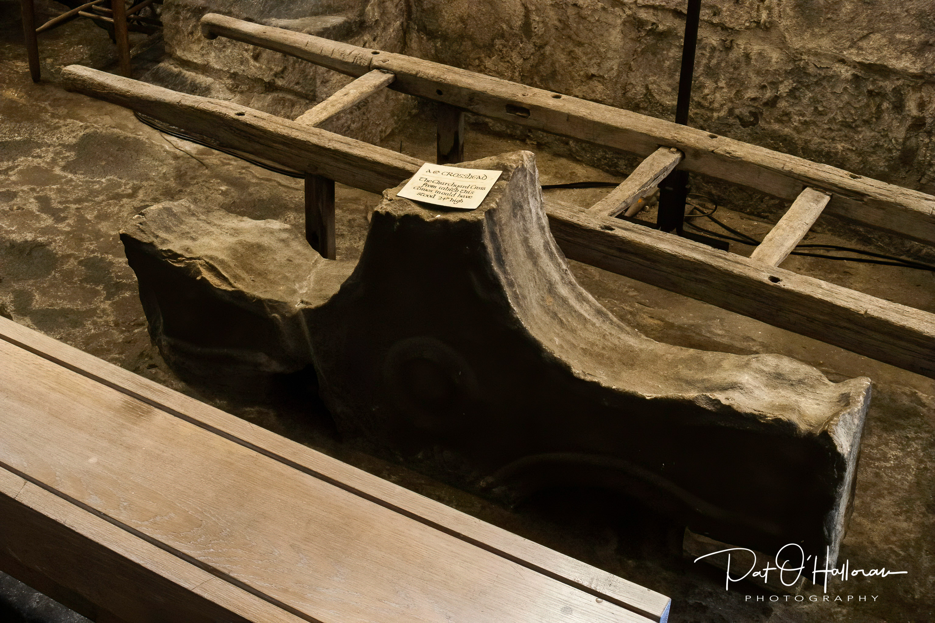
It is known as both Ainhowe Cross (also One Howe) and Ana Cross depending on where you look. It is believed that the original cross once stood up to a height of twenty-four feet, the cross we see now is a reconstruction of a replacement made in the 1949. In the crypt of Lastingham church there is part of a crosshead said to be from the original Ana Cross.

Ainhowe Cross in 1999

I have included a photograph of that crosshead but I apologise for the image quality, it is a scan of an old photograph taken in challenging conditions. The original cross no doubt marked part of the track system between Rosedale Priory and Lastingham, it would have been visible, and impressive, from quite a distance.

Possibly the original Ana Cross

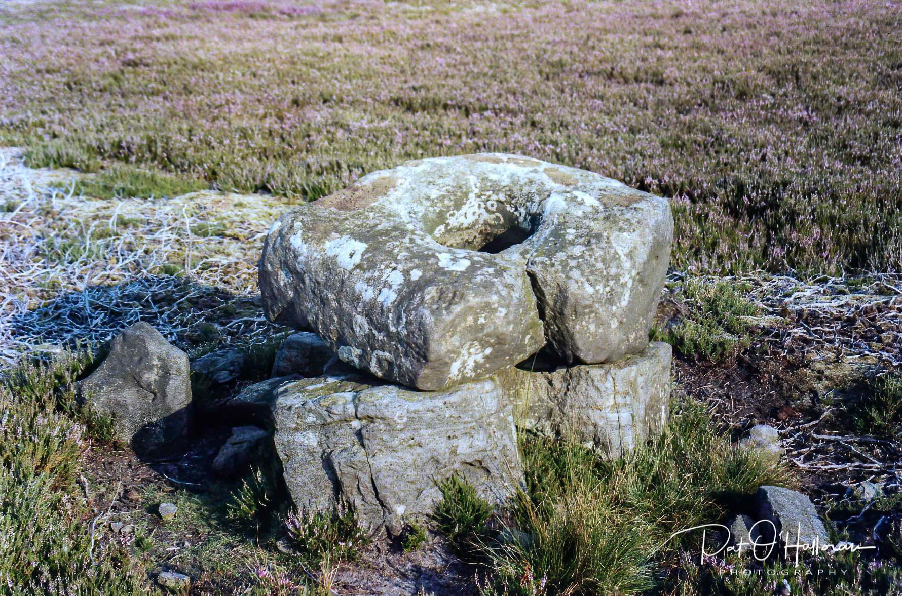
If you were to travel approximately half a mile to the south-east of Ainhowe Cross and searched in the heather off the track you may find Redman Cross, or what remains of it. This cross would also have been a waymarker on the moorland track system. Unfortunately all that survives is a socket stone, propped up on two unrelated (I think) stones. Many of the moor’s crosses now exist only as bases, I’ll be looking at some of these in the next post but thought I’d include this one here as it is so near to Ainhowe Cross. As fas as I know this base is not listed, it does not appear on any maps or in Historic England’s records.

Redman Cross

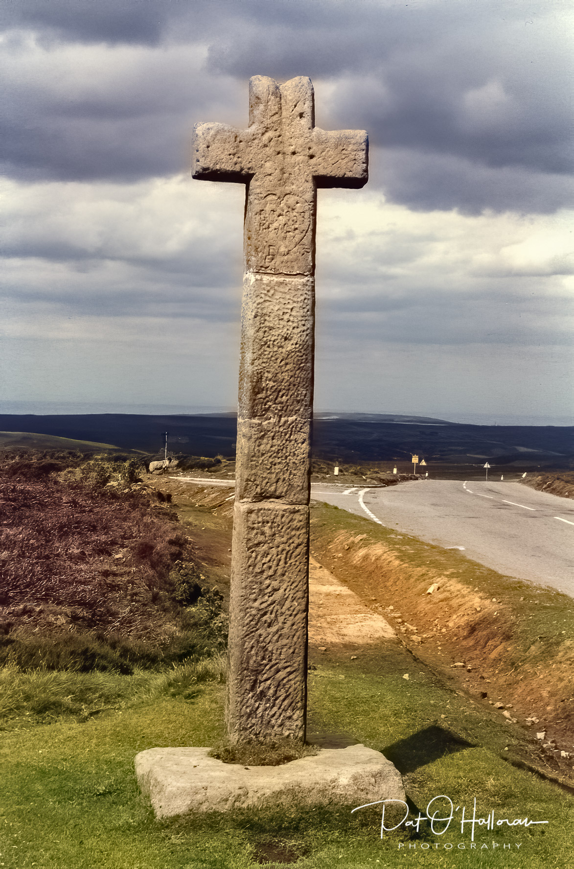
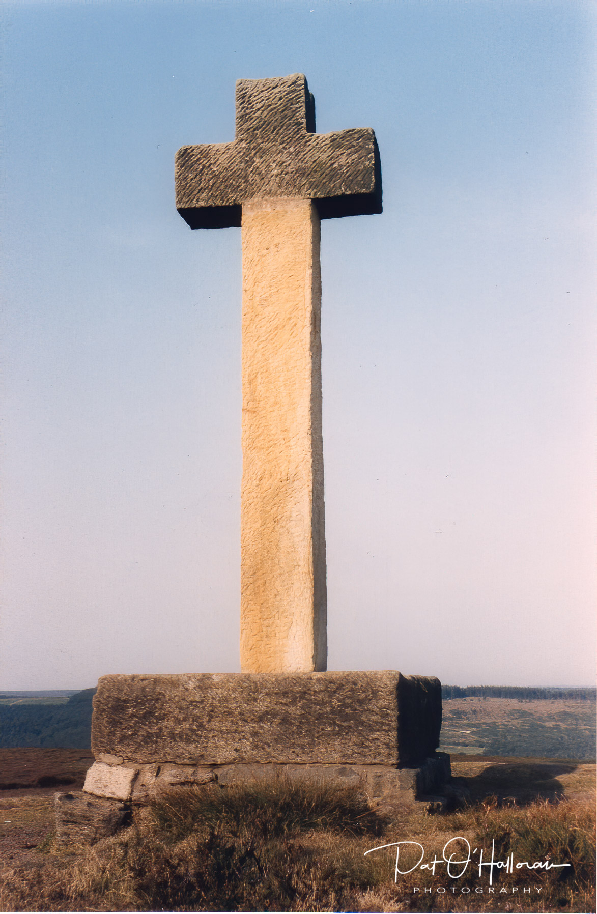
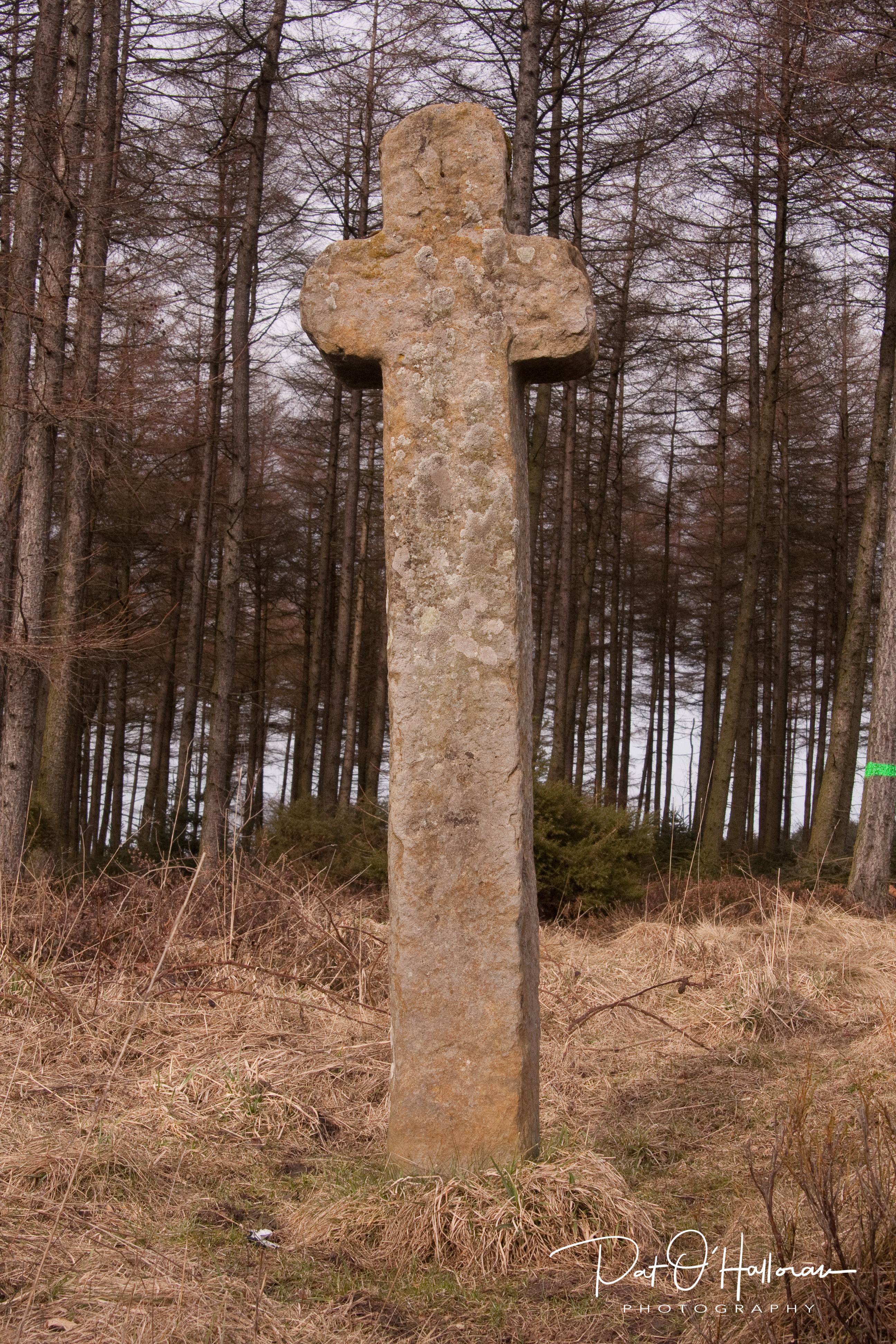
The next cross lies to the east in Cropton forest. It stands a few yards from the Roman road across the moors, this road was used extensively as a trackway in the medieval period and Mauley Cross would have been a marker. It is pleasingly weathered with rounded ends to the cross arms and stands just over two metres high. Its name comes from the De Mauley family, landowners of Mulgrave.

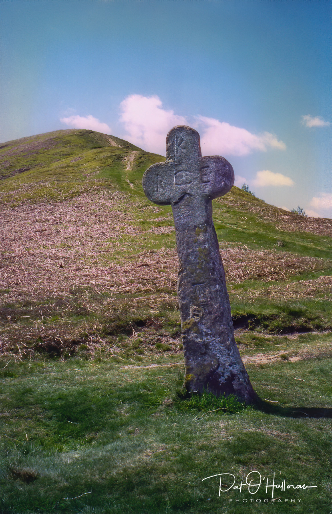
Travelling yet further east we find another cross with rounded arms at the foot of Whinny Nab not far from the main road between Pickering and Whitby, a short walk from the Saltergate Inn. Malo Cross was also named after the De Mauley family. It is shorter than Mauley Cross at about 1.75 metres and is marked with the letters K R E which are supposed to stand for Sir Richard Egerton. The cross is referred to in different places as a wayside marker and a boundary cross, it could, of course, be both.

Malo Cross

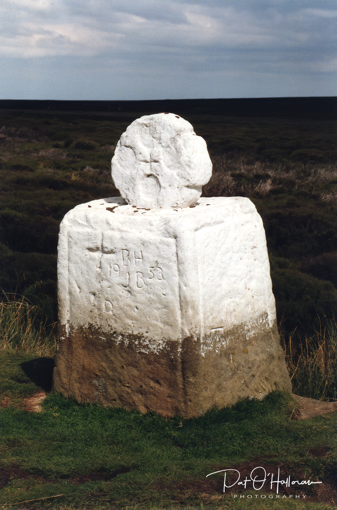
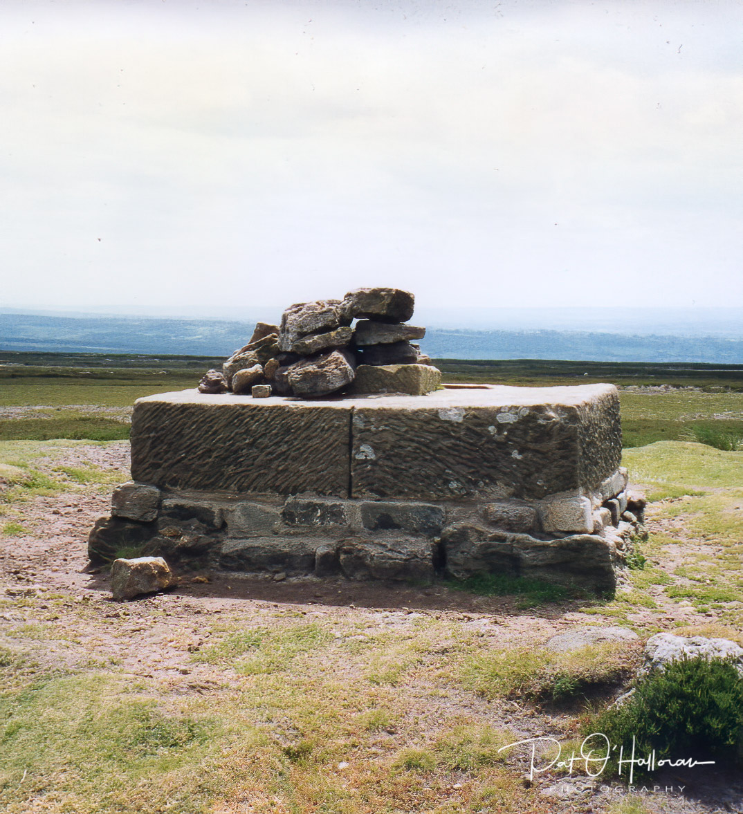
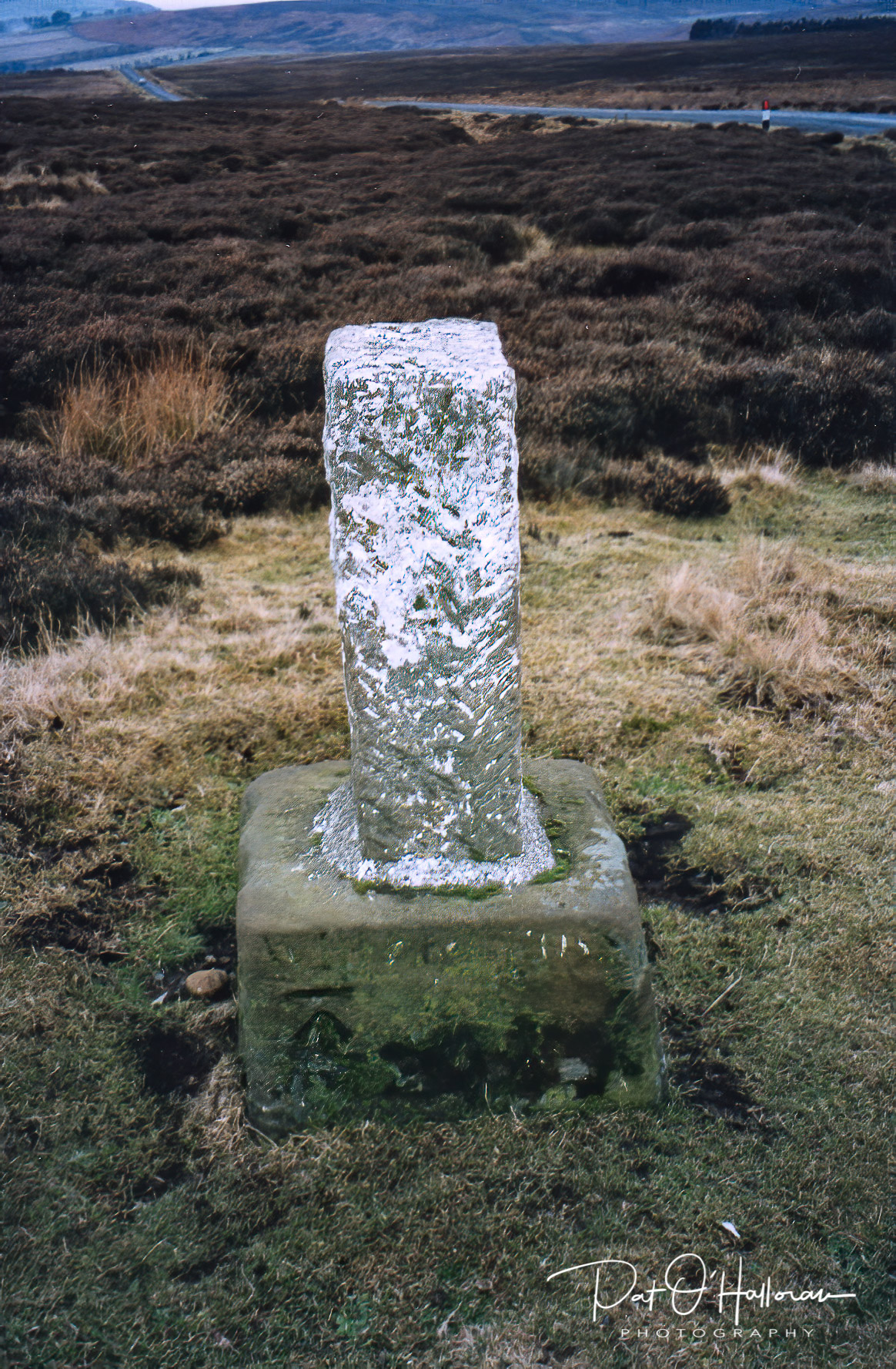
We move now to the north of the National Park to the road heading north from Castleton to Lingdale. At the meeting of this road with the road to Commondale stands White Cross. Thought to be in its original position marking the route and parish boundaries the base survives with a later shaft set in it. This point marks the meeting of several medieval trackways but the two modern roads are now the most apparent. The eastern face, shown in the photograph, has ‘white cross’ inscribed on the base and a bench mark. The original medieval shaft is in Whitby museum but I have no photograph of it.

White Cross

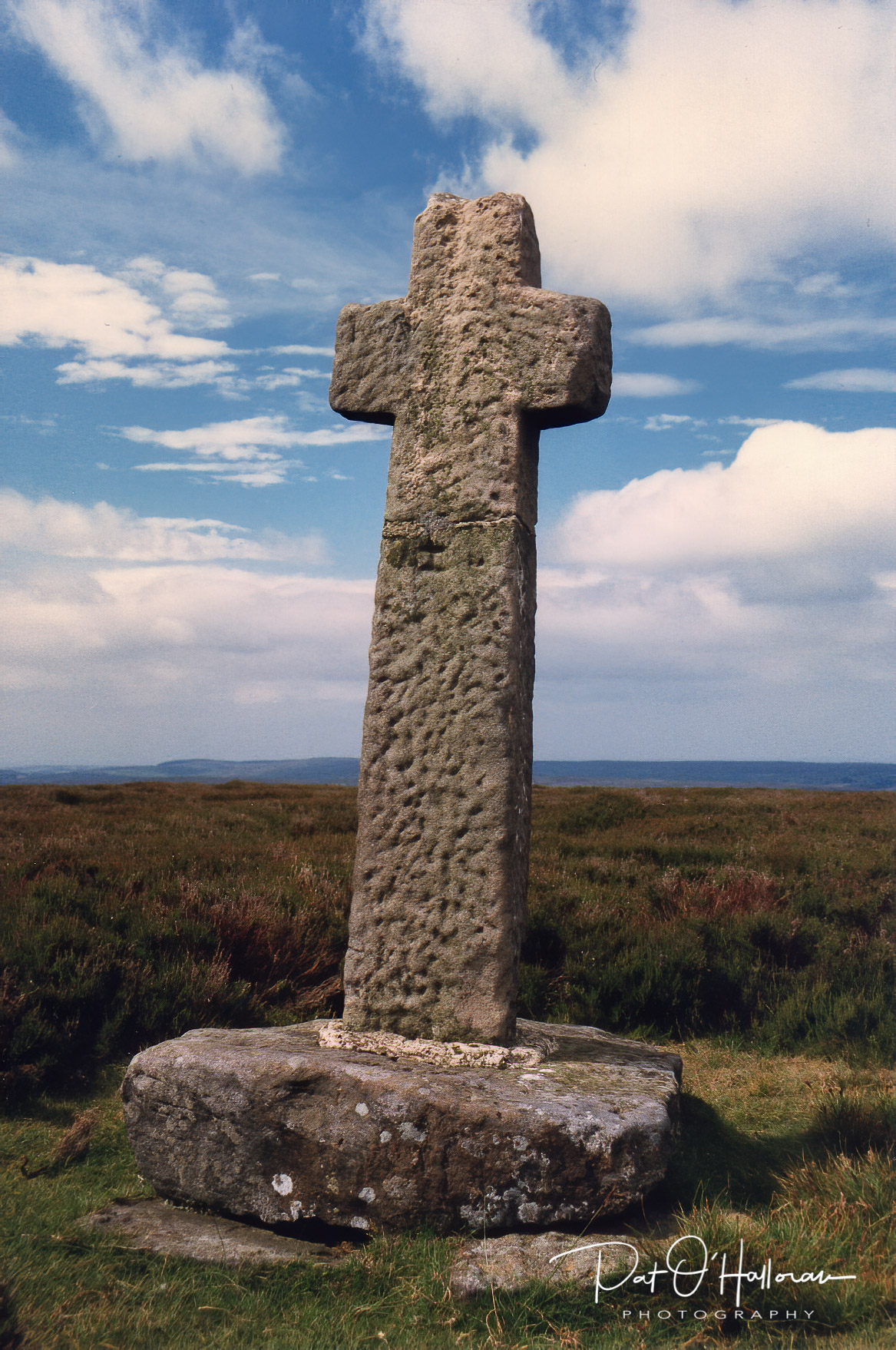
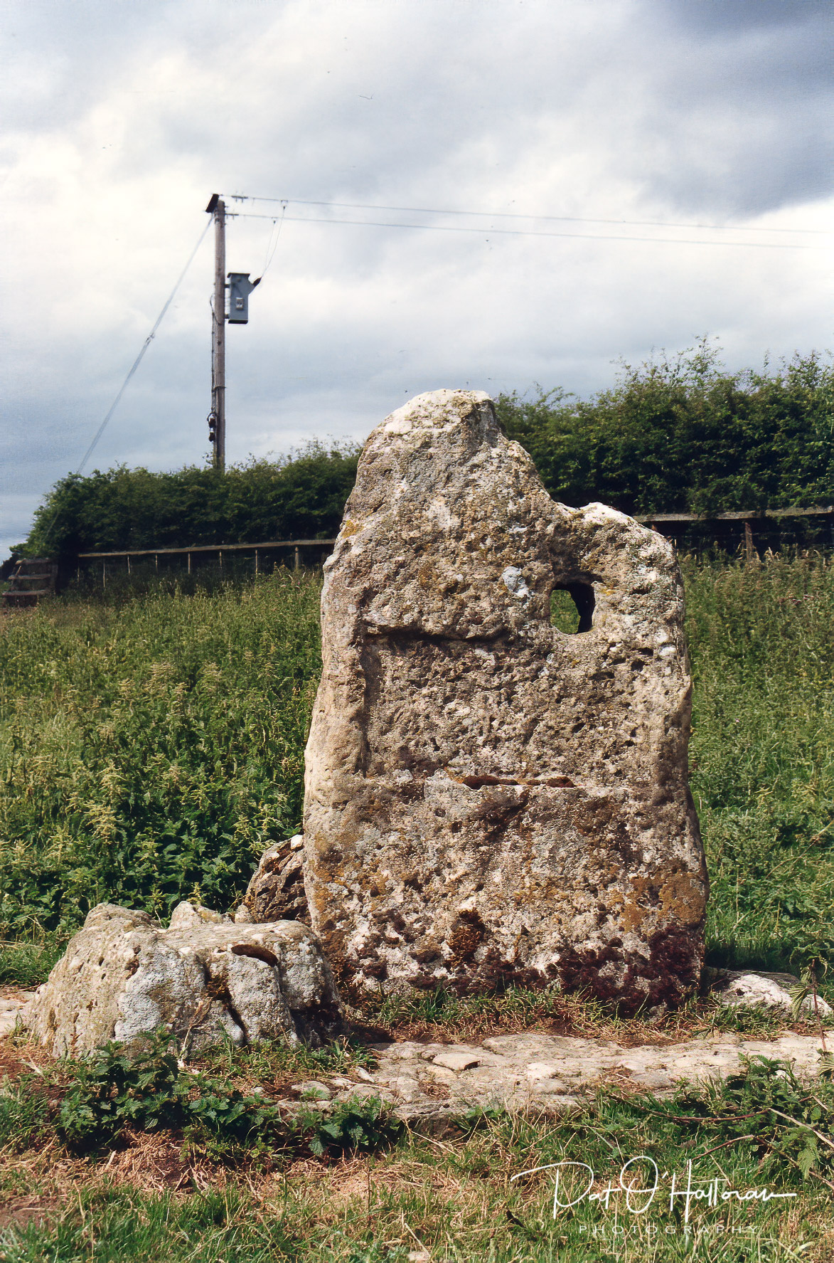
For the last two crosses of this post we move almost due south to the edge of the National Park at Appleton le Moors. Low Cross sits alongside the road north from the village to Spaunton at the junction of a lane to Lastingham and was probably a waymarker for travellers to the monastery there. It is unusual in its shape and is undoubtedly a mixture of ancient stonework with more modern additions. It may have been an early standing stone repurposed as a waymarker. The current slab has an indentation on the south face, as if to hold a plaque or sign, and a square hole cut in it. There are pieces of stone set into a cobbled base, obviously relatively recent, which may have been an attempt to preserve some of the original stonework. It has been proposed that the hole and indentation may indicate its later use as a toll point.

Low Cross

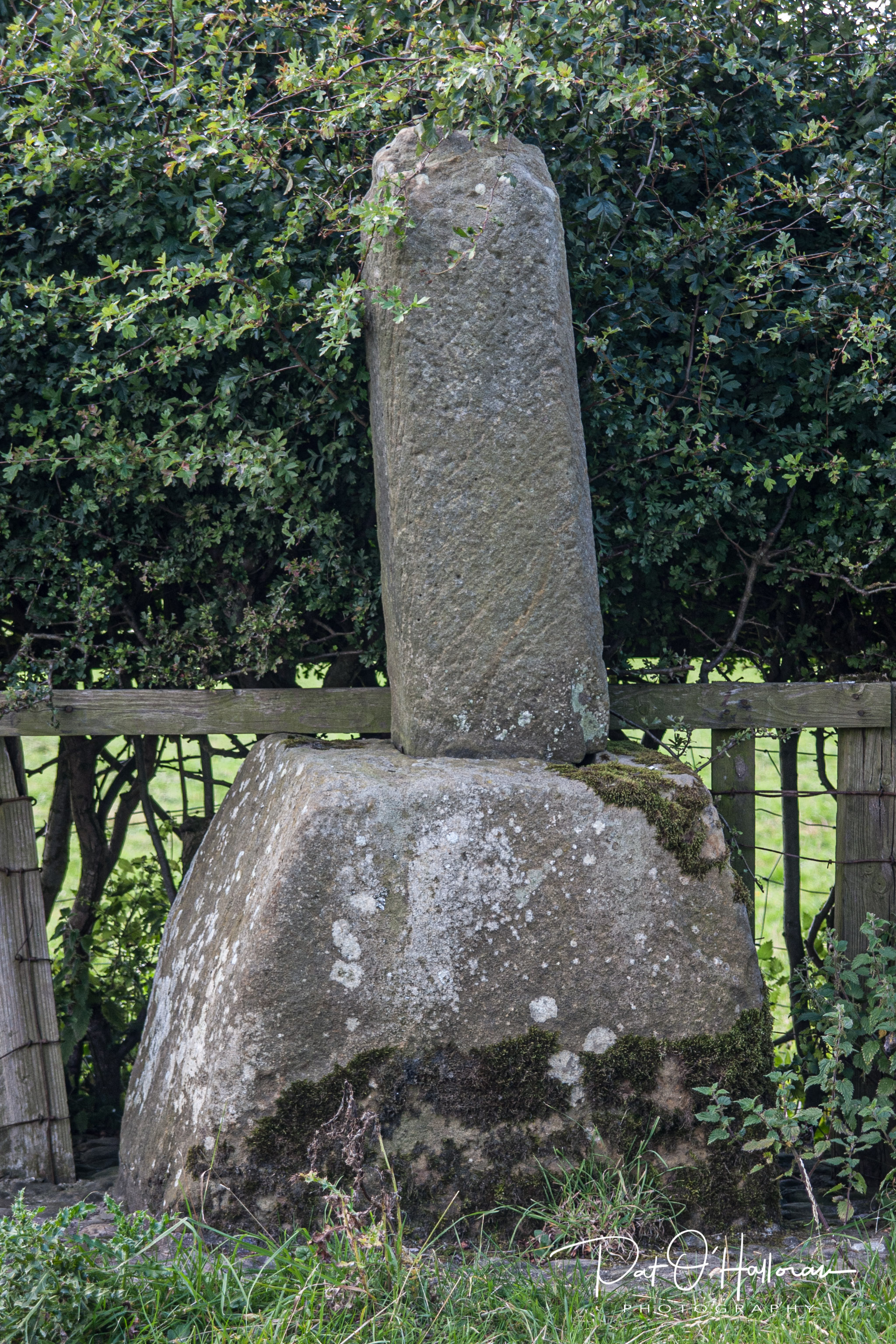
A little further up the road towards Spaunton stands High Cross. This has a large base a little reminiscent of Fat Betty from my previous post but is surmounted by a slender shaft which, if original, may have been as long as three metres. The cross base is thought to be in its original position marking the road between the villages and opposite an old drove road. Like Low Cross the base has been set in cobbles in recent times. It would have been an important cross marking the route much used by travellers to the monastery in Lastingham.

High Cross

That concludes this post, my second on moorland crosses. There are others and I intend to write a little more in my next post.

References

Mead, H., (1994) Inside The North Yorks Moors. Otley: Smith Settle

Ogilvie, E., Sleightholme A, (1994) An Illustrated Guide To The Crosses On The North Yorkshire Moors, York: The Village Green Press

Peach, H., (2004) Curious Tales Of Old North Yorkshire. Wilmslow: Sigma Leisure.

White, S., (1987) Standing Stones & Earthworks On The North Yorkshire Moors. Scarborough: S. White.

https://historicengland.org.uk/

Moorland Crosses 1

Firstly, apologies for the long hiatus between posts. There are many reasons, not all valid.

I have long been interested in the wayside crosses of the North York Moors and their environs. I found them fascinating even before I came to live in this area and over the years have driven and walked through many miles of the countryside searching out examples. Some of them are fine upstanding specimens of a cross while others are mere bases on the roadside, long forgotten in the grass and hedgerows. In this short post I hope to show you a few of those I have found and maybe inspire you to go out and find them for yourselves.

Initially I must address the issue of what these crosses are and what they were for. Most of them are medieval in origin and date from around a thousand years ago up to five hundred years ago. Many of them were waymarkers, signposts along tracks through the moors to enable travellers to move along the pathways knowing they are heading in the right direction. The choice of the cross shape is probably to reinforce Christianity to the travellers, especially on routes of religious importance. Some ‘crosses’ do not have the cross shape and are plain upright pieces of stone. They may have originally had the cross head and this has either been broken and lost or deliberately damaged and then replaced with a plain stone. Crosses were also used as boundary markers between parishes, advising travellers they were moving from one district to another. Rumour and superstition are also linked to many of the crosses, with often fanciful tales of how or why the crosses are situated as they are.

One of the most well-known crosses in the area is Young Ralph, firstly because it sits close to the roadside as you travel between Hutton-le-Hole and Castleton but mainly because it has been adopted by the North York Moors National Park as their emblem and features on many signs and notices throughout the area.

Young Ralph

Many visitors stop at the roadside to see Young Ralph and there is an old tradition that coins can be left on top of the cross for those in need. If you found coins up there you could take what you needed but always made sure there were some remaining, or if it was empty you should leave some. Unfortunately, this has meant decades of people scrambling up the cross shaft to check the indentation at the top and this has led to significant damage. The cross has needed repair more than once. This activity is now discouraged, so please don’t try.

This tradition may stem from the legend that the cross was erected by a local farmer named Ralph after he found a traveller in that spot who had died from exhaustion and exposure, the cross was to mark the spot and guide future travellers along the track.

My favourite cross lies about 400 metres from Young Ralph but is hidden from the road by a rise in the ground and is often missed completely by visitors, it goes by the name of Old Ralph.

Old Ralph

Old Ralph is about a thousand years old and has been sitting up on the hill watching all this time. I like the proportions of the cross and the fact you can sit there and look at the view for miles around, even seeing the sea off Whitby on a good day.

Old Ralph was mentioned in a Guisborough charter of around 1200 and was referred to as “crucem Radulphi”. The shaft has a date of 1708 and the initials CD carved into it leading some to believe it is of that date. However, this is just the repurposing of the cross as a boundary marker by Charles Duncombe, the landowner at that time.

Fat Betty
Fat Betty

A little to the east of Young Ralph is another well-loved cross on the moors, Fat Betty or White Cross. Although called a cross she has a round, wheel-shaped head. It dates from the 10th or 11th century and the round head would almost certainly once have been on top of a shaft, making it unusual and a rarity in this area. This cross is both a waymarker standing at the side of an old road into Rosedale and also a boundary marker as it sits on the meeting point of Danby, Westerdale and Rosedale parishes.

Lilla Cross on Lilla Howe

The final cross in this post is thought to be the oldest cross on the moors. Legend has it that it marks the spot on which Lilla forfeited his life in order to save King Deira by putting himself in the path of an assassin’s dagger. However, the cross is believed to date from the 10th century and Lilla and his compatriots date from the 7th or 8th century. The cross stands on a Bronze Age bowl barrow that has been reused for Anglo-Saxon burials.

The cross sits tucked away behind RAF Fylingdales BMEWS site and is at the junction of two medieval trackways, one of which is the Old Salt Road mentioned in my post on the Saltergate Inn, which runs down to Pickering, the other being the Pannierman’s Way. The cross is important in that it also marks the boundaries of four parishes – Allerston, Fylngdales Moor, Goathland and Lockton. It also marks the boundary of the lands belonging to Whitby Abbey.

I hope to continue this theme and present a few more crosses of the North York Moors in a post in the near future.

References

Mead, H., (1994) Inside The North Yorks Moors. Otley: Smith Settle

Ogilvie, E., Sleightholme A, (1994) An Illustrated Guide To The Crosses On The North Yorkshire Moors, York: The Village Green Press

Peach, H., (2004) Curious Tales Of Old North Yorkshire. Wilmslow: Sigma Leisure.

White, S., (1987) Standing Stones & Earthworks On The North Yorkshire Moors. Scarborough: S. White.