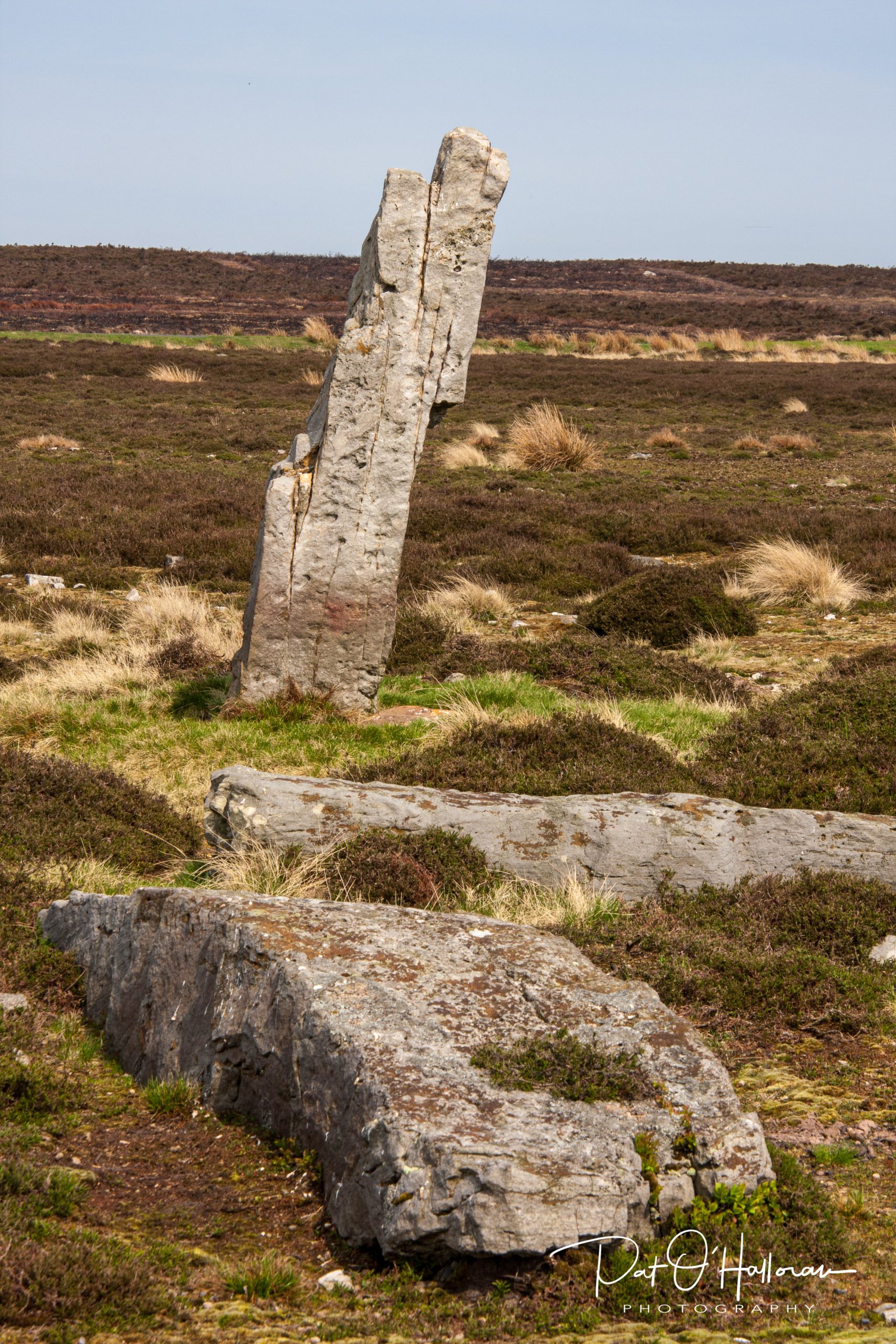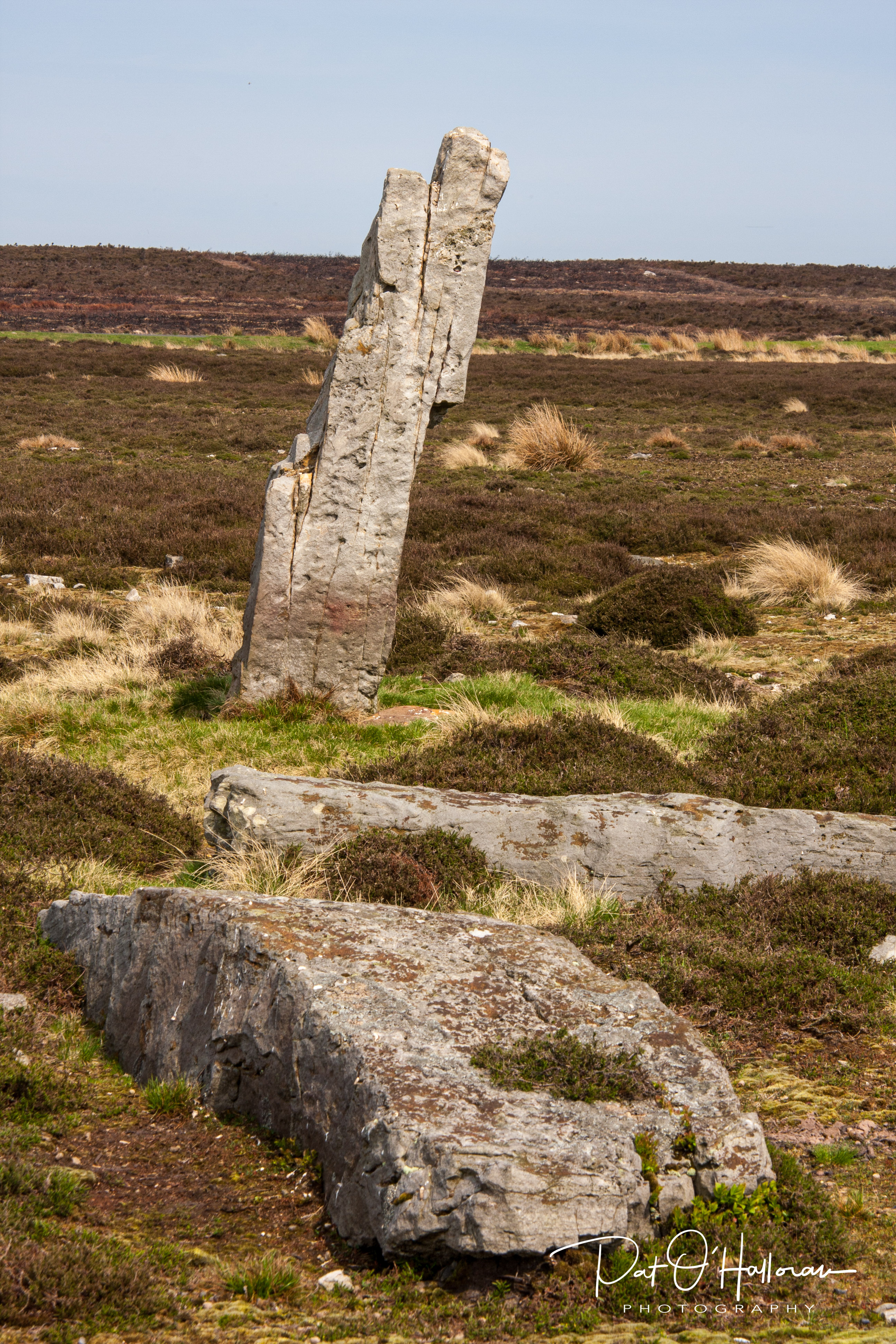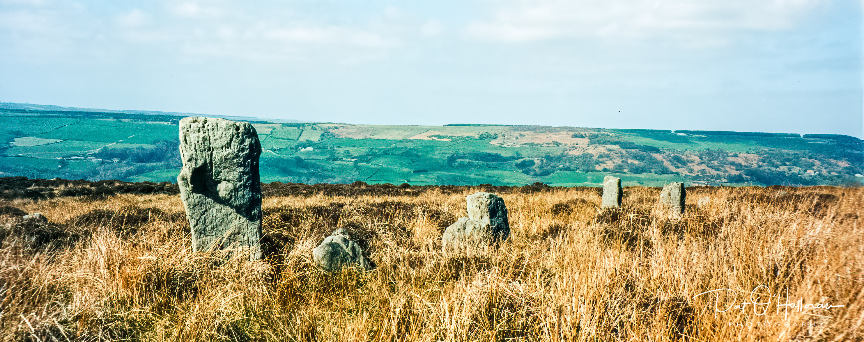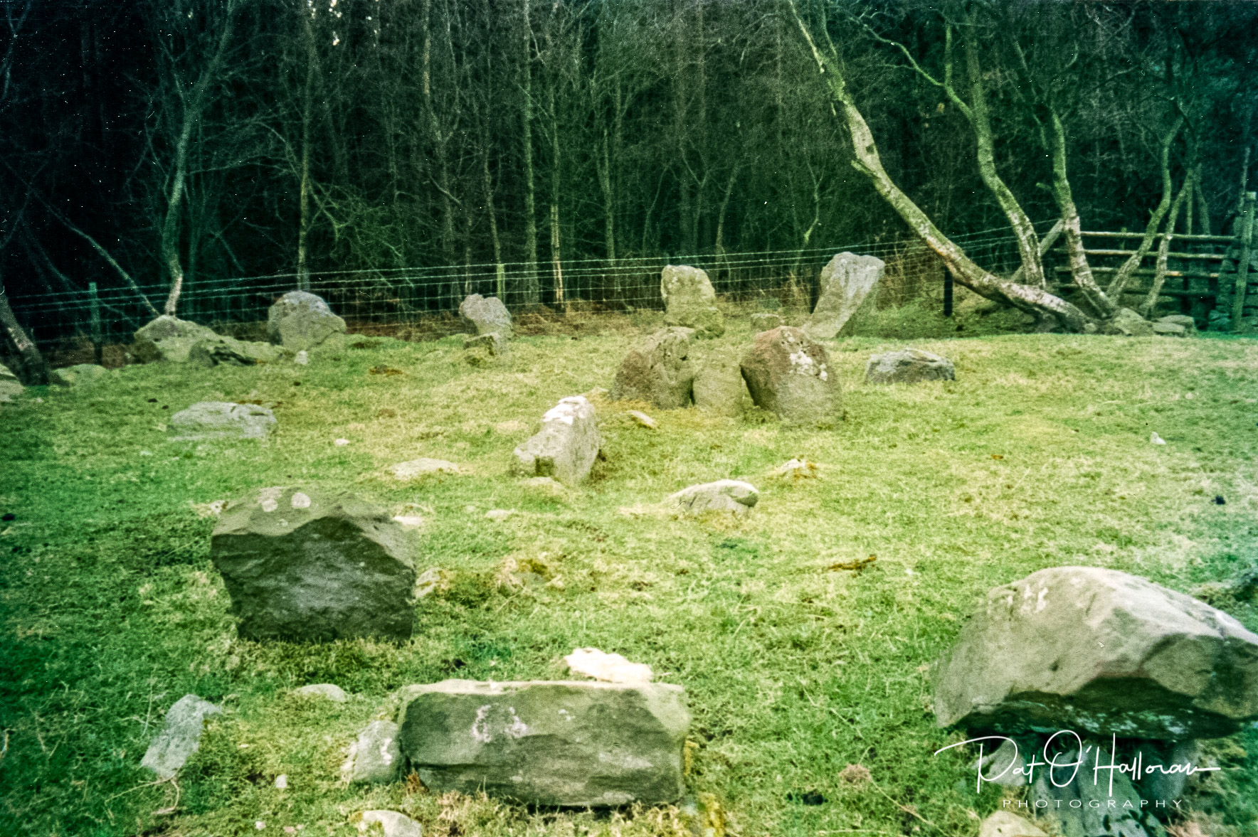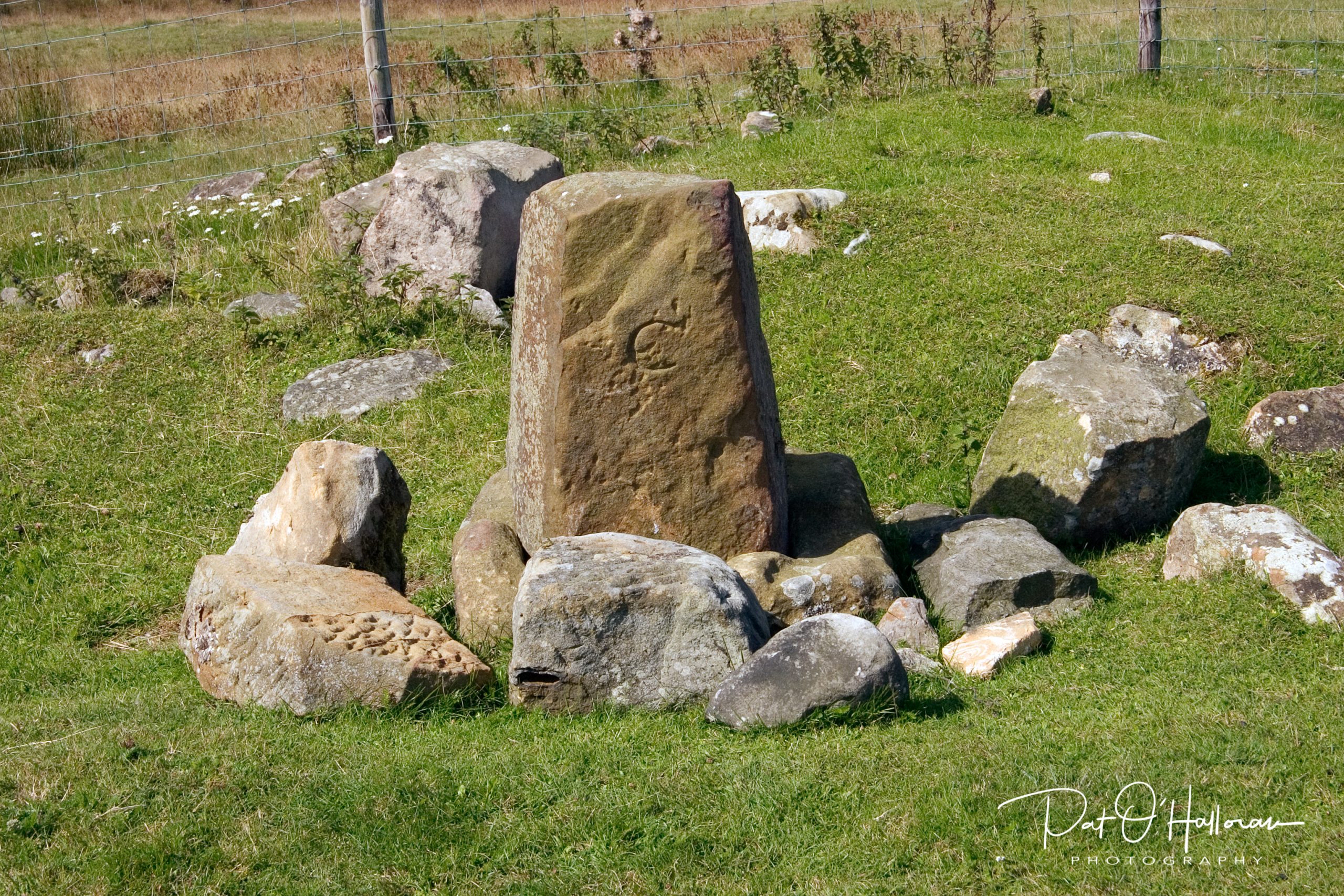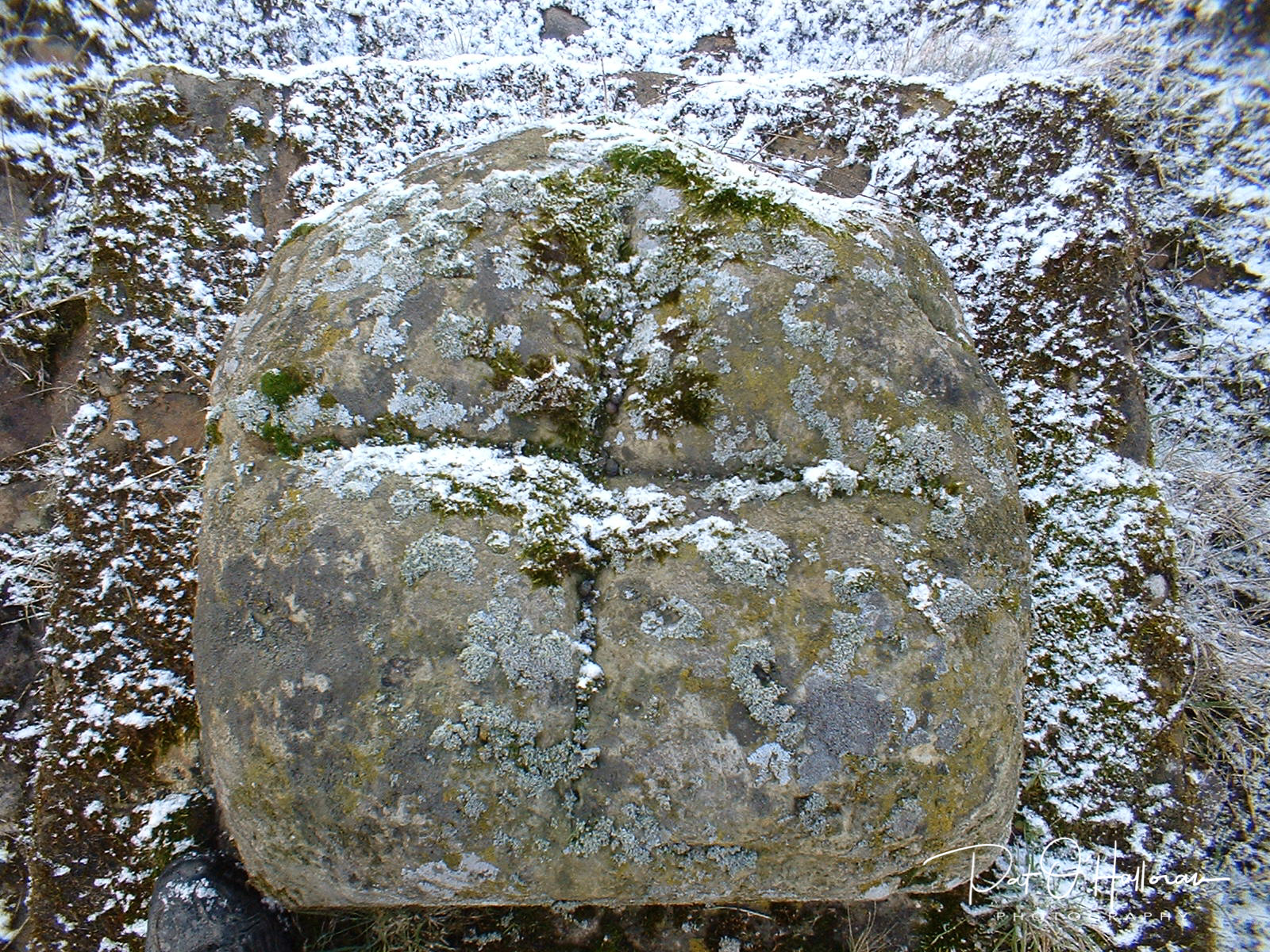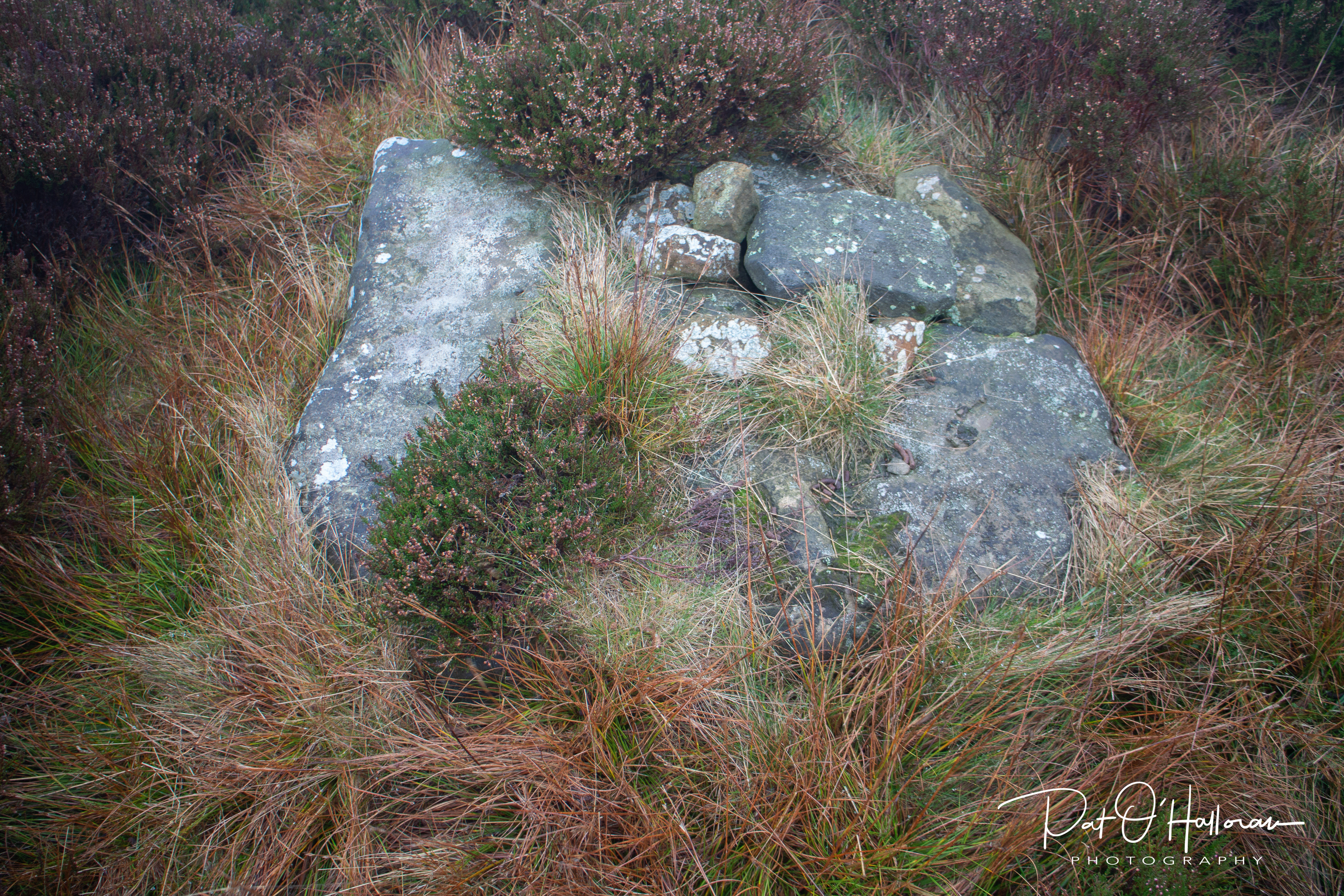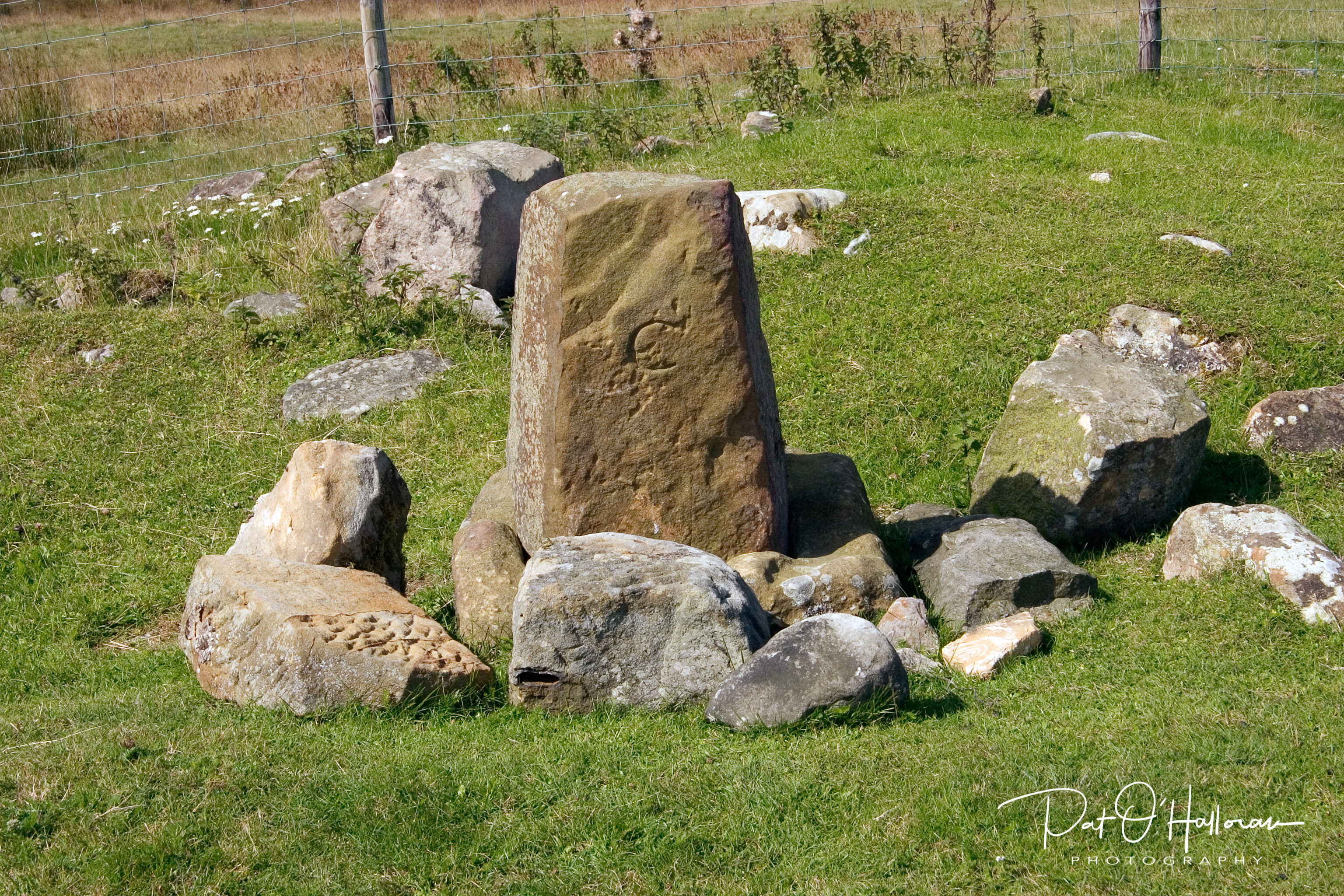
Sheelas in Yorkshire

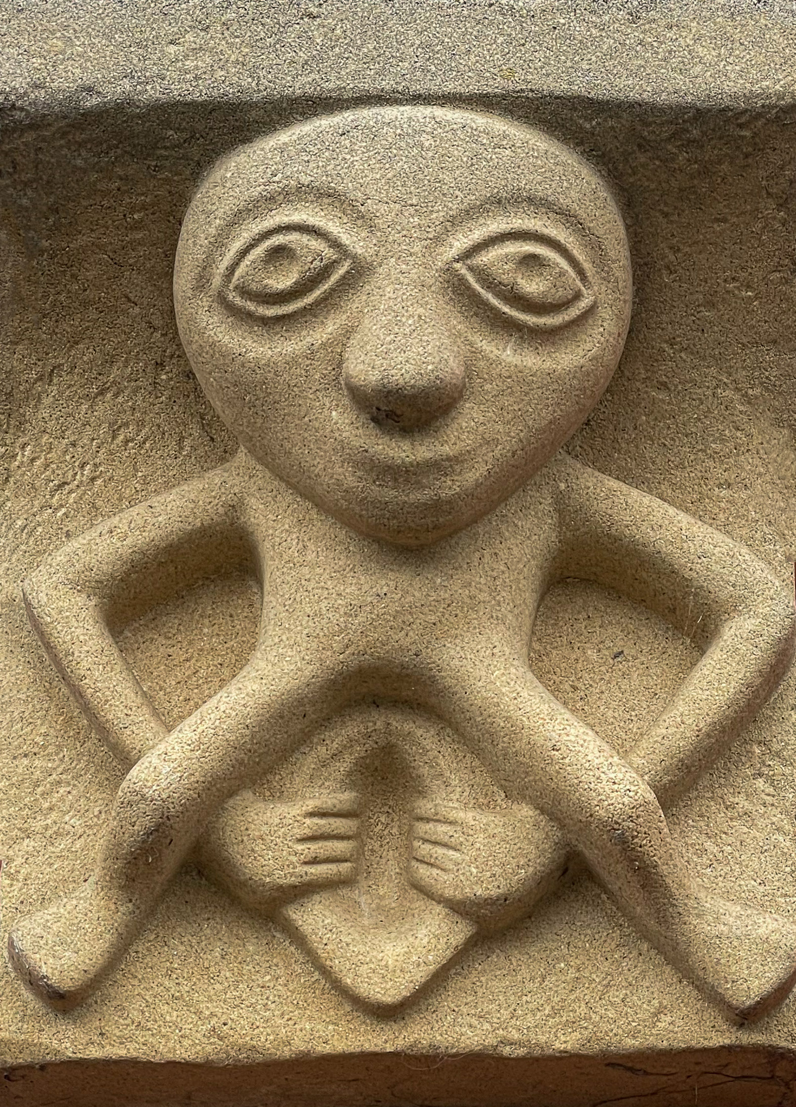
Kilpeck replica on my patio

Sheela-na-gig: A stone carving of a woman with exposed and/or exaggerated genitalia, usually found on religious buildings (www.sheelanagig.org).

Usually referred to as a sheela-na-gig, sheela, sile, or any number of names the sheela  appears on numerous churches throughout the British Isles. As there is no consensus on her name neither is there agreement on why she sits on the buildings displaying her wares. There are, of course, varied theories but the real reasons are lost in time and we may never know from where she originated nor what her message may be. That said, one of the most popular theories is that she is apotropaic in nature, warding off evil. Another suggests she is a graphic warning against the sins of lust, aimed at the mostly illiterate masses of the medieval period. There are many reasons why each theory has been discarded by some and championed by others, it is not my intention to examine these in this post but for those interested a good starting place would be John Harding’s site (www.sheelanagig.org). Likewise, the definition of what constitutes a sheela is also debated and often includes male figures too. I prefer to class these in the umbrella group of exhibitionists and maintain the sheela group as female only though some figures are difficult to determine. The main identifying features are usually accepted as an opening symbolising the vulva and one or more hands either touching it or pointing towards it. 

The ‘classic’ most well-known image of a sheela is probably the one on Kilpeck church in Herefordshire, I have a reproduction of it casting her gaze over my patio (shown above). However, there are many other forms often called sheelas and some of those exist in Yorkshire. I intend to look at a few of those I have visited in the rest of this post.

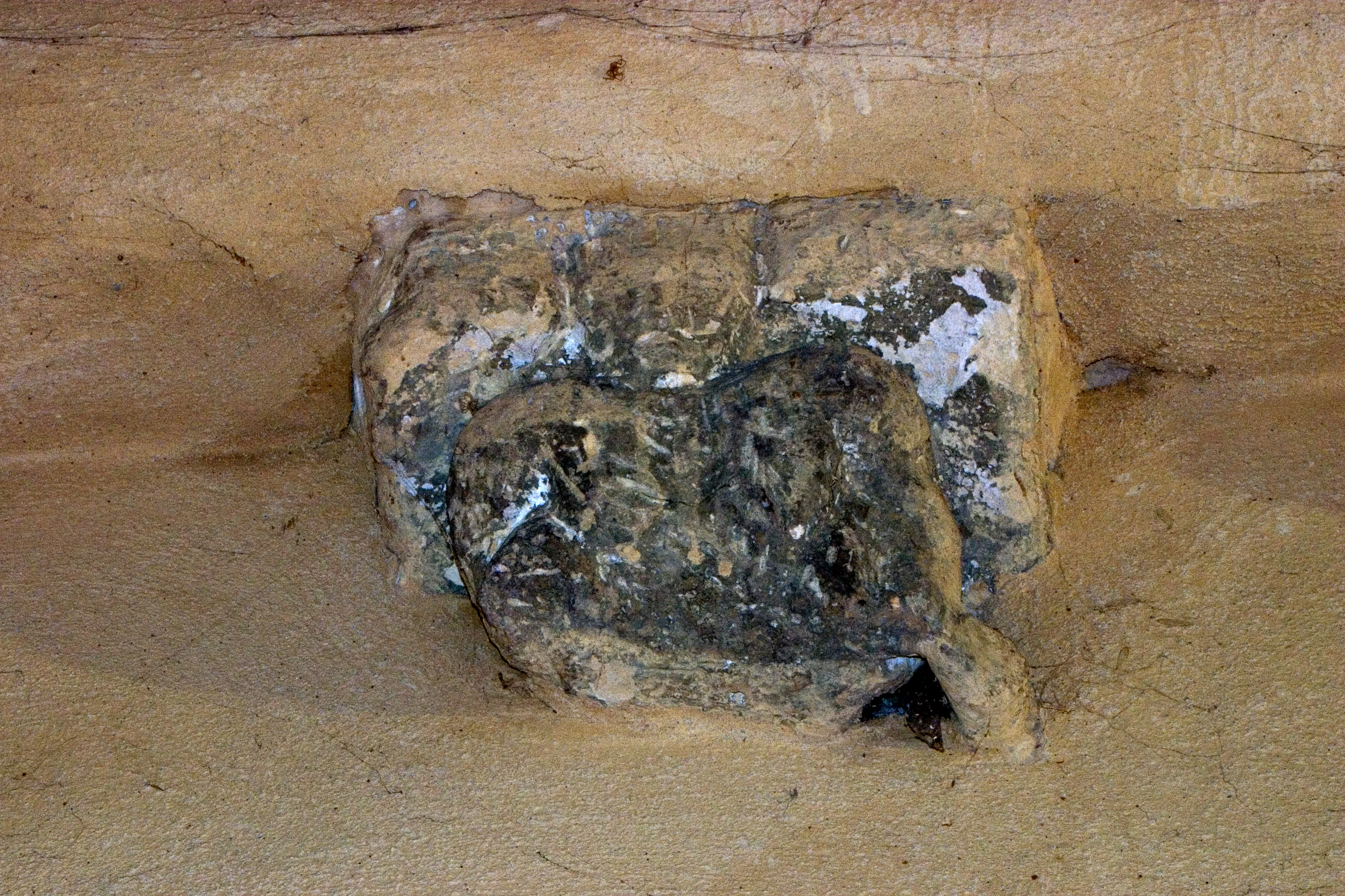
Our first stop is at a small church in the village of Copgrove. Here we find an enigmatic carving on the south side of the nave. It was originally on an exterior wall of the church and its move inside has been relatively recent and prompted by the damage done to it by the weather. It is quite worn and photographs are best obtained by using a raking light to highlight the features. It has one hand between the legs, near a representation of the vulva, and appears to be holding some form of round object in the other; there’s a cross shape in the upper corner. Because of the wear it is impossible to say for sure what this figure represents and what is happening. It is usually accepted as a sheela-na-gig.
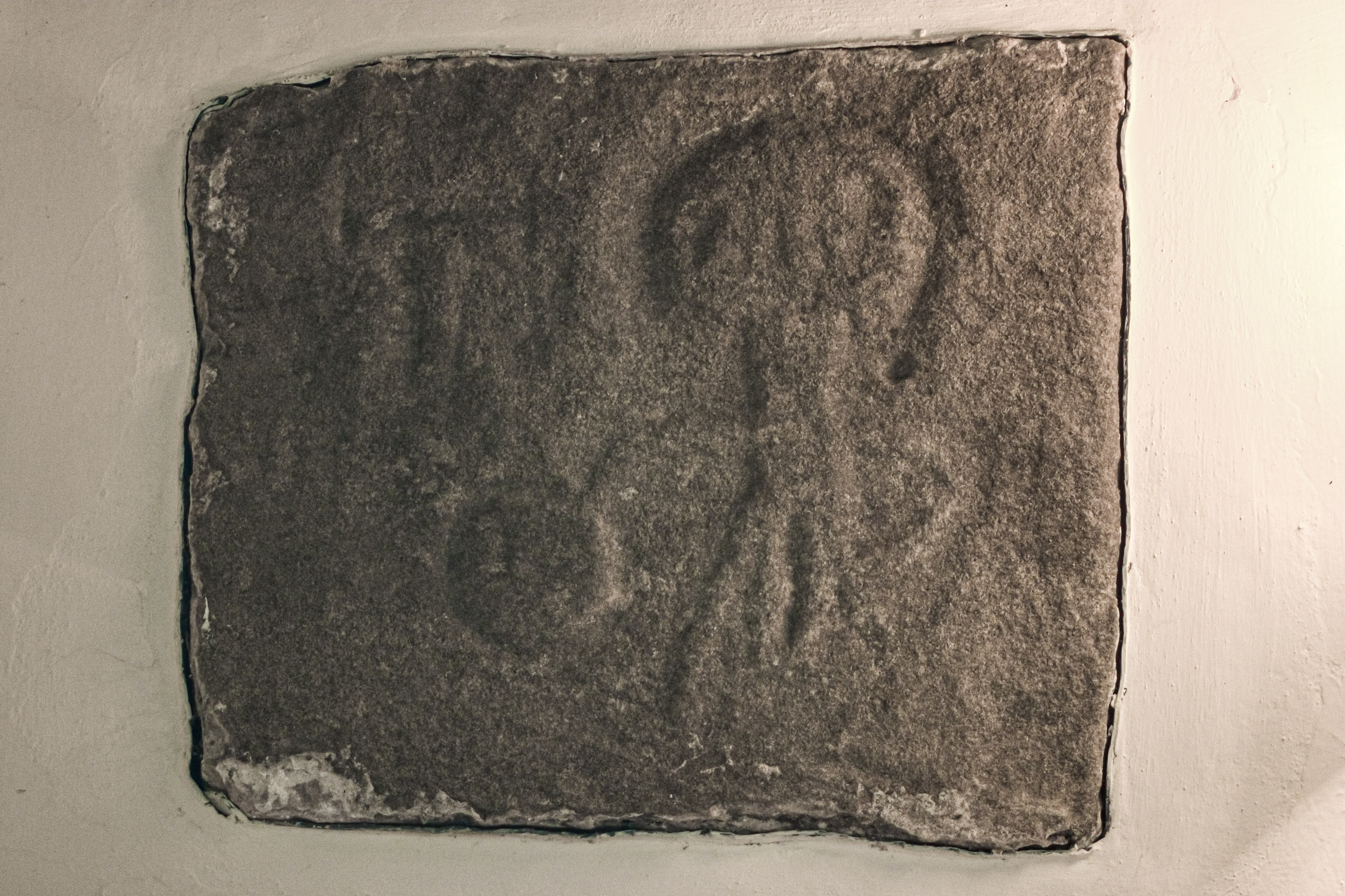
Copgrove

Moving on to Croft-on-Tees there is a figure on the wall by the main door, it has some similarities to Copgrove in that one arm points to the groin area but the other is over the head rather than holding something. There has been some debate as to whether this figure is male or female. The depression which appears to be a vagina may have been caused by the figure’s penis being destroyed at some point in the past. There are also suggestions that it may have been a river god overseeing the crossing of the Tees near the church. For the present it is included in the list of sheelas. 
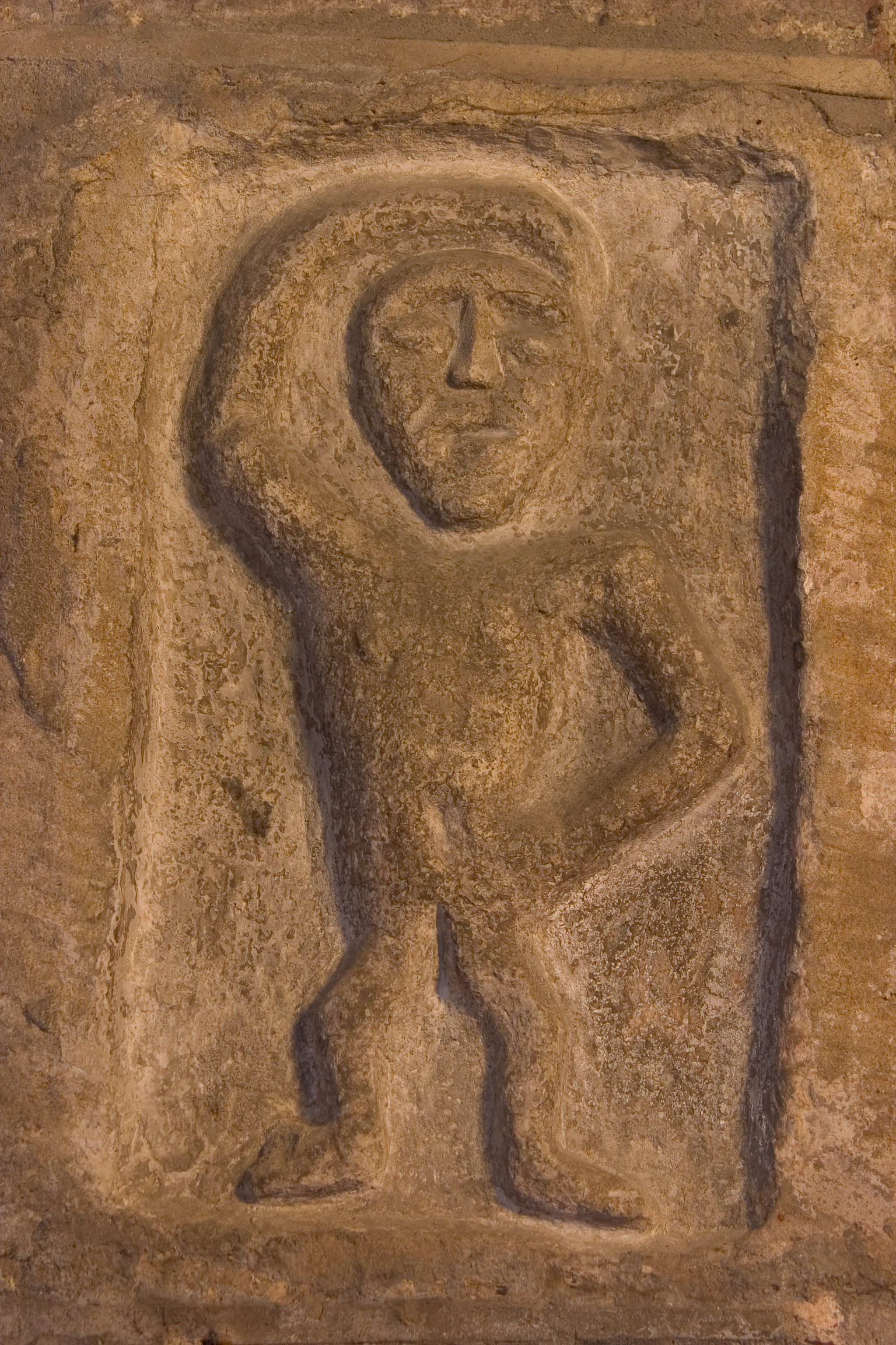
Croft-on-Tees

Moving nearer to York we arrive at the wonderful church in Bilton-in-Ainsty. There has probably been a church here since Saxon times though the current one is Norman with Victorian additions and various meddling between. The church has been extended by adding north and south arcades to the original building. This has resulted in the exterior walls becoming interior walls and it is on one of these, in the vestry, that a series or corbels exists – two of them are sheela-na-gigs. Both are quite worn, or damaged, and difficult to see. The first has some features discernible and you can make out arms holding the genitalia. The second has been badly damaged in the lower body area, it was either another sheela or a male exhibitionist. The church is well worth a visit with many carvings and features to discover. 
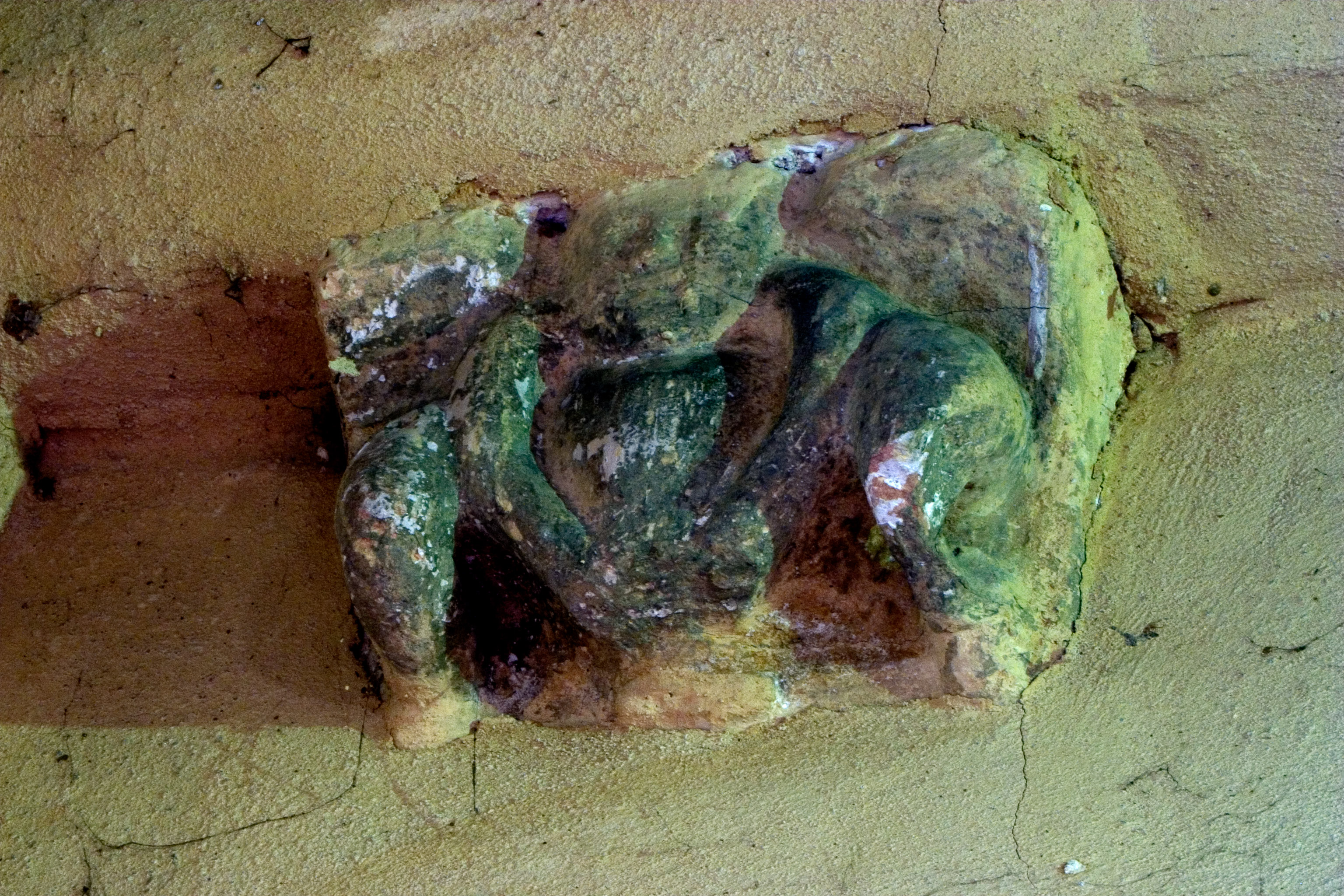
Bilton-in-Ainsty
Bilton-in-Ainsty 2

Nearer to home we now come to Malton. On the north exterior wall of the church in the market place is a carving of two people side by side. Each appears to be holding their hand on the other’s groin. The right-hand figure clearly has a depression representing the vulva. The left hand figure has a small socket-like hole that could have held a stone penis. The figures are weathered, or damaged, to the extent that it is now impossible to work out the details of the carving. There appears to be something between the two figures and some have suggested it may be an animal but it is hard to see. 
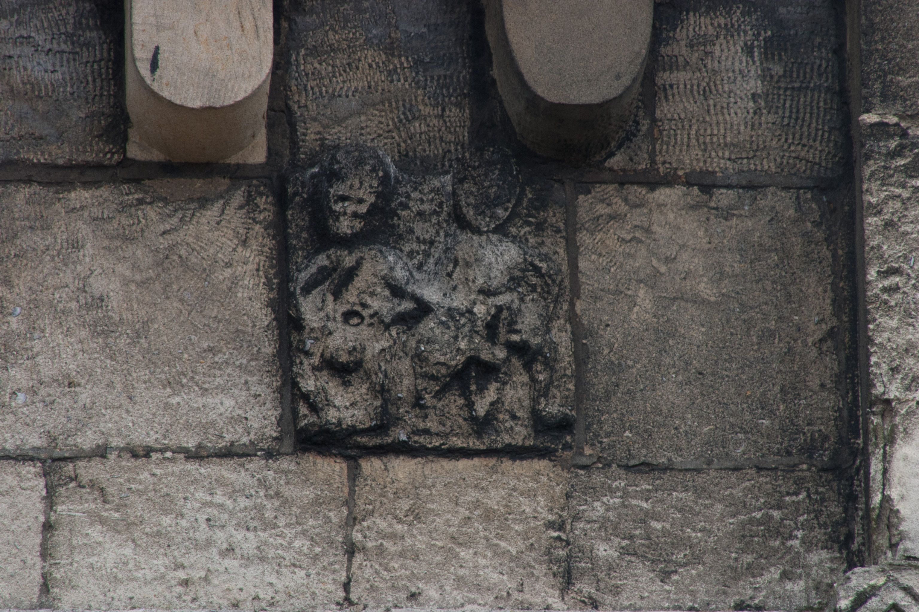
Malton

Hop across to the coast and enter Bridlington. In the old town lies the Priory Church of St Mary and within it a sheela-na-gig. This is another that has been moved from its original location, it adorned the arch of a stretch of medieval arcading that was probably part of the cloisters. The whole piece of arcading now sits within the church in the north aisle for all to see. If you do visit it is probably pointless asking one of the guides to point it out to you, I did on my first visit and they denied all knowledge of it. On the reverse side of the arch is quite a nice beard-puller.
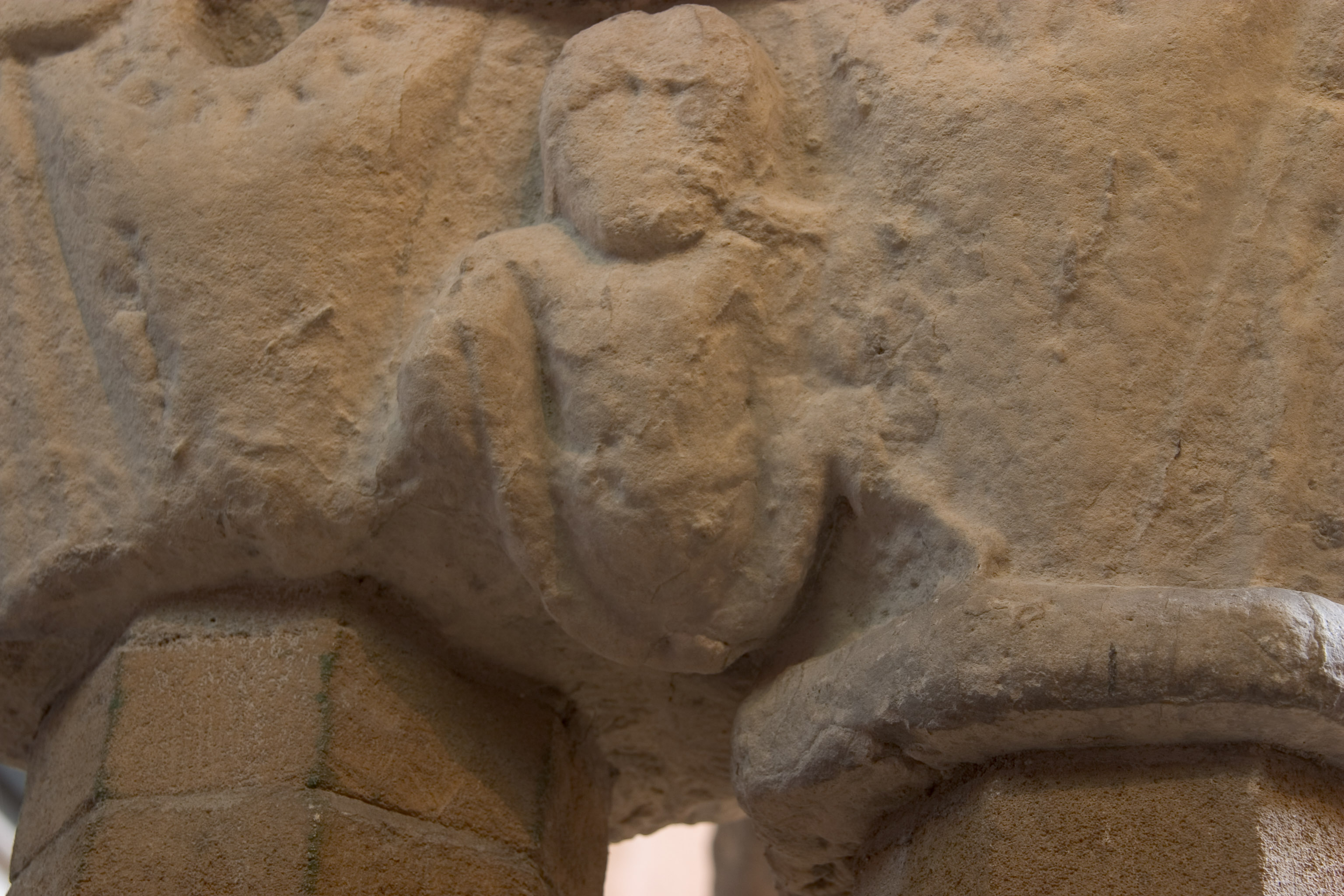
Bridlington

Travel inland a way to  Garton-on-the Wolds and view their magnificent church. It has a number of corbels on the exterior walls. most of these are weather-worn or damaged so it becomes difficult to decide exactly what they represent. One of them looks distinctly like it is, or was, a sheela. Its arms are held so they come towards the genital area. There is a cleft on the figure though it may be a bit high up to represent genitalia. It is impossible to tell what the figure originally looked like.
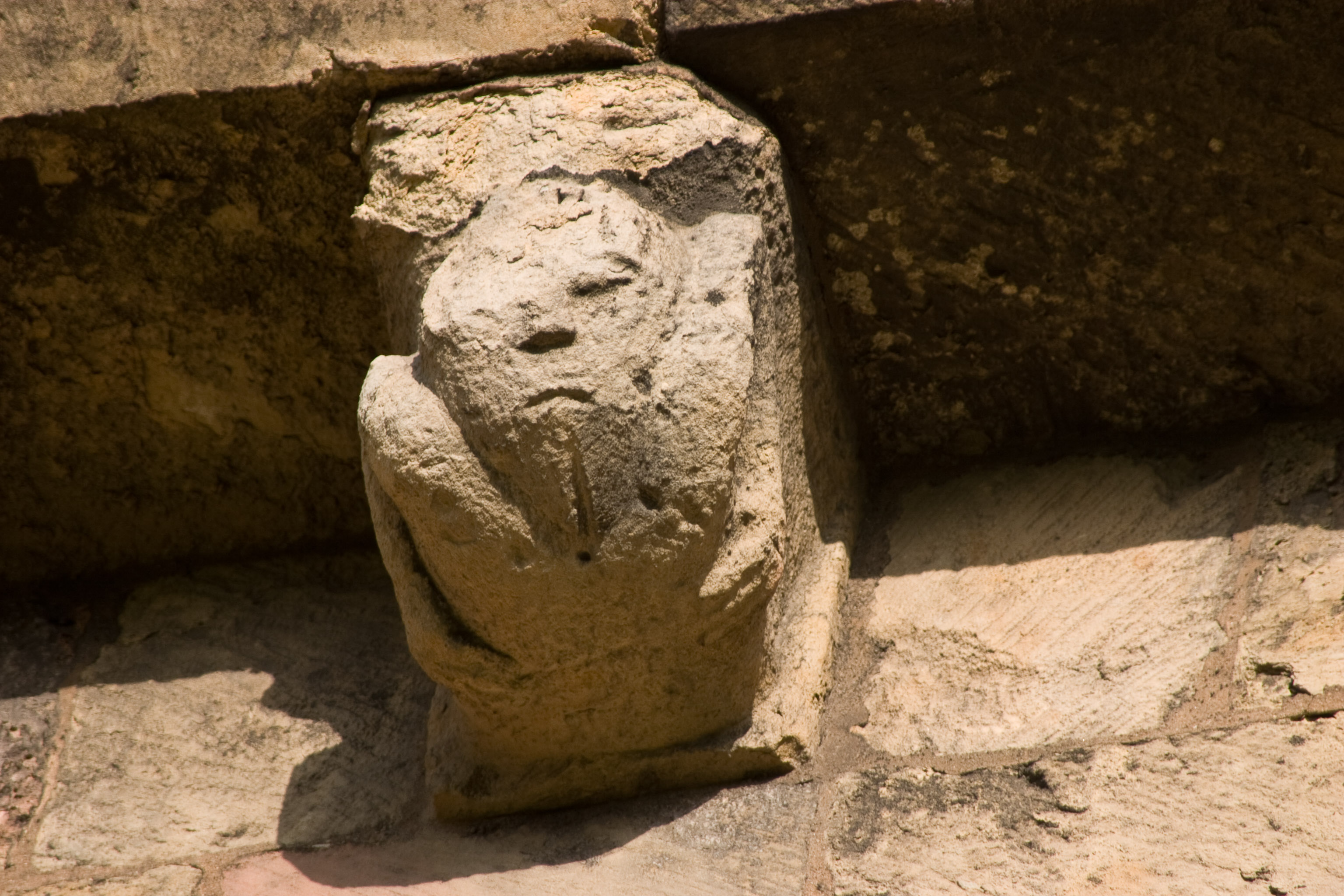
Garton-on-the-Wolds

A short trip down the road and you arrive at Kirkburn, another church of interest. On its exterior corbel table on the south wall of the nave there is a figure that may be a sheela It has its arms forward and held in the groin area but I have been unable to see clearly whether there are any details of a vulva hidden there. I must pay a return visit.
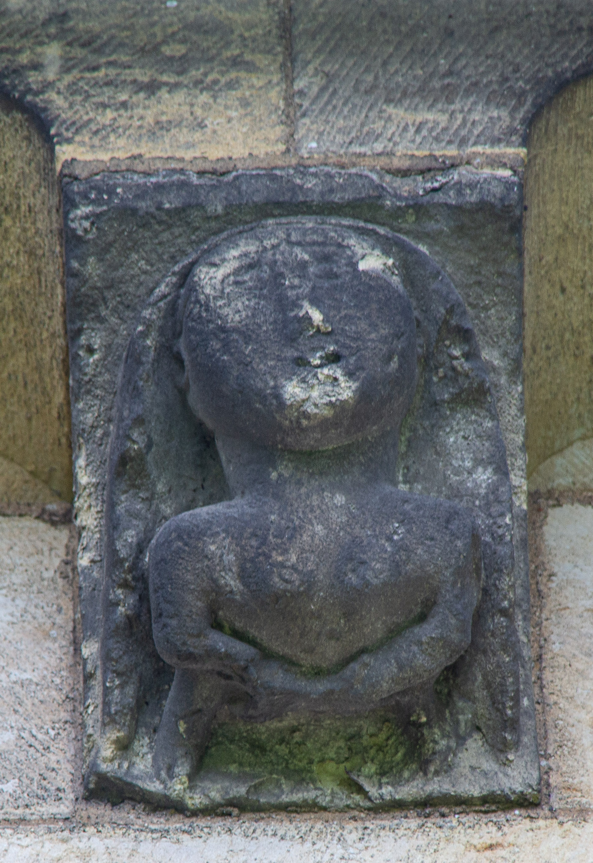
Kirkburn

Further north-west we come to North Grimston and another fine church with a collection of corbels. It is thought the corbels were not originally from this church. Two of them are of interest to us in this post, one appears to be a sheela with arms pointing to the groin area. The other, next door, was probably once a male exhibitionist.
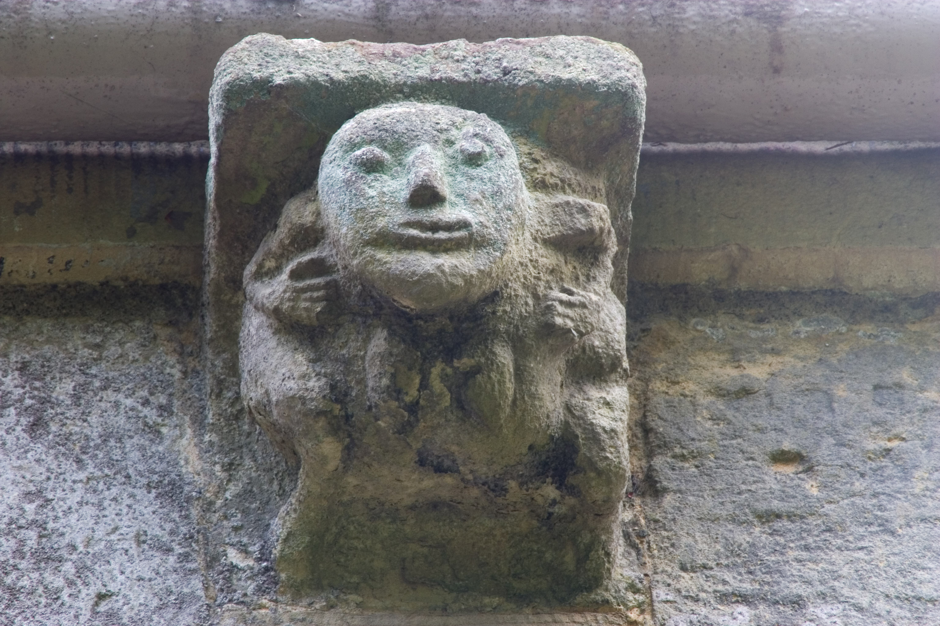
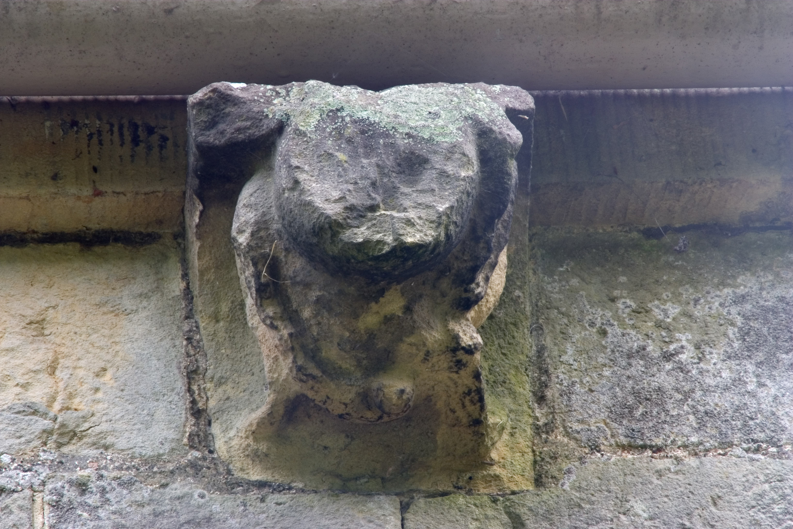
North Grimston
North Grimston 2

Now we head south to the village of Nunburnholme and its ancient church. There are a number of interesting carvings here but the one we are interested in is on the tower arch at the rear of the church and is quite large. The arch was probably once the chancel arch and has been re-used during later renovations. The figure is of a naked person, again with hands pointing to the groin area, though in this case it is thought to be male.
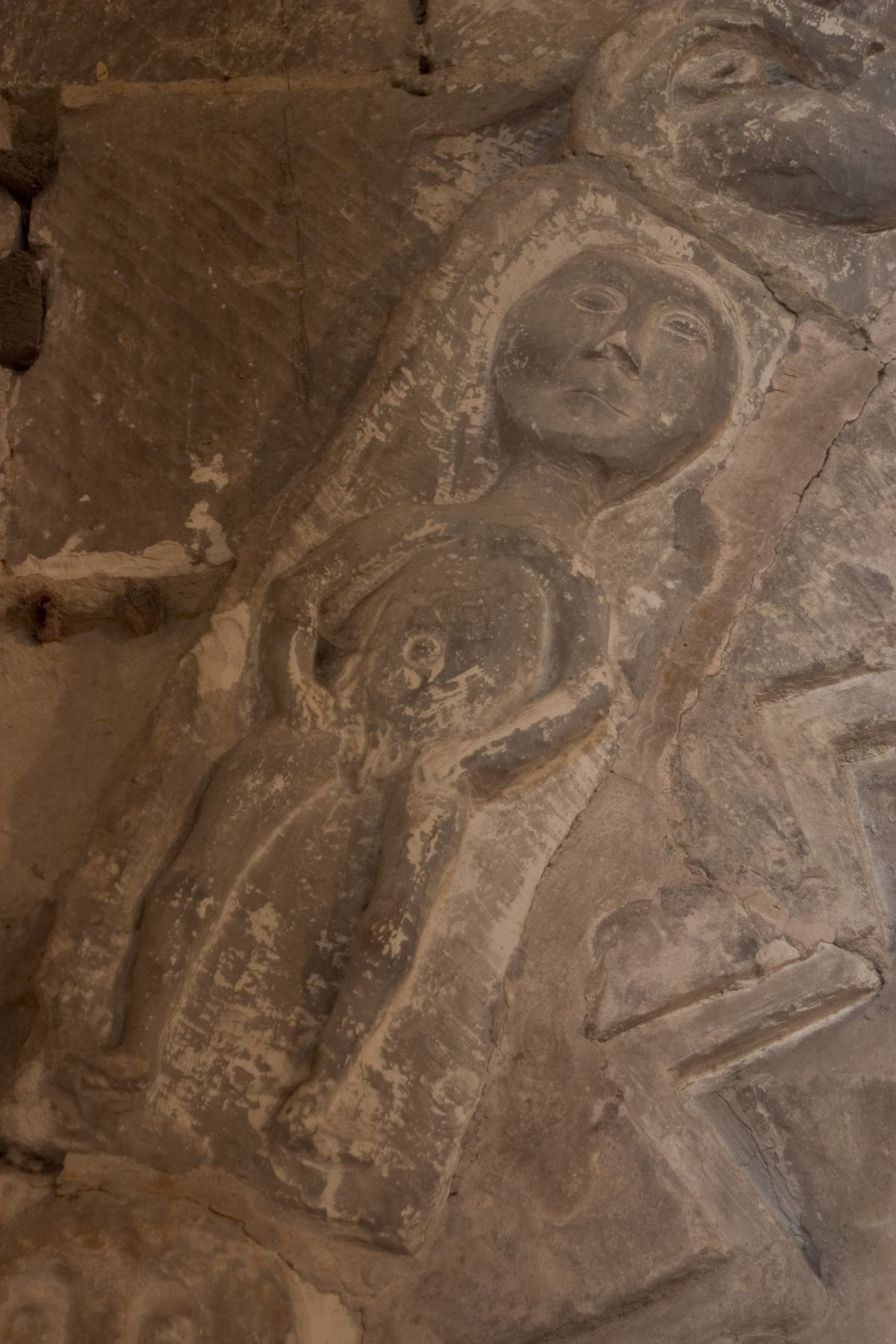
Nunburnhome

Finally we move a little further north to Bugthorpe. In this church there may be a sheela. At present there is an odd-shaped lump on the chancel arch which is believed to be a sheela that has been covered with many layers of whitewash or plaster. The shape does resemble a sheela but what exactly lies under the covers is unknown. There was supposed to be a plan to remove the  whitewash to see what lay beneath. I haven’t been to the church for several years so I have no idea if anything has been done.
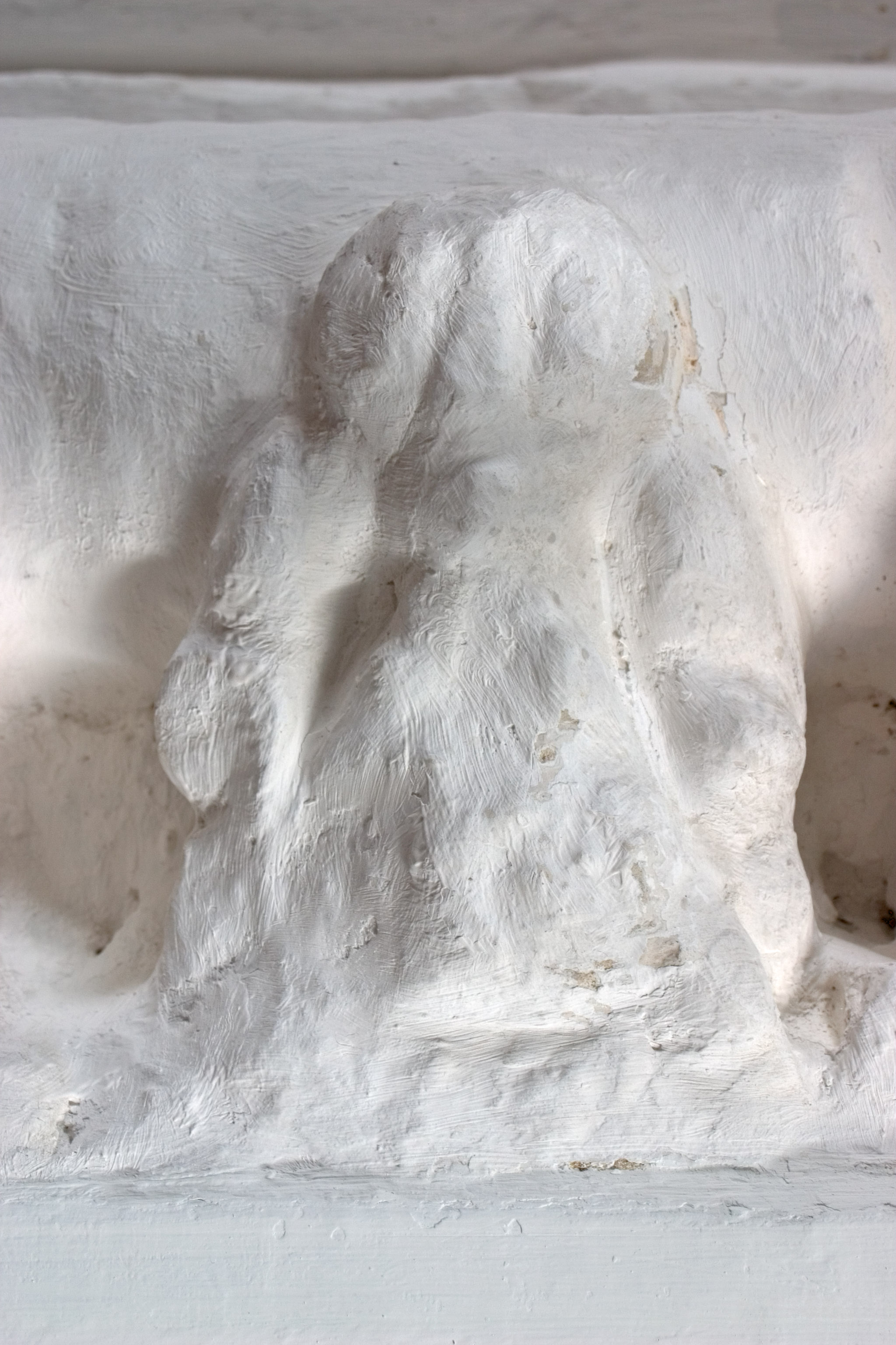
Bugthorpe

We’ve had a brief tour of the main exhibitionist figures in Yorkshire that I have visited. There are a few others that are known and probably several more that are hidden or damaged beyond recognition. If you find anymore I would love to hear about them. Happy church-crawling.

Sources

Andersen, Jorgen, 1977, The Witch on the Wall: Medieval Erotic Sculpture in the British Isles

Freitag, Barbara, 2004, Sheela-na-gigs: unravelling an enigma

Kelly, Eamonn P, 1996, Sheela-na-gigs: origins and functions

Roberts, Jack, McMahon, Joanne, 2000, Divine Hag of the Christian Celts: An Illustrated Guide to the Sheela-na-Gigs of Britain and Ireland

Satan in the Groin, www.beyond-the-pale.org.uk

The Sheela Na Gig Project, www.sheelanagig.org

Weir, Anthony, Jerman, James, 1993, Images of Lust: Sexual Carvings on Medieval Churches

All images copyright Pat O’Halloran 2021

The Valley Church

It is some time since I last posted here so I thought I’d write a short item.

I have to state from the outset that I have never visited this church and it was only recently I discovered it even existed. As we are now in lockdown again I have had to postpone plans to go there. I may write an update to this once I have had chance to see it for myself.

Levisham Church
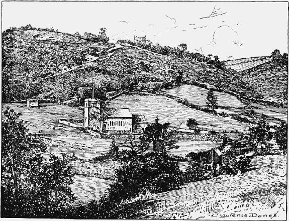
An engraving of the church from a book dated 1923. Picture courtesy of British History Online, see link below.

As you may have gathered the church in question lies in a valley, that valley is a steep sided gorge between the villages of Lockton and Levisham, just to the north of Pickering. Anyone who has travelled between these two villages will be aware that the road is very steep, diving down into the valley from the north side of Lockton then immediately rising steeply, twisting, to arrive at the southern edge of Levisham. In the valley bottom, by the road, are a few buildings, an old flour mill, as the road crosses Levisham Beck. Having travelled this road many times I was surprised to find that just a few hundred metres to the west of the mill, hidden by the trees, is a church. A ruined church.

It is the Church of St Mary, Levisham. The record held by Historic England gives little information. It states it has an eleventh century chancel, part of which was rebuilt in the nineteenth century along with the nave and tower. There are a few features listed including some pieces of carved stone thought to be pre-conquest that have been included in the more recent walls.

The church appears to have been in regular use until the late nineteenth century, according to the web site of Pickering church the burial ground around it is still used. It was not formally abandoned for some time and the roof was repaired. The current church in the village was originally built as a chapel of ease and gradually took over the role of the church in the valley. The font in the current church may have originated in the valley church. A report in the Driffield Times in August 1937 states that the valley church was no longer in use in winter due to it being inaccessible.

There are conflicting ideas as to why this church is here. Some say it was a convenient location between the two villages but others suggest the original medieval village of Levisham lay near to the church on the valley floor. The church stands at a ford across Levisham beck and alongside a road known as Sleights Road which would have been a main route from Pickering north towards Whitby. It would make sense that a village once existed here and the church is now the only evidence for it. Historic England suggests that the village disappeared during the Black Death in the fourteenth century. According to an article in the Yorkshire Evening Post in 1926 local legend suggests it was never meant to be built there. It says that workmen tried to build it at the top of the hill at Levisham but each morning they found all their tools and supplies on the valley floor. Whether it was the wind or the devil they didn’t know but soon decided it was best to build the church in the valley.

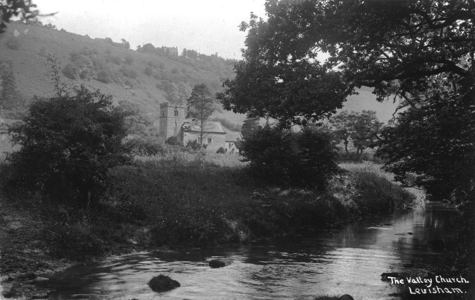
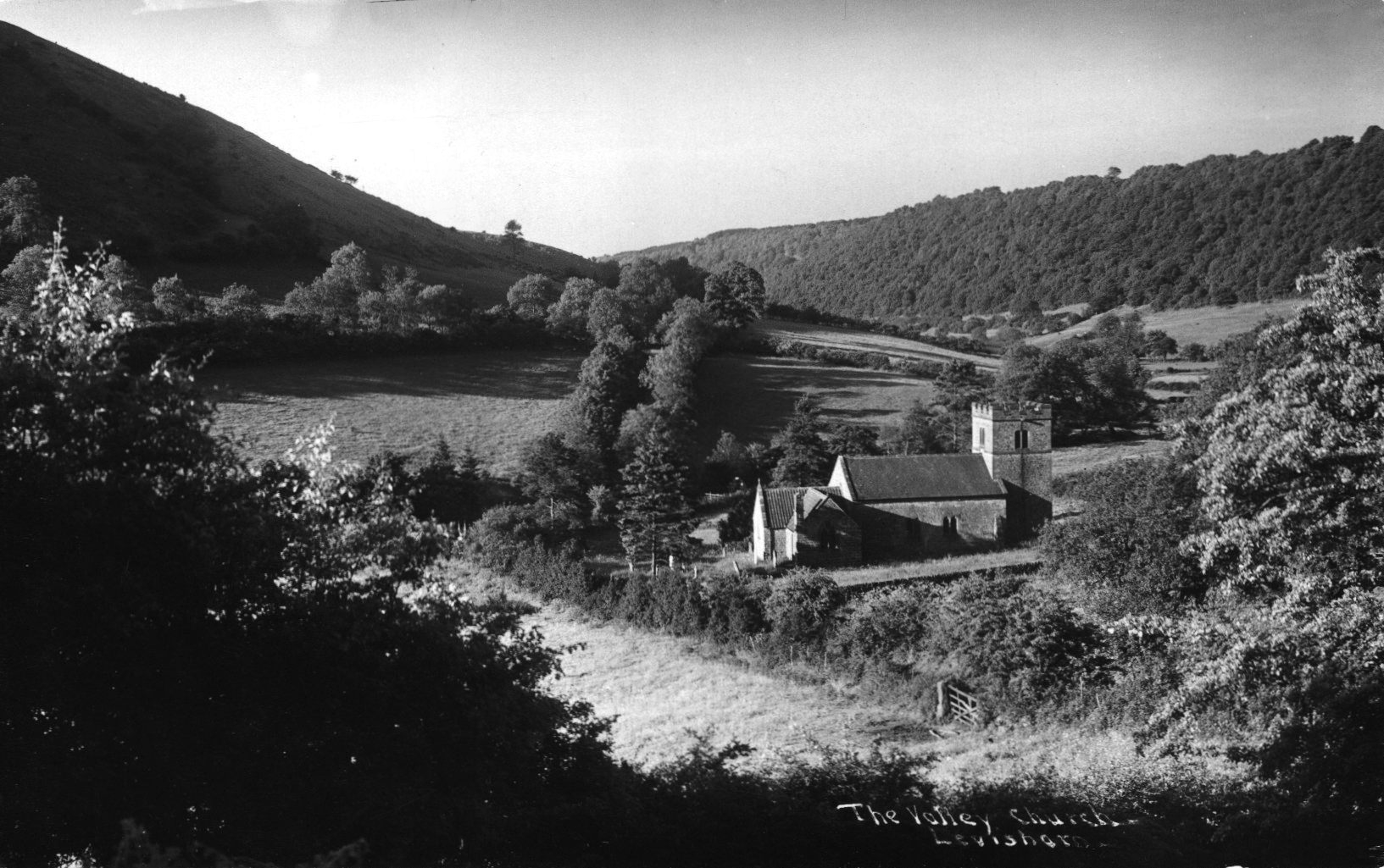
Two views of the church captured by Sydney Smith, a Pickering photographer in the early twentieth century. The top one is from the south, across Levisham Beck. The bottom is from the north looking down from the bank leading to Levisham. Both images from postcards.

There is nothing recorded on DEFRA’s MAGIC map suggesting there are any known remains of the village, but this doesn’t mean they don’t exist.

The church is interesting and enigmatic and deserves further study. When times are easier I will try to visit and explore the site for myself.

References

Historic England

St Peter and Paul’s Church, Pickering

British History Online

DEFRA

Standing Stones on the Moors

The North York Moors are littered with stones, some of them naturally occurring and others that have been moved and shaped by human hand for one purpose or another. Often they may have been repurposed making it difficult to be sure of their original use and even location.

In this post I intend to look at just a few of those which the human hand has played a part and I hope to give some flavour of the variety of stones and uses that exist on the moors. As always I encourage those interested to get out on the moors and see them for themselves, most of those shown below are fairly easy to access. I apologise for the quality of some of the photographs, they are scans taken from old prints of mine, but they are the best I have at present.

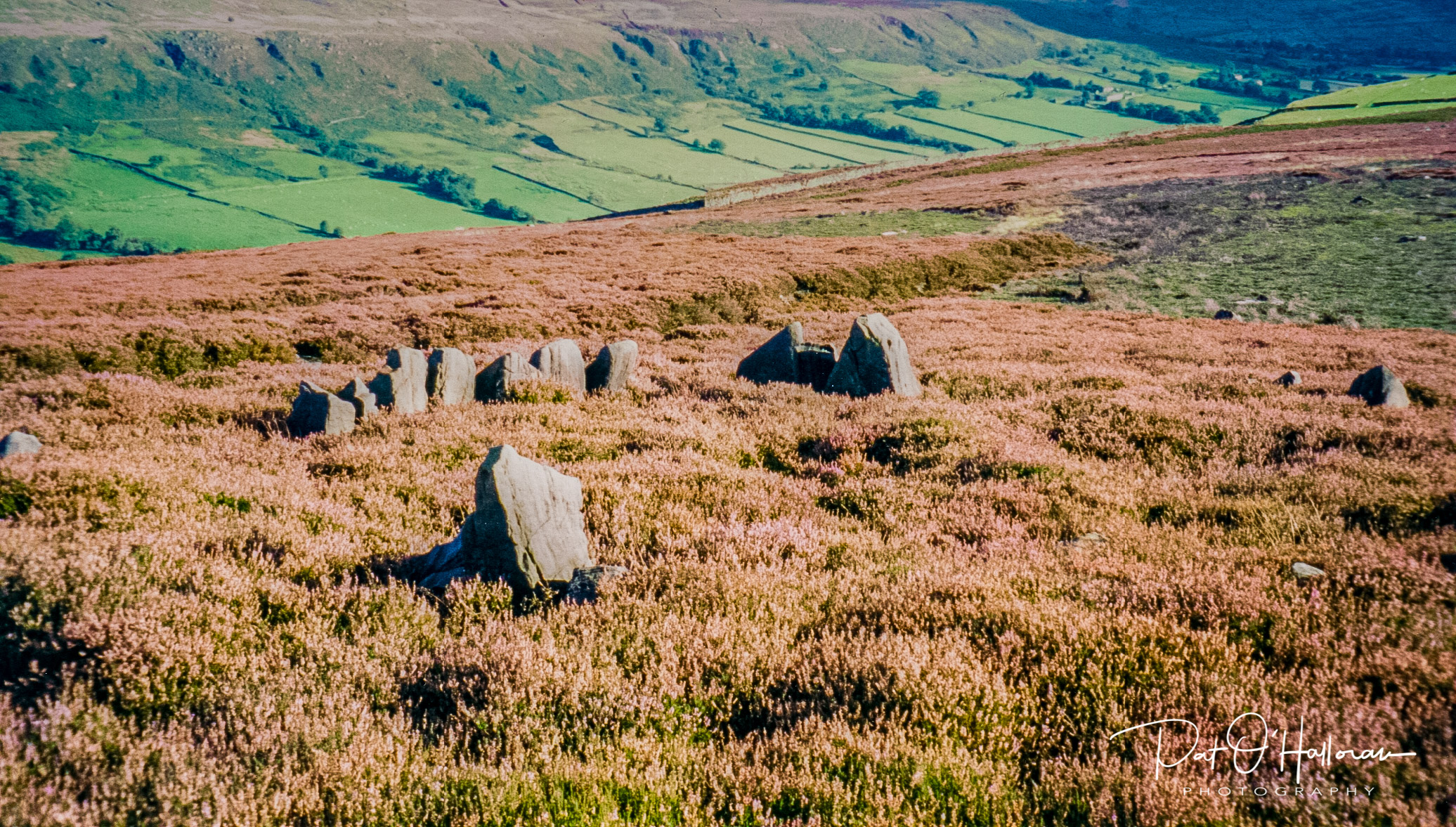
I will start with some stones that, as far as I know, have not been reused. These are known as the High Bridestones and are found just by the side of the road leading from the main Pickering to Whitby road down to the village of Grosmont. There are several stones scattered over quite a wide area. Unfortunately, many of them have fallen and it is difficult to decide what their original positions and pattern may have been. The most well known expert on stones in the UK, Aubrey Burl, thought they were two ruined four-posters [1]. Four-posters are, as you may imagine, four upright stones forming a roughly square configuration. Of the 250 stone circles identified in England only 22 are four-posters, so they are not at all common [2]. This has always puzzled me as there are many more than the eight stones required for a four-poster, indeed Elgee [3] identifies at least 14 stones in the formation and he thought there was two stone circles plus further outlying stones. More recently there has been a theory proposed that it was in fact a stone circle with an avenue leading from it [4].

High Bridestones
High Bridestones

A little further down the road to the southwest lies another formation of stones, known as the Low Bridestones they are much lower and more difficult to spot. These are often referred to as a stone row. I was once given a document that described how these stones, in excess of 86 of them, were originally used as a calendar. However, Elgee [3] says they are the remains of field walls but I find this hard to believe. They have never been fully investigated and although they are both listed sites Historic England hold very little information on either of the Bridestones formations.

Low Bridestones
Low Bridestones

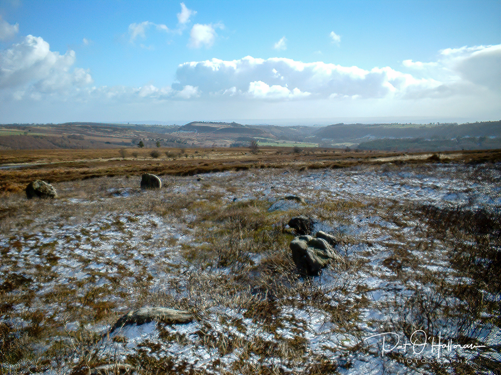
Another stone circle is known dramatically as the Druid’s Circle but rather plainly in official documents as the stone circle on Standingstone Rigg. It appears to be quite a jumbled site with fifteen stones forming a circle of about 8 metres. It originally surrounded a burial cyst , or possibly two, which have been excavated in antiquity.

Druid's Circle
Druid’s Circle

There were thought to have been 24 stones in the circle originally but some have been removed to be used elsewhere or scattered around. Four of the original cyst stones had cup and ring marks but these stones are no longer on the site [2]. Of course, the circle was never used by druids but fanciful names are commonly given to historic sites in an attempt to explain their existence.

Another stone circle can be found on Harland Moor. This is a large 18m circle which is now slightly D-shaped but was probably more circular when constructed, the flattening of one side was probably due to hollow trackways running through the site [2]. The stones are set atop a low bank of a few metres width. The whole area is a cairn field and has numerous ditches and hollows; some of these date from a similar time to the circle while others are medieval iron ore pits.

Harland moor circle
Harland moor circle

Just because a site is referred to as a stone circle doesn’t mean that it actually is one. The next site is known as the Bride Stones (yes, another one) and is often called a stone circle yet in reality it is the remains of a bowl barrow. It is approximately 10 metres in diameter. The ring of stones would have been kerb stones around the barrow which consisted of a mound of earth and stones. Over the years both the weather and inquisitive explorers have removed the covering, and any contents there may have been, leaving only the kerb stones to view. I remember the walk up here was quite steep but the view was stunning.

Nab Ridge
Nab Ridge

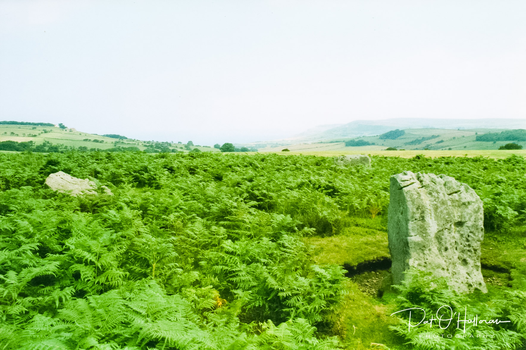
Across the other side of the moors, overlooking the coast near Robin Hood’s Bay, lies the Ramsdale circle. It looks more like a triangle at present as only three stones remain but it would have been a circle of around 10 metres in diameter. Little more is known about this circle except that it lies within an extensive area of Bronze age activity including burials and earthworks [2]. Perhaps one day it will be excavated and we can discover more.

Ramsdale circle
Ramsdale circle

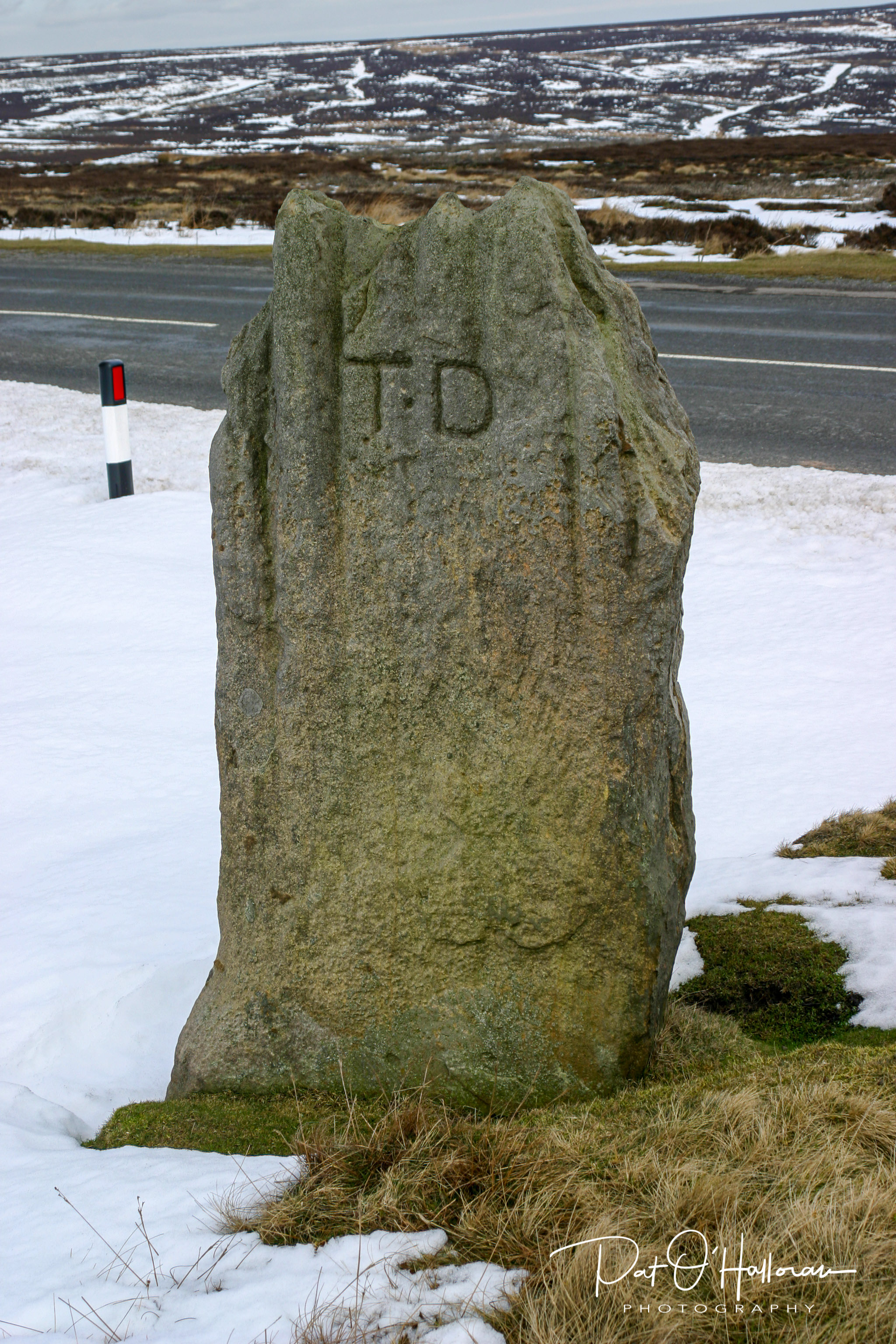
I’ll move now to standing stones and the first goes by the wonderful name of Margery Bradley. She sits by the side of the road along Blakey Ridge and an adjacent trackway, though she aligns with neither.

Margery Bradley
Margery Bradley.

She bears the initials TD one one side which stand for Thomas Duncombe who used the stone as a boundary marker for his estate in the eighteen century but there is no indication the stone has been moved from its original site. The stone is from the Bronze Age and is contemporary with Flat Howe which lies a few hundred metres away in the moors. On the other side there is a benchmark cut into the stone, an indication of further re-use in the modern times. I’m sure you will be wondering from where she got here name, no-one knows. There are, of course, many different tales. She is often grouped with nearby Ralph’s Cross and Fat Betty and represents a nun lost on the moors. One reference says Bradley is a corruption of ‘breadless’ and was a spot where beggars would gather for alms, though as the author points out it is a lonely spot for such an enterprise [5]. There are at least two other stones with the surname Bradley, Jenny and Ginny, so perhaps this makes sense.

The next stones have a romantic tale to explain them too. The legend tells of a deer being hunted across the moors and as they eventually managed to impale the animal it took a huge leap across the heather before expiring and two stones were planted there to mark the length of its dying leap. The stones were thereafter call the Hart Leap Stones.

Hart Leap Stones
Hart Leap Stones

Whilst this is undoubtedly an interesting tale it is one invented in later years to explain their existence. One stone even bears the inscription ‘Hart Leap’ and the area is also now known as the Hart Leap cross dyke. It was once thought these stones may be the remains of a stone row but know they are believed to be part of the aforementioned cross dyke that stretches out on either side of the road here on Glaisdale Rigg [2].

We move now to further legend and a stone knowns as Old Wife’s Neck, if you look at the photograph it may be clear how it got its name. The area consists of earthworks including three ditches with banks and several standing stones on the dyke. The largest stone is Old Wife’s Neck. This part of the moors is quite isolated now but there is evidence that it was once heavily populated [2].

Old Wife's Neck
Old Wife’s Neck

Another type of stone often seen on the moors are guide stones. As the name suggests these were to aid the traveller in choosing the right path across the heather to reach his destination. Some of these were stones erected for that purpose while others were existing standing stones repurposed. One of the most well known is the Hand Stone

Hand Stone west side
Hand Stone east side

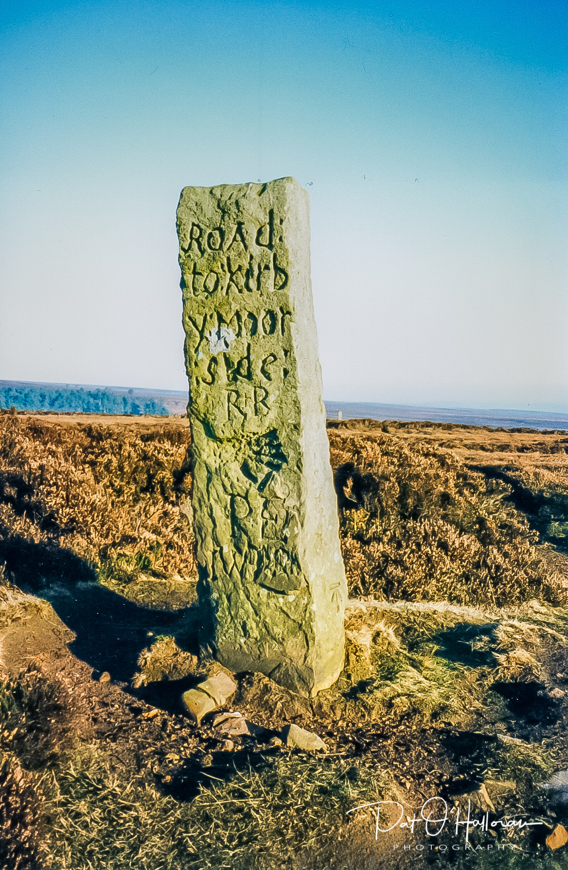
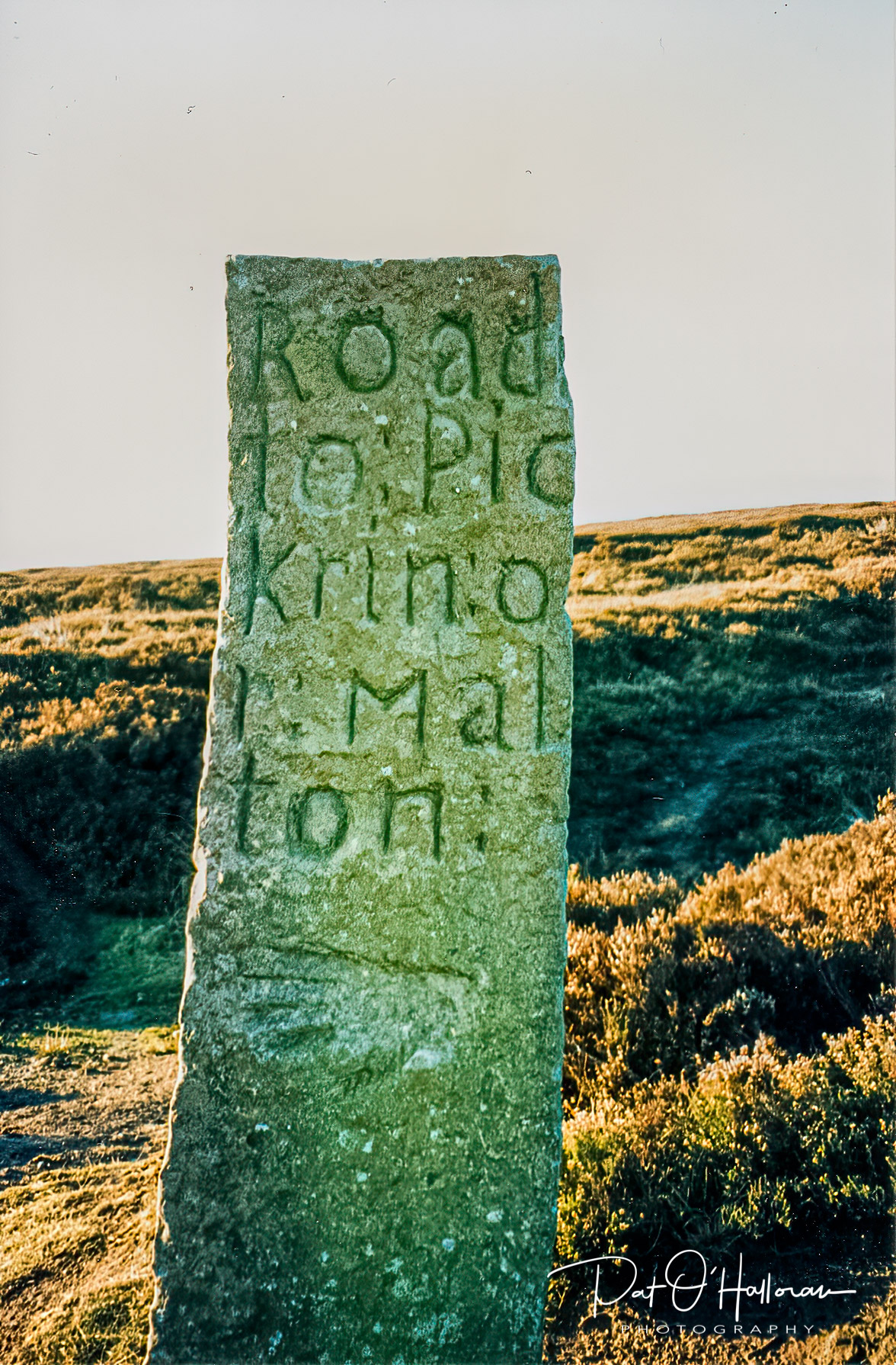
The stone stands close to the modern road just north of Hutton-le-Hole. As the photographs show it points the way to Kirkbymoorside and Pickering and these sides have a representation of a hand carved into them. The north side also has a hand and an inscription pointing the traveler to Guisborough. The south side only bears the initials RW. It is thought to date to around 1720 [2].

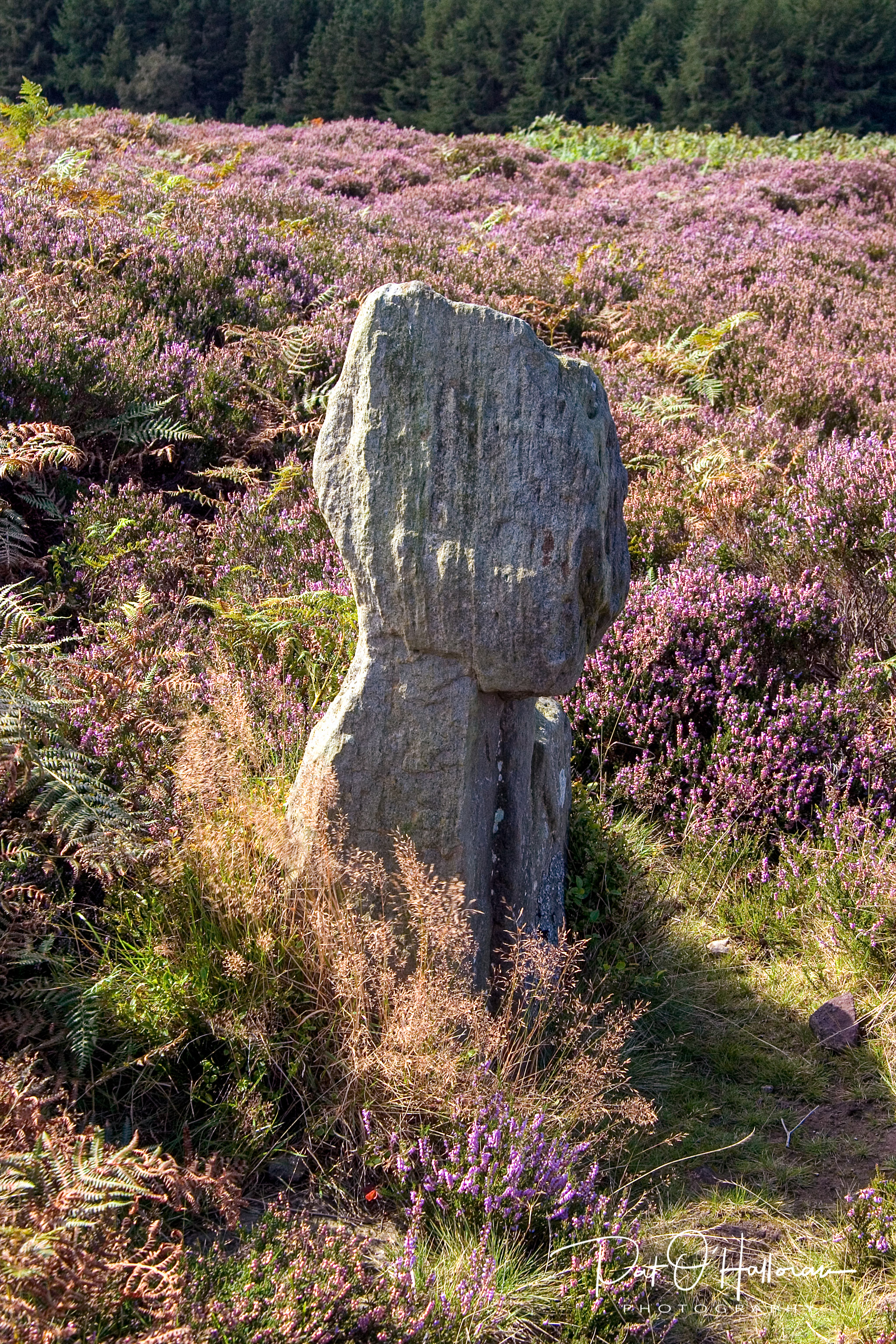
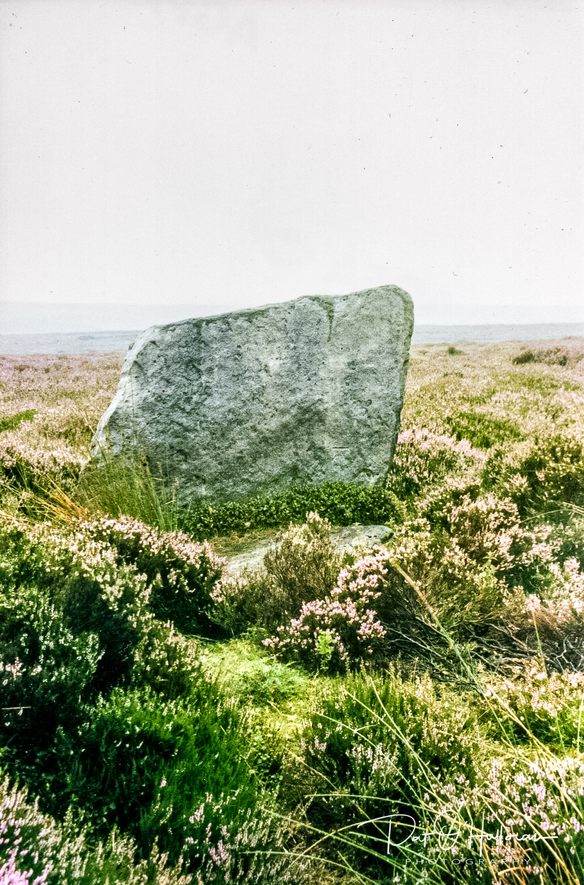
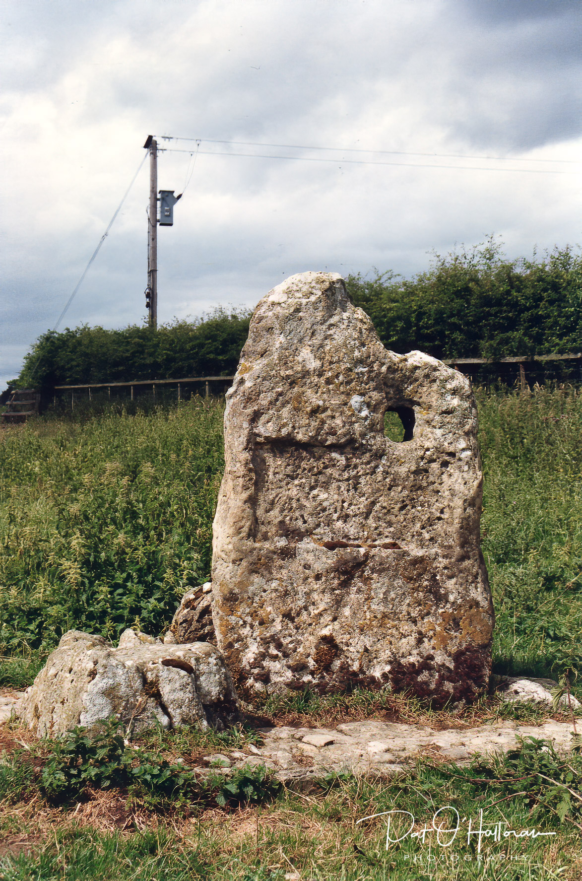
The next stone is listed in the official records as a waymarker [2] but I’m not certain that it is. As far as I’m aware it is only known by the name of Traverse Moor stone and is a large slab of stone set upon its edge.

Traverse Moor stone
Traverse Moor Stone

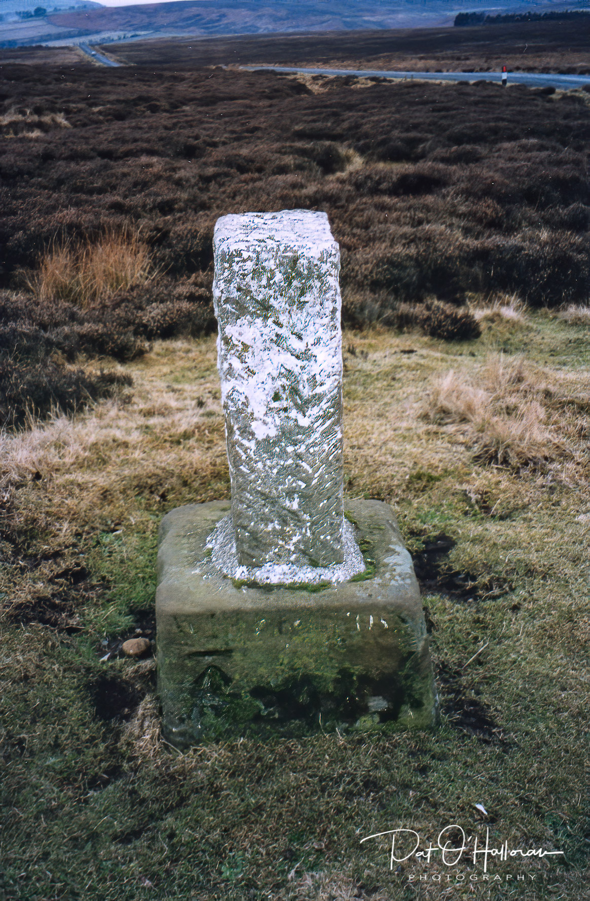
It stands by the side of the road that crosses Traverse Moor on its way from Rosedale to Egton Bridge, it is aligned with the road with its tallest corner to the south so could be marking the way but I just feel it is something other than that. There is little information on the stone. You can just make out a benchmark on the lower right of the stone on this, the west face. Historic England believe it to be eighteenth century and gritstone [2].

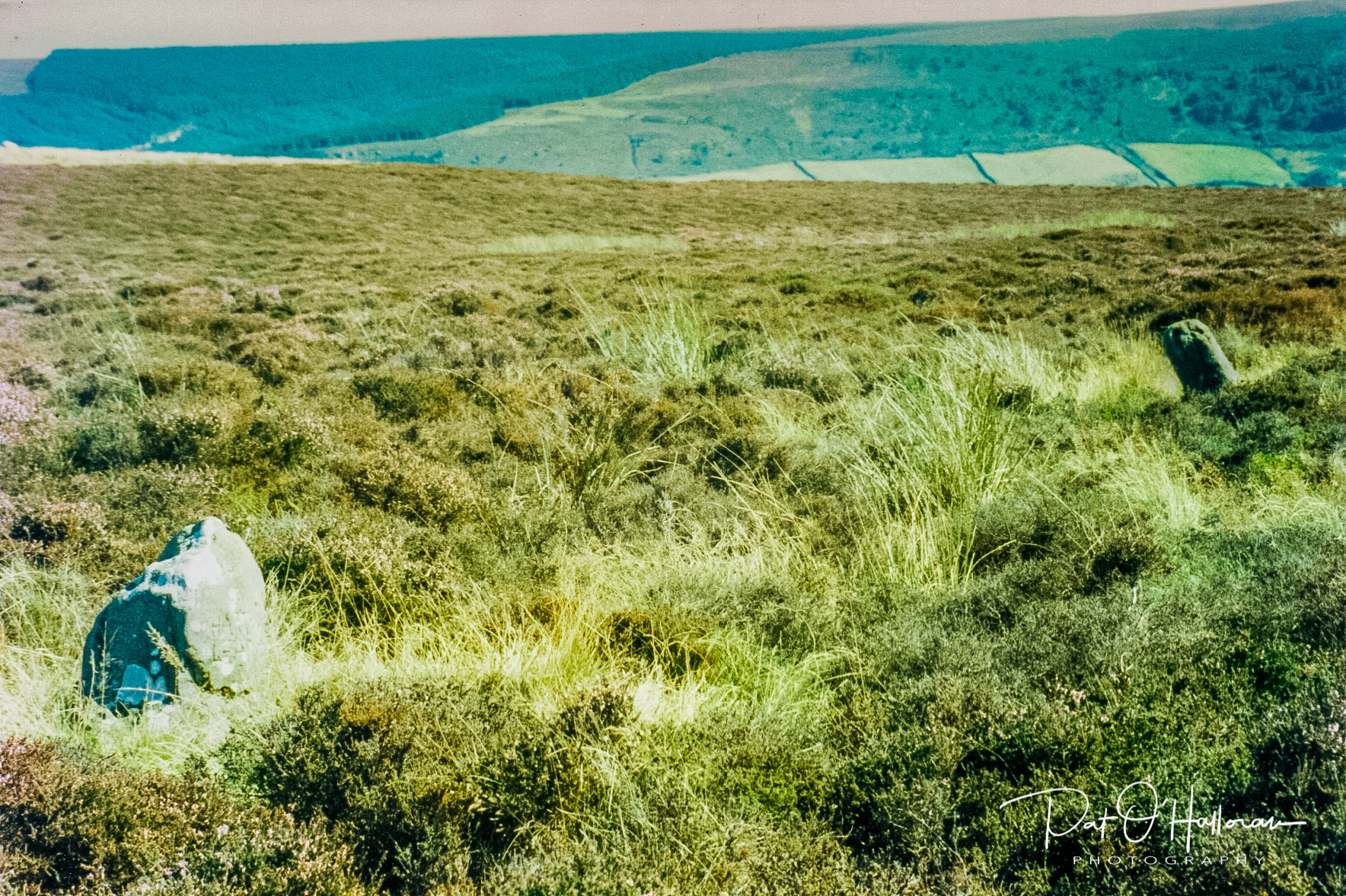
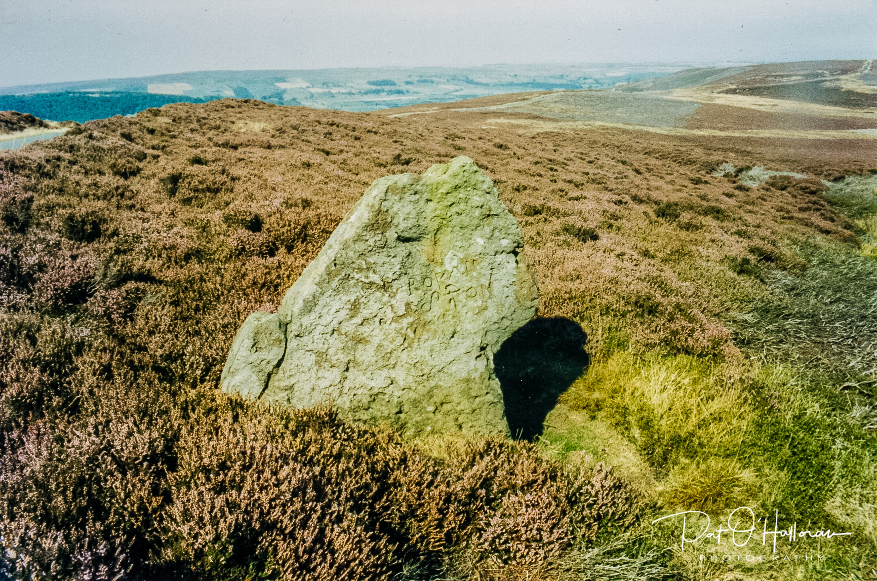
Finally I have another stone about which I know nothing, I can’t even remember how I found out about it, maybe I just happened across it whilst out on my travels. It is called the Rokan Stone because this is what appears to be inscribed on its face, or at least ‘Rokan Ston’ is there.

Rokan Stone
Rokan Stone

The stone lies alongside the road on Glaisdale Rigg so could be another waymarker however it is not aligned with the road but at right angles to it. It is marked on old maps as ‘Rokan stone’ but doesn’t appear on modern ordnance survey maps nor is it listed by Historic England. What ‘Rokan’ refers to I’ve no idea, perhaps someone reading this can enlighten me.

That concludes a brief tour of a very few of the stones on the moors. There are many more, some of which are probably not listed anywhere, and each one has its story. Perhaps I’ll look at a few more in a later post.

[1] Burl, A. (1995) A Guide to the Stone Circles of Britain, Ireland and Brittany, London, Yale University Press

[2] www.historicengland.org.uk

[3] Elgee, Frank., Elgee, Harriet. (1933) The Archaeology of Yorkshire, London, Methuen & Co.

[4] https://stonerows.wordpress.com/gazetteer/region/north-yorkshire-moors/high-bride-stones/

[5] White, Stanhope (1987) Standing Stones & Earthworks on the North Yorkshire Moors, Scarborough, self-published

Springs & Wells – Holy & Otherwise

Throughout these lands there are many points where water comes to the surface. In times past these would have been the only sources of fresh water and often meant a walk of some distance to resupply a household. As time went on some of these springs and wells took on a mysticism and a reputation that has filtered down to modern times.

Fresh water issuing from the ground can easily be thought of as miraculous in itself, especially if it was supplying life-giving fluids to a household or village. Many wells and springs were attributed great powers whilst others were called ‘holy’, perhaps because they had been blessed by an official of a church or because they were used by a religious house.

In the area around the North York Moors we have several sites of wells and springs, and several more in villages away from the moors. In this post I will discuss a few of these that I have visited.

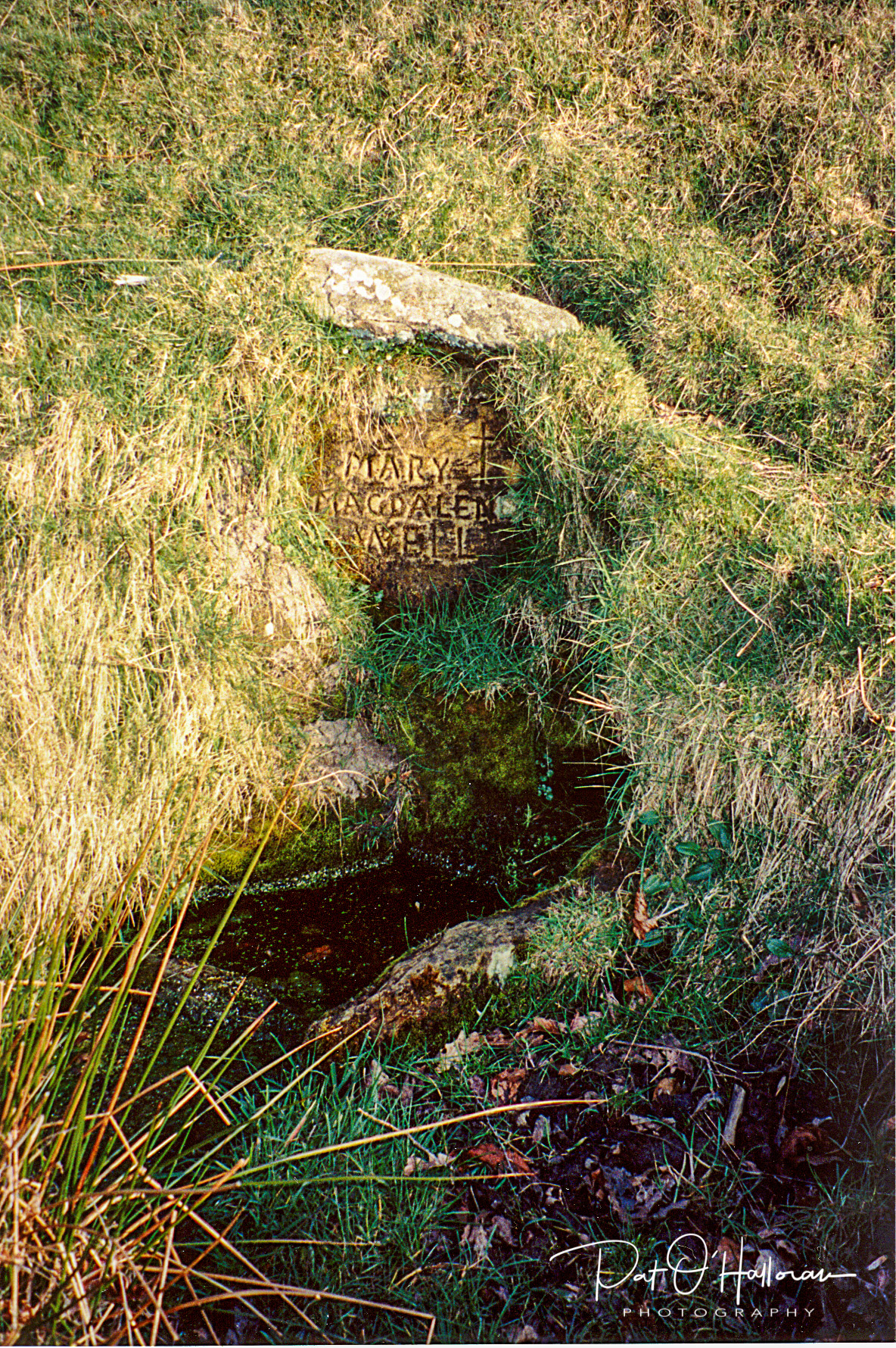
The first is at Spaunton Bank Foot, just outside Lastingham. Set into the bank below the road through the village is Mary Magdalene’s Well.

Mary Magdalene’s Well

It can be difficult to find if you don’t know where it is but has probably been tucked away here for many years. In 1964 it was cleaned out by a Mr H Frank, a local man, and he found pottery from the 13th century and some from earlier; depending on the source this second piece was either Saxon or Roman. Whichever it was it suggests continued use for many centuries. As with many such wells the origin of the name is unknown in that though Mary Magdalene was known about it is not clear why her name was attributed to this well. She is often linked with healing so maybe this well had a reputation as a healing well.

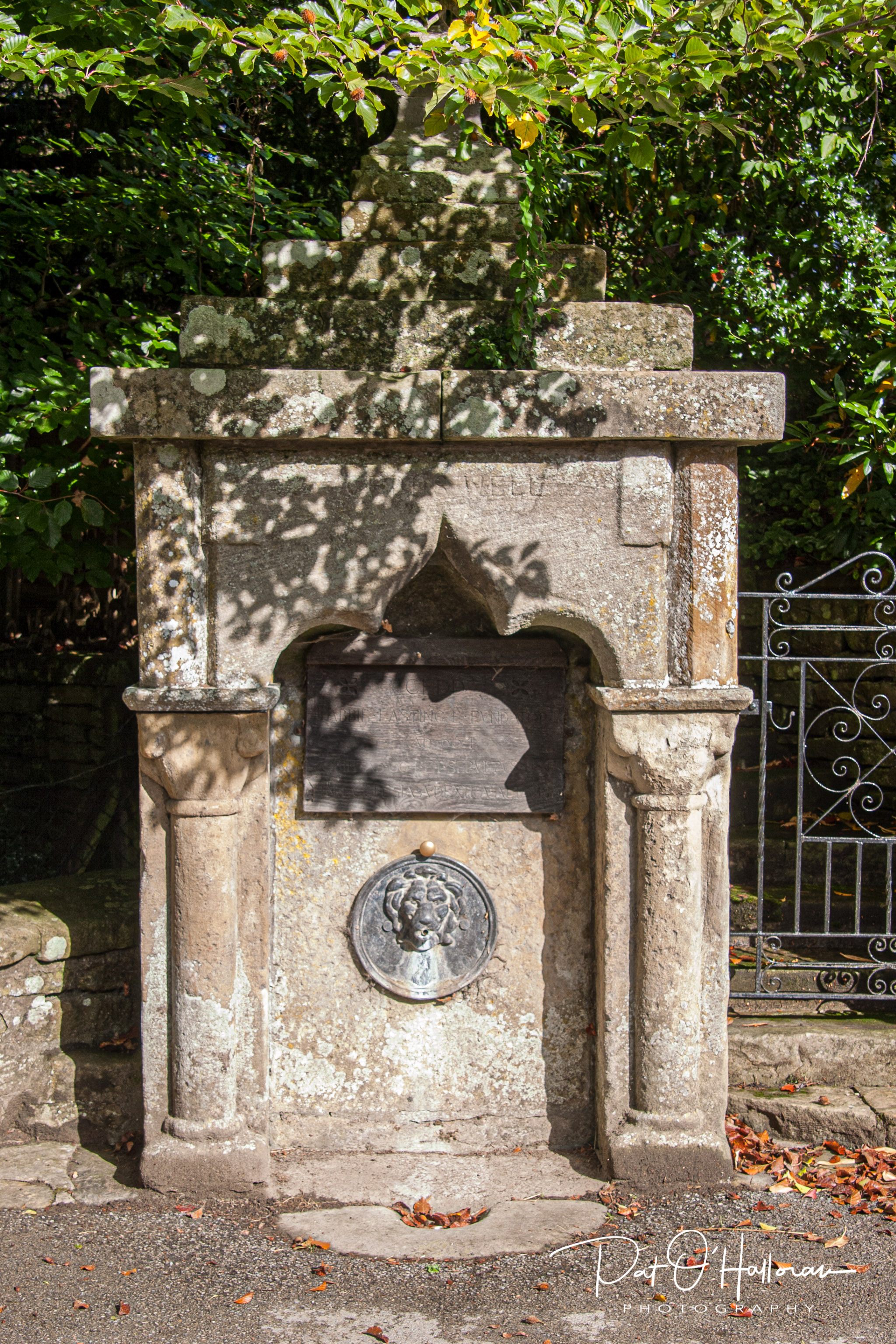
Travel a short distance to the east and you arrive in the legendary village of Lastingham. The village is probably worthy of a post entirely for itself, and I may well embark on that in the future. Today, however, I will concentrate on the wells, for there are three. The most obvious and well-known (sorry) is St Cedd’s Well that stands at the end of the bridge over the beck in the village centre.

St Cedd’s Well

The stonework surrounding the well is said to have originated from a local abbey, some say Rosedale, others say Lastingham. The site for Lastingham Abbey, if it ever existed, is unknown so Rosedale is probably correct. The story about Lastingham Abbey is another interesting tale for another day. St Cedd was the Bishop of the East Saxons and is said to have founded a monastery in 648 CE, he died in 664 CE. The well was probably in use long before Cedd arrived and may have been Christianised at that time. It was used as the source of water for the village until relatively recently. An article in the Yorkshire Evening Post in 1913 mentions that villagers still draw water from the well.

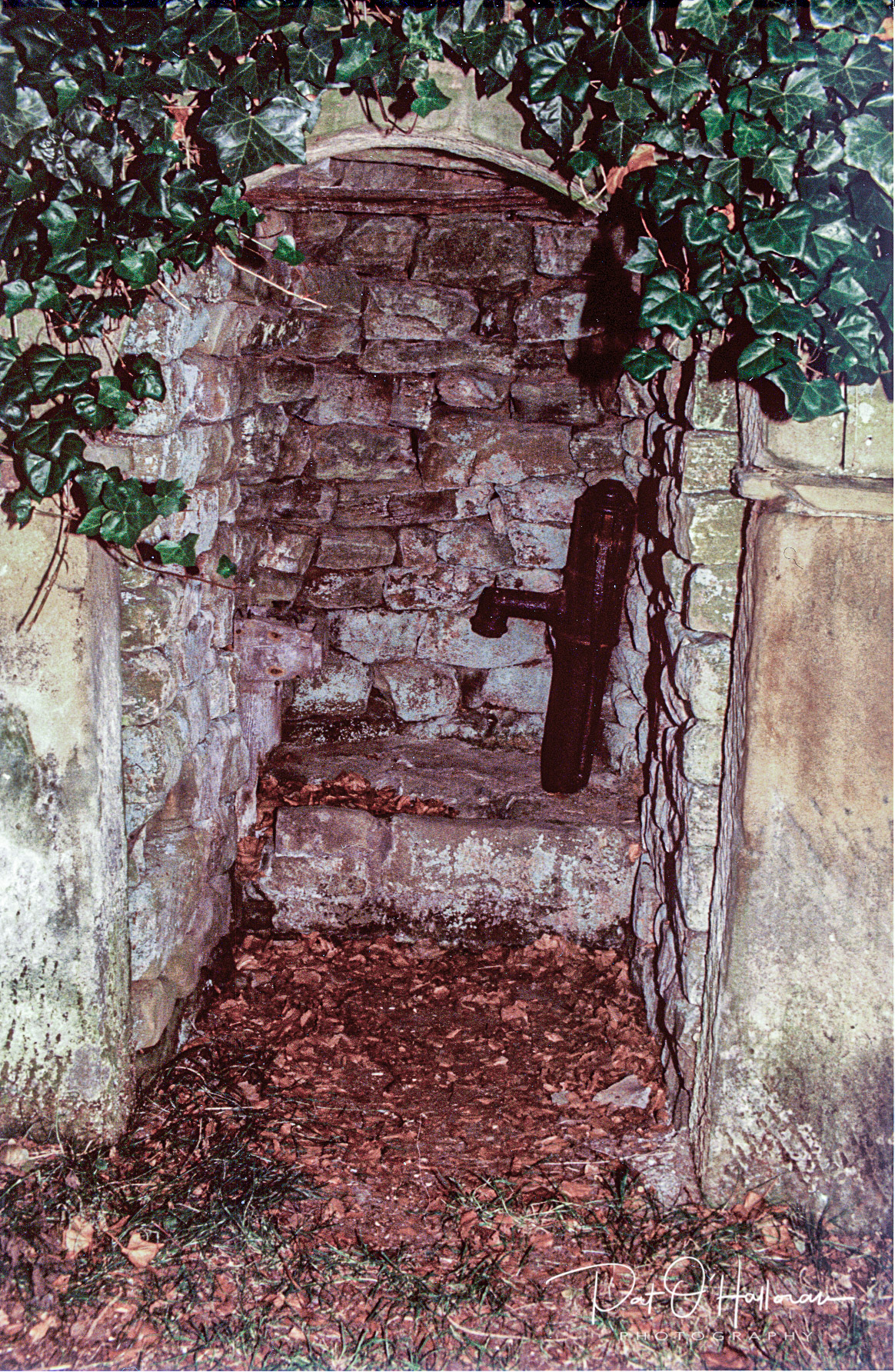
A little further along from St Cedd’s Well is St Chad’s Well. St Chad was St Cedd’s brother and he too was involved in the building of the monastery, wherever it was, he later became Bishop of Lichfield. His well is less grand being housed in a simple shelter tucked into a wall. Last time I visited it had a hand pump at the back but it appeared to be dry.

St Chad’s Well

This well was also used as a water supply for the village. In an article in the Whitby Gazette in 1895 there are complaints that the water had become contaminated. It also states that the other source of water in the village was also impure, presumably referring to St Cedd’s Well. Apparently work had been undertaken on St Chad’s to rectify the problem but had not been done satisfactorily, the chairman of the Parish Meeting offered to pay for this work to be done at his own expense. It was noted there were frequent visitors to the village and a good water source was paramount. It is interesting that it was said the wealthier residents had their own springs on their land and were therefore little interested in the village water source.

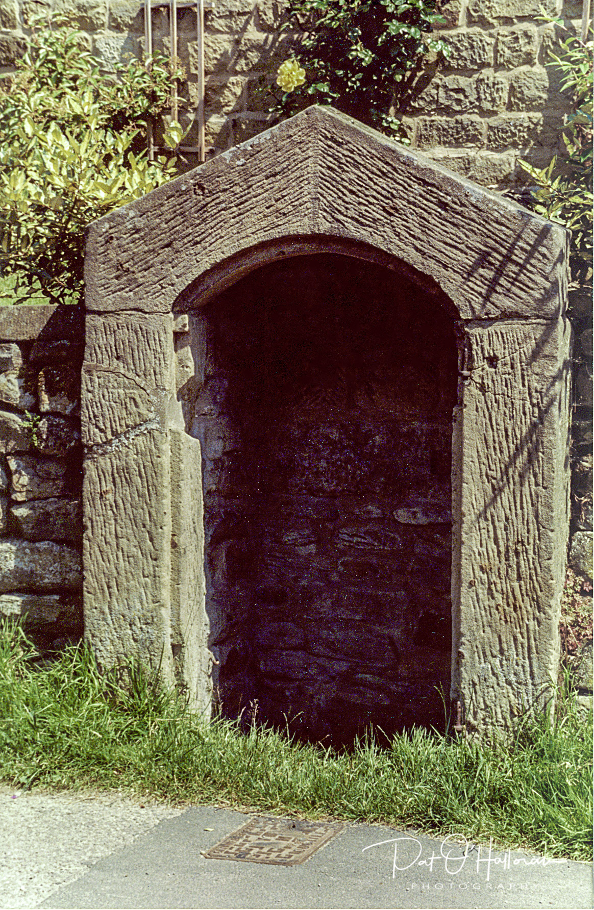
Our third well in this village is St Ovin’s Well. All that remains of this well is the shelter at the side of the main street. Ovin arrived in Lastingham at a similar time to Chad and went to Lichfield with him. Why the well is named after him is not known.

St Ovin’s Well

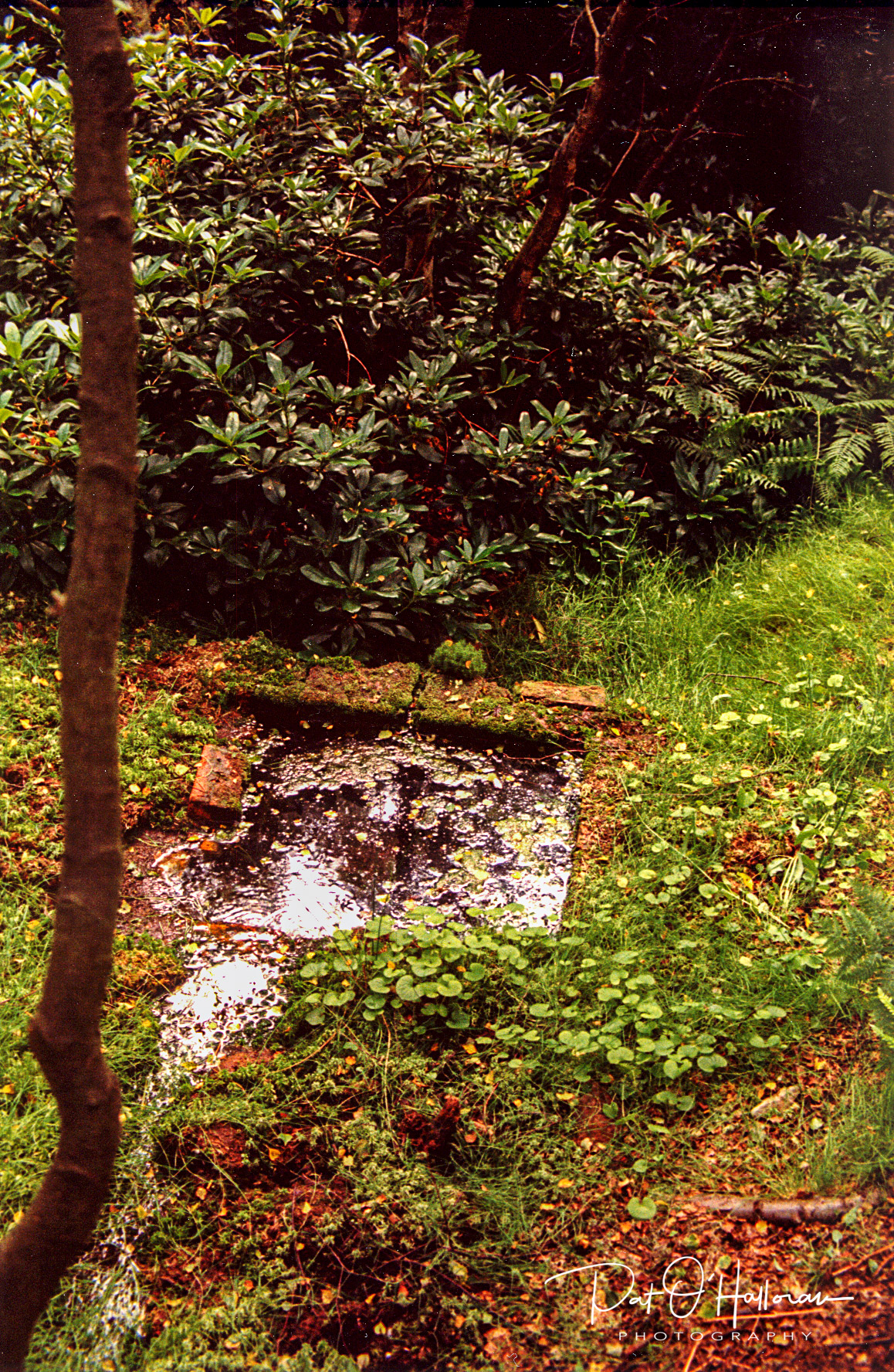
We travel further east now into part of Cropton Forest at the foot of Cawthorne Banks. At the top of the banks lay the Cawthorne Roman Camps with their boundaries tight up against the edge of the escarpment. From there you can look down over the forests and across the moors as far as Blakey Ridge. If you were to explore the forest immediately below the camps you may find what is known as Roman Well.

Roman Well

It is now hidden among a thicket of rhododendron bushes and is quite small. It is brick-lined and whenever I have visited it has always been flowing. Whether the romans used it is anyone’s guess but the spring would have been there when they occupied the camps so they may have done. It was used by occupants of the local farmhouse until recently.

Now we move northwards and a little further east to Stape. There is an old roman Road called the Wheeldale Road that runs north from around the Cawthorne area past Stape and up across the moors towards Whitby. Or maybe not. There is a lot of conjecture at present that it may not have been a Roman road or indeed a road at all but a Neolithic boundary feature, again, maybe another post could explore this. There was an old trackway running north from Stape across the moors and soon after it left the village it would have passed our next well, Old Wives’ Well.

Old Wives’ Well

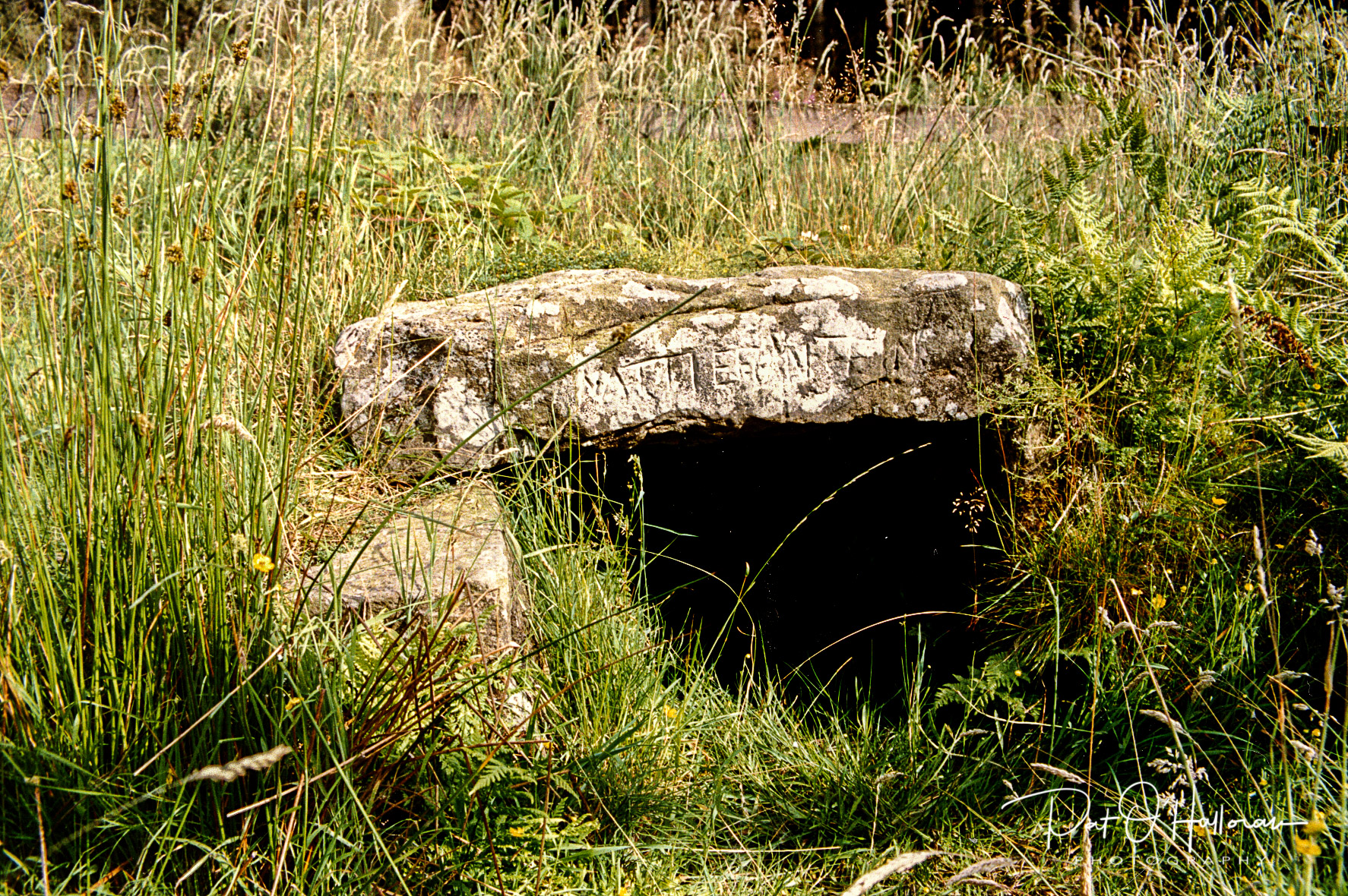
This lies just to the east of the road among a stand of trees. It has a rough housing around it and the roof has an inscription, “Nattie Fontein”. It has been suggested that this is a corruption of Fons Natalis, a Celtic water nymph, but I’m not convinced and have not been able to find any reference to a nymph of that name. I don’t know what it does mean but maybe it is something as simple as ‘natural spring’. The well may have been used by travellers along the road over the moors. Recently there has been a habit of leaving ribbons and cloths on the nearby trees, treating it as a rag well. Unfortunately, there has been a large amount of plastic tat left there too, making it seem more like a rubbish dump than a place of veneration.

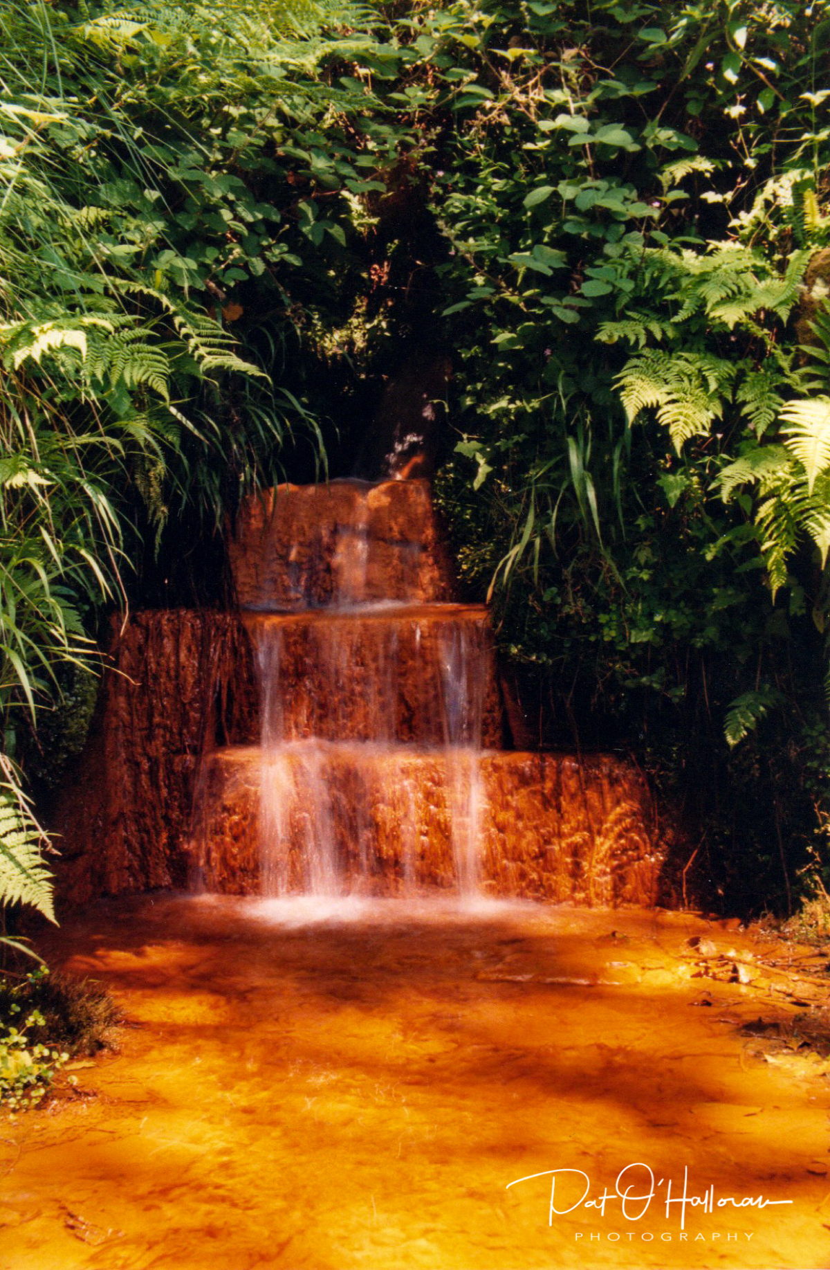
Travel north-east now to the steep embankment overlooking the railway line north of Levisham at Newtondale near Needle Point. Here you might find the Newtondale Spring. When I visited here it was quite a struggle to find it and a tough hike on the hillside. However, it was quite impressive once there.

Newtondale Spring

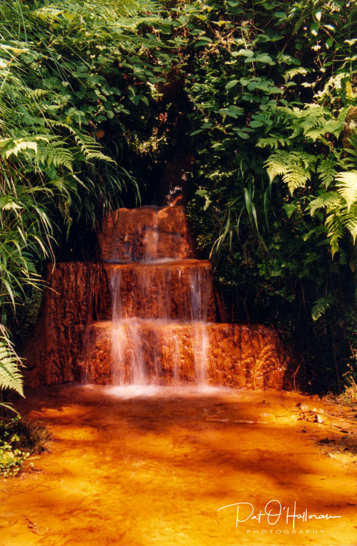
It is obvious from its colour that this is a chalybeate spring and contains iron deposits, it may be the presence of such minerals that has made it known to locals as a well of some importance. Murray states that

a fair was long held here on Midsummer Sunday, to which all the people of the district resorted, in order to perform certain ceremonies which ensured them the “blessing of the well.”

John Murray

The well itself has several large hewn stone blocks forming a basin into which the water runs. Much of it is hidden in undergrowth and may have been much more elaborate at one time.

Next we move over to the coast near Hawsker. By the side of the road that runs from this village to Robin Hood’s Bay is T’awd Abba Well/Abbey Well/Boiling Well.

T’awd Abba Well

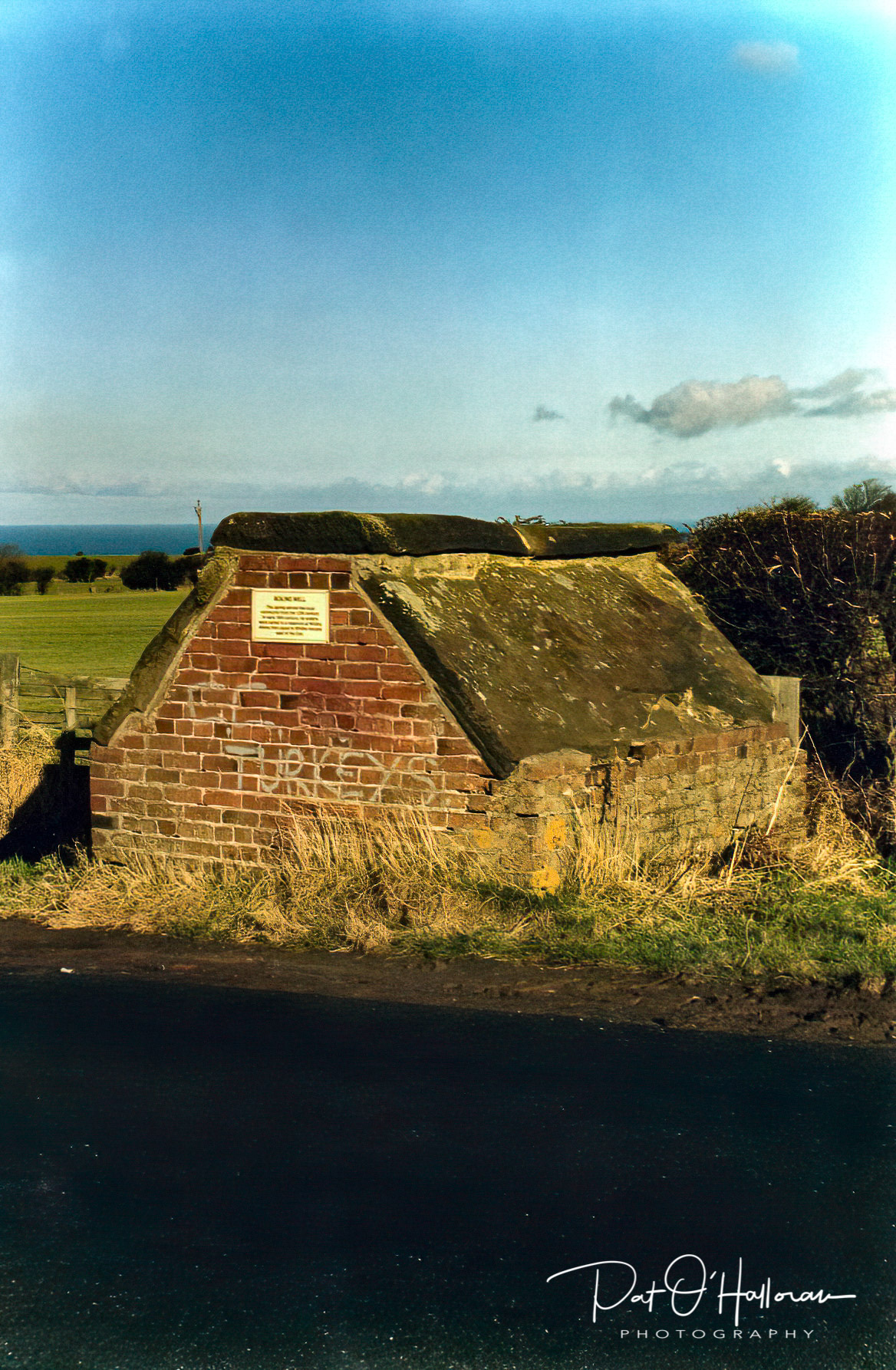
There is a large brick housing with a solid slabbed roof offering itself as a canvas to the local graffiti artists (I have removed some offensive graffiti from the photograph). It is thought that this well once fed the ponds at Whitby Abbey and this accounts for its name. You can view the water from the field end of the housing and it appears plentiful and clear. The plaque on the end used to have a poem written on it but this was changed several years ago, it read

Lang centuries aback

This wor t’awd Abba Well

Saint Hilda veiled i’ black

Lang centuries aback

Supped frey it an no lack

All t’sisterhood as well

Lang centuries aback

This wor t’awd Abba Well

Saint Hilda refers to Saint Hild who was the founding abbess of Whitby Abbey.

We stay with St Hilda for our final well, a little way up the coast in the churchyard at Hinderwell is St Hilda’s Well.

St Hilda’s Well

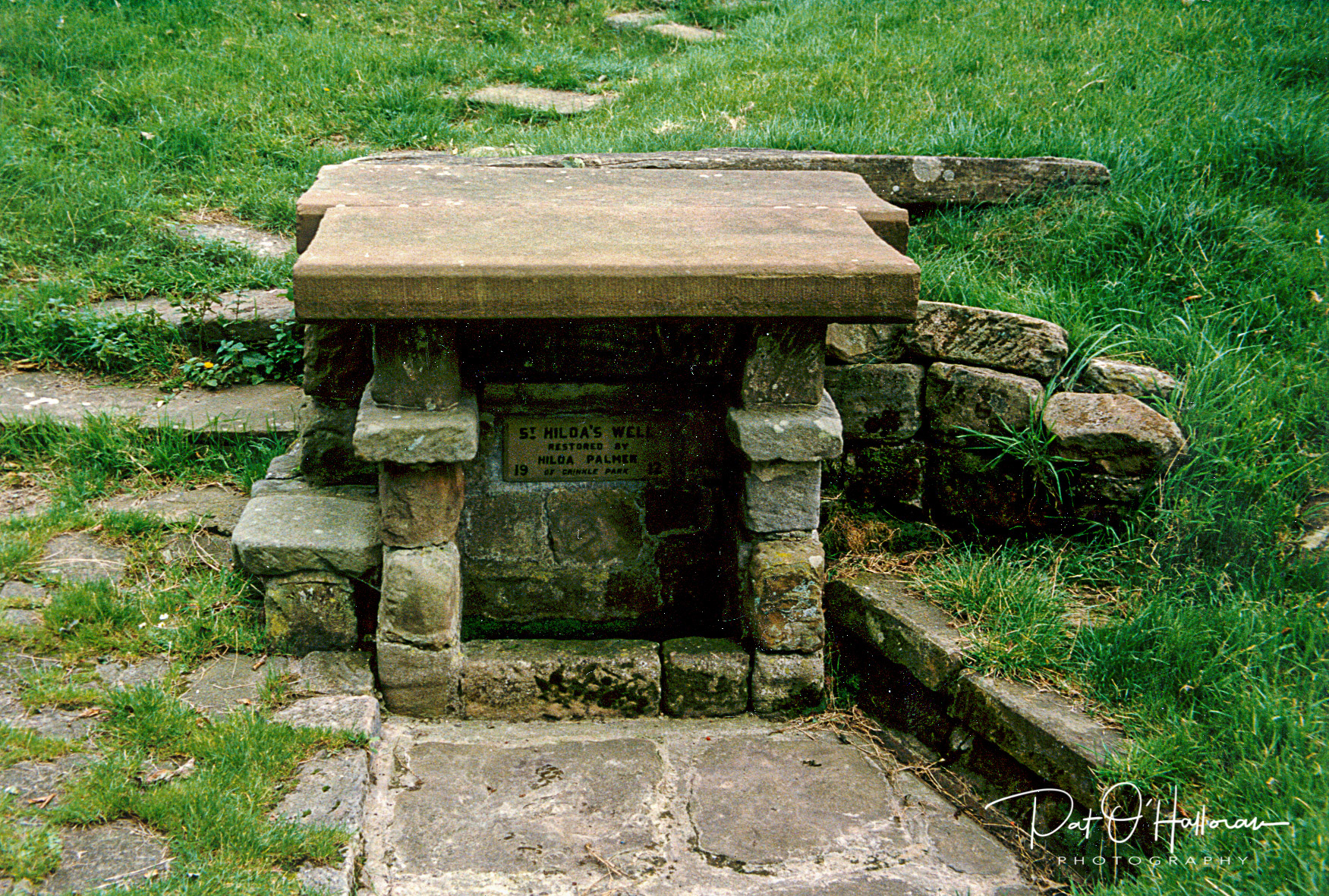
It is said that Hilda used to have a retreat near here and that she used this well while staying there. The well has a fairly recent housing and a plaque states it was restored in 1912. It is still quite prominent in the churchyard with steps leading down to it.

That concludes our brief look at wells in the area. There are many more and, unfortunately, many that have been lost. I have spent many hours trying to find evidence on the ground of some historic wells. Thankfully several of them are looked after and remain to be found by the visitor.

References

Gutch, E. ed., 1901, County Folklore, Vol II, The North Riding of Yorkshire, York and Ainsty, pp30

Murray, J. 1874, Handbook for Travellers in Yorkshire, London, p210

Yorkshire Evening Post, Saturday, 23rd August, 1913, p4

Whelan, E., Taylor, I. 1989, Yorkshire Holy Wells and Sacred Springs, Northern Lights

Whitby Gazette, Friday, 22 November, 1895, p3

Moorland Crosses 3

In this post I thought I would look at the less dramatic subject of cross bases, many of which are never seen. Last time I briefly mentioned Redman Cross which exists only as a base and may not be in its original position, in this post we will see a few more.

The first we shall look at is Cooper Cross. Many people will have passed close by this cross without realising it, it sits by the side of the road at the top of Sutton Bank and marks the intersection of two ancient tracks. It is a square block standing around half a metre high with a round socket for the shaft. Travellers moving along the drove road running along the Hambleton hills, or those heading east from places like Rievaulx via the Sperragate, would encounter this cross as the tracks headed downhill to the vale below. It would have been a waymarker and, as all crosses are, a spiritual sign.

Cooper cross

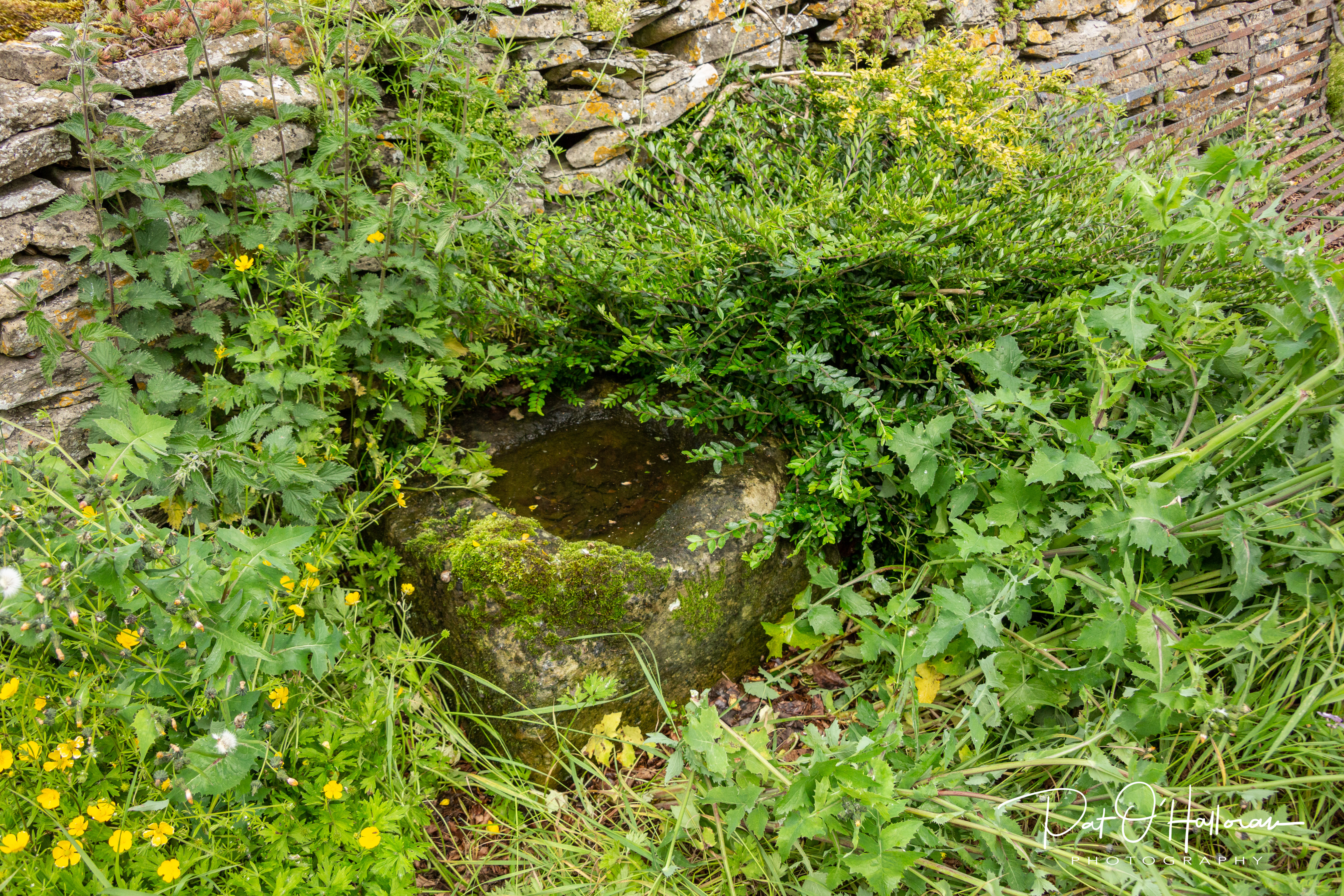
Heading east along the road towards Helmsley there is a turn off to Rievaulx and a short distance down that road lies the village of Scawton. Nestled against the churchyard wall on the south side is another cross base, that of Scawton Cross. It is often difficult to find as the weeds and vegetation cover it in the summer. It too is a marker cross and sits on the Sperragate as does Cooper Cross above.

Scawton Cross

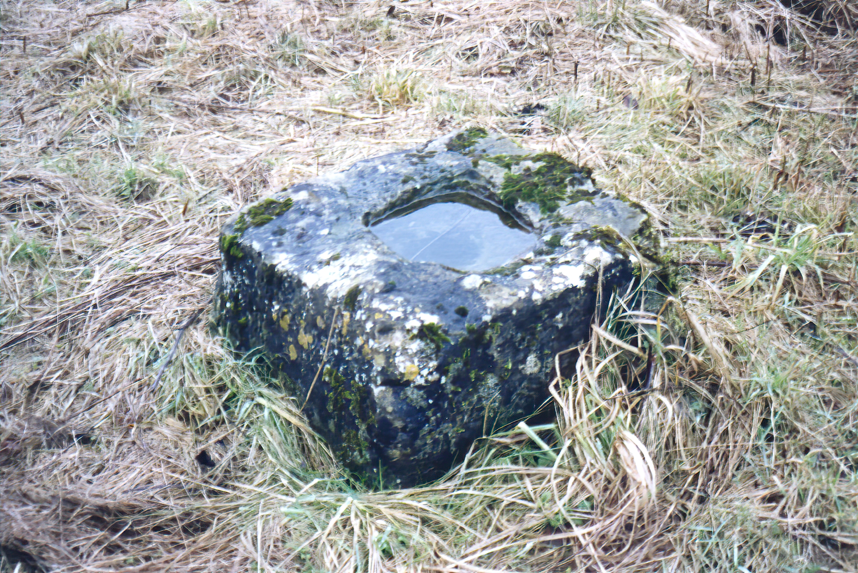
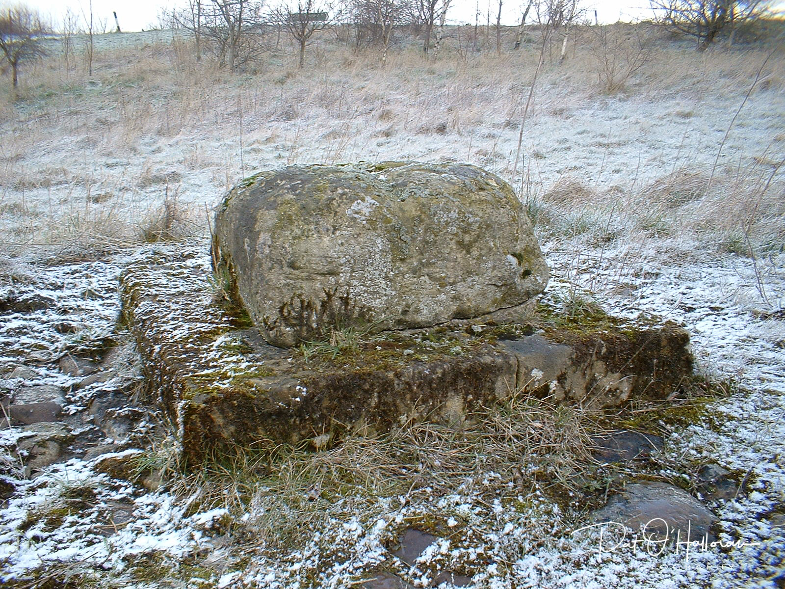
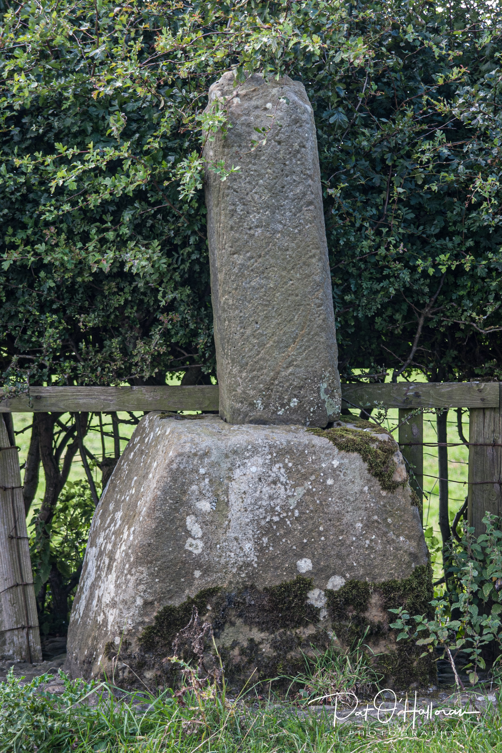
Moving east through Helmsley towards Kirkbymoorside we come to the turn off to Wombleton. Sitting on the verge by the roadside is Stony Cross. At one time an important medieval road, the Thurkilsti, crossed here and no doubt this was a marker for that junction. It is unusual in that it is not a cross at all, and probably never has been. The ‘cross’ consists of a modern stone plinth, now sat in a more recent cobbled footing, surmounted by what is probably a cushion capital. This is deeply incised with a cross shape. The origin of the capital in unknown but it would have been from a substantial building.

Stony Cross on its plinth.
The incised cushion capital

We now move north into the moors themselves to Blakey Ridge. The moors have many burial mounds scattered across them, these vary in size and shape. Some are large long barrows which still stand to some height above the surrounding moors while others are smaller and have all but disappeared, sinking into the landscape. One such barrow is called Flat Howe and is a bowl barrow being a round earthwork 20m in diameter but not quite reaching a metre high and often indistinguishable in the heather. It dates from around 2000 BC and was used for burials though, to my knowledge, this one has never been excavated. What makes it interesting in the context of this post is that on its top there is a cross base, Flat Howe Cross. The cross has obviously been put there much later as a way marker or boundary cross. It is now broken with a piece missing but still has its socket which would have held the shaft.

Flat Howe Cross

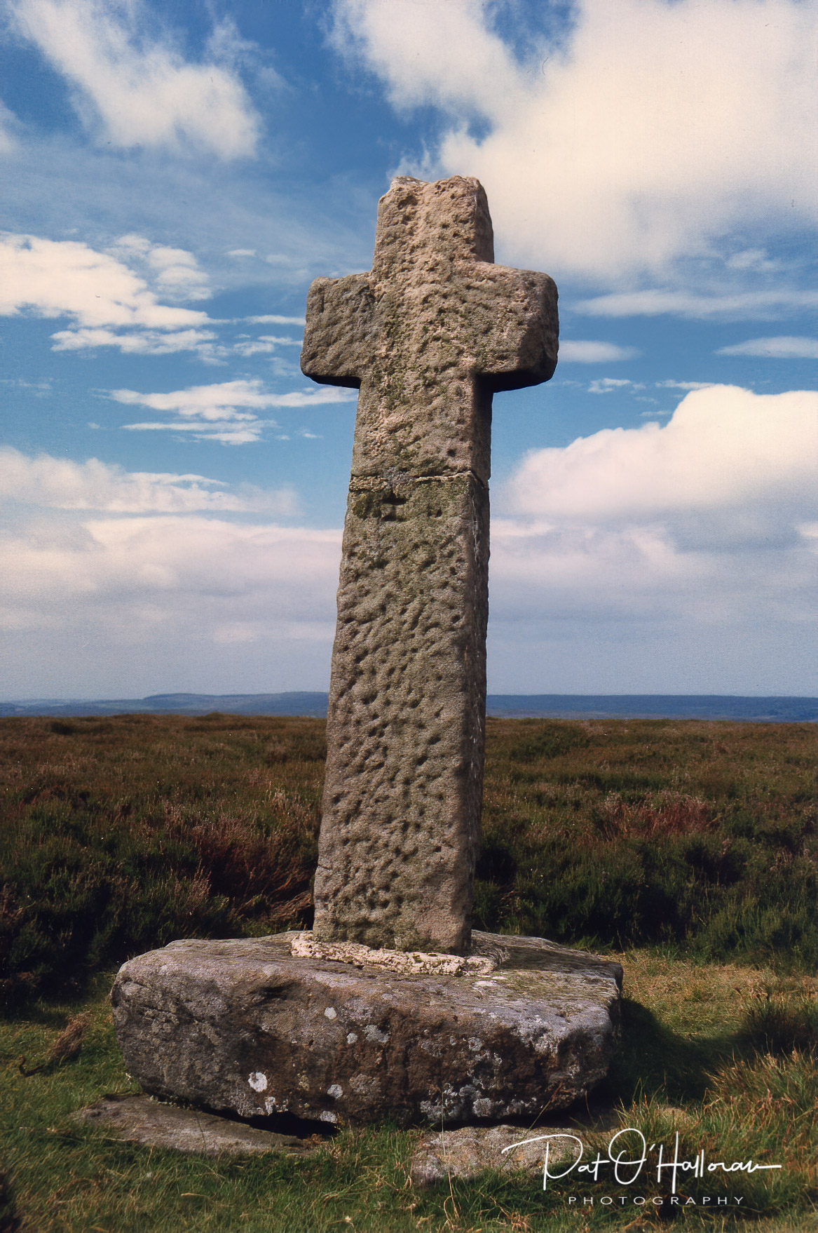
We move now to the final cross base I wanted to discuss. It appears to have a shaft and not just a base but the stone thrust into it is totally unconnected to the cross and is a re-used boundary stone as it bears the letter ‘C’ for the Cholmley estate. Known as John Cross it lies at the boundary of Whitby Abbey’s medieval lands on Shooting House Rig, indeed the remains of the shooting house still lay scattered around. It stands at a high point and would have been visible for some way, probably marking the Old Salt Road, the path down to Saltersgate from Robin Hoods Bay. It may have been named after an abbot of the abbey.

John Cross

That concludes this series on crosses of the North York Moors. I haven’t included all of them, not even all of those which I have visited and photographed but it gives a good idea of what lies on the moors. Perhaps it may encourage readers to get out and find some of these for themselves, when times permit such travel.

References

Boyes, M., (1974) The Crosses Walk. Clapham: Dalesman Publishing

Historic England web site https://historicengland.org.uk/

Mead, H., (1994) Inside The North Yorks Moors. Otley: Smith Settle

Ogilvie, E., Sleightholme A, (1994) An Illustrated Guide To The Crosses On The North Yorkshire Moors, York: The Village Green Press

Peach, H., (2004) Curious Tales Of Old North Yorkshire. Wilmslow: Sigma Leisure.

White, S., (1987) Standing Stones & Earthworks On The North Yorkshire Moors. Scarborough: S. White.

Moorland Crosses 2

In my first blog on moorland crosses I mentioned the damage done to Young Ralph and the need for it to be repaired. I’d like to start this post with a similar tale.

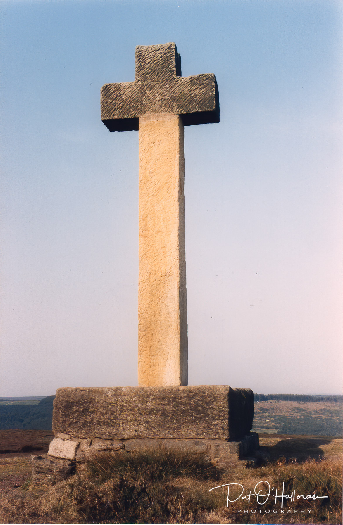
I first went to find Ainhowe or Ana Cross in 1997. It stands on Spaunton Moor not far from the top of Chimney Bank above Rosedale. I was very disappointed when I arrived to find only the base remaining and the shaft of the cross in pieces scattered around it. However, I later learnt it had collapsed in the winter of 1995 and was to be restored, this happened in 1998.

Ainhowe Cross in 1997

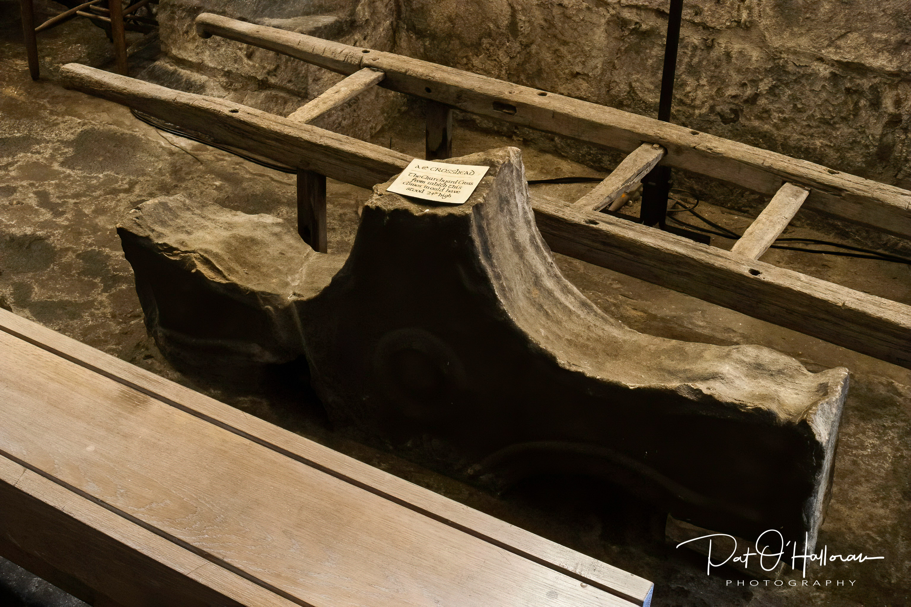
It is known as both Ainhowe Cross (also One Howe) and Ana Cross depending on where you look. It is believed that the original cross once stood up to a height of twenty-four feet, the cross we see now is a reconstruction of a replacement made in the 1949. In the crypt of Lastingham church there is part of a crosshead said to be from the original Ana Cross.

Ainhowe Cross in 1999

I have included a photograph of that crosshead but I apologise for the image quality, it is a scan of an old photograph taken in challenging conditions. The original cross no doubt marked part of the track system between Rosedale Priory and Lastingham, it would have been visible, and impressive, from quite a distance.

Possibly the original Ana Cross

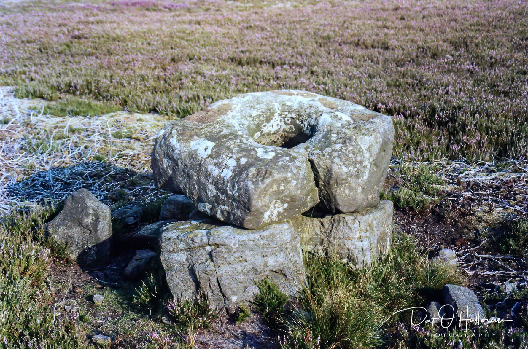
If you were to travel approximately half a mile to the south-east of Ainhowe Cross and searched in the heather off the track you may find Redman Cross, or what remains of it. This cross would also have been a waymarker on the moorland track system. Unfortunately all that survives is a socket stone, propped up on two unrelated (I think) stones. Many of the moor’s crosses now exist only as bases, I’ll be looking at some of these in the next post but thought I’d include this one here as it is so near to Ainhowe Cross. As fas as I know this base is not listed, it does not appear on any maps or in Historic England’s records.

Redman Cross

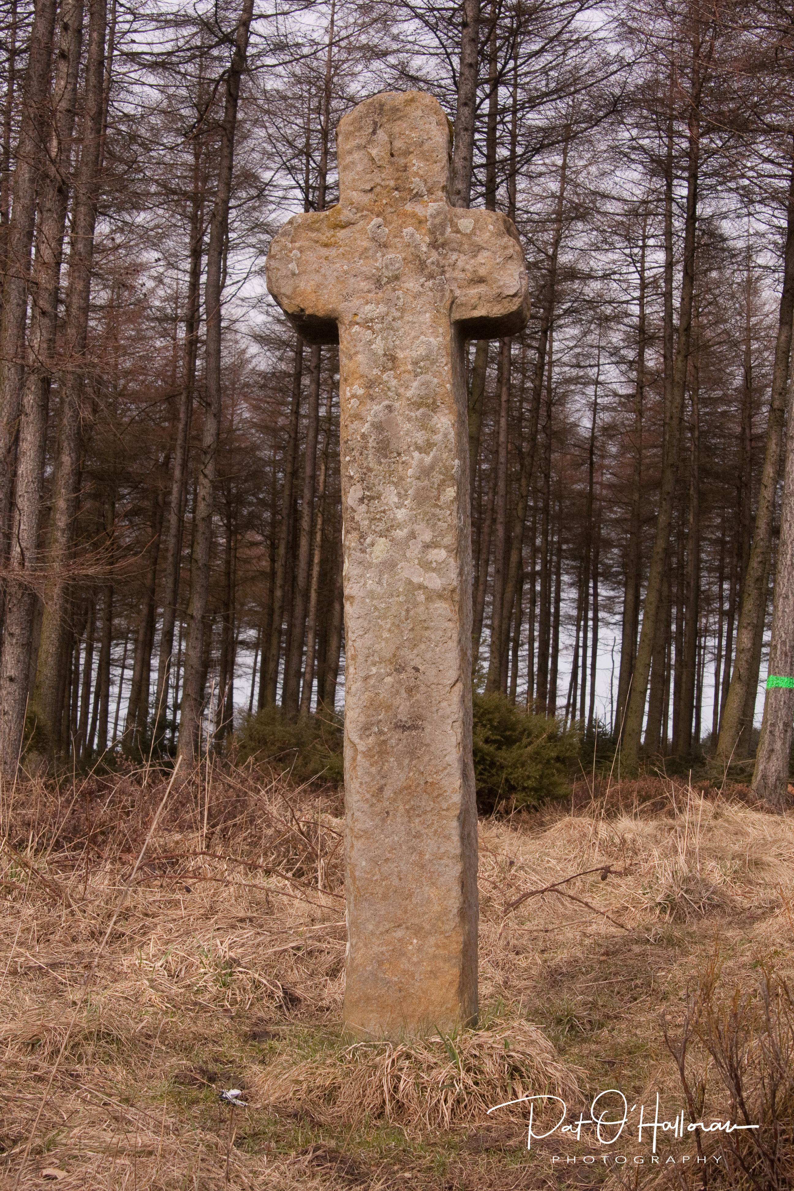
The next cross lies to the east in Cropton forest. It stands a few yards from the Roman road across the moors, this road was used extensively as a trackway in the medieval period and Mauley Cross would have been a marker. It is pleasingly weathered with rounded ends to the cross arms and stands just over two metres high. Its name comes from the De Mauley family, landowners of Mulgrave.

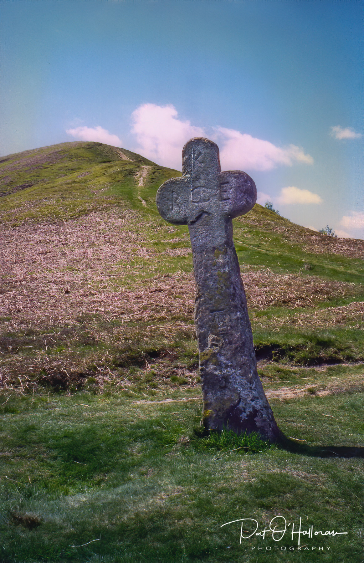
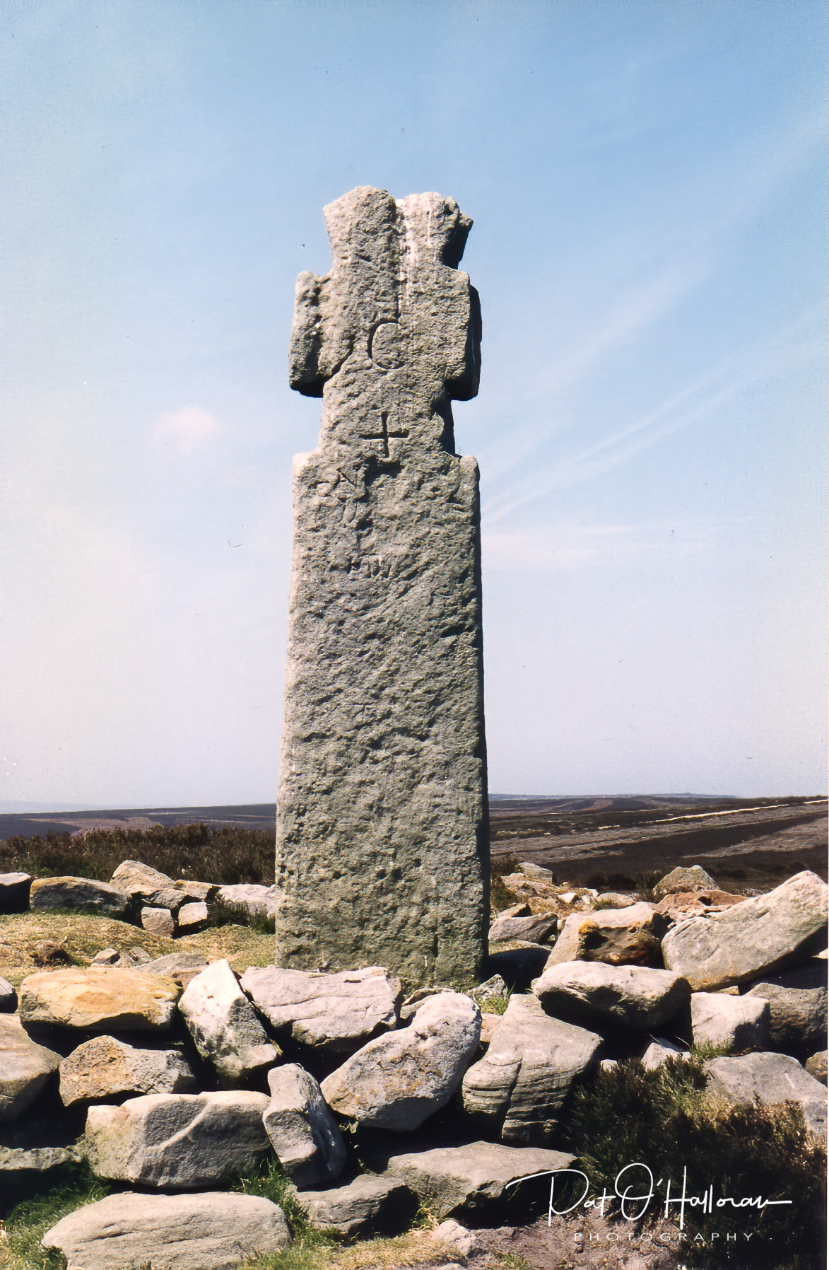
Travelling yet further east we find another cross with rounded arms at the foot of Whinny Nab not far from the main road between Pickering and Whitby, a short walk from the Saltergate Inn. Malo Cross was also named after the De Mauley family. It is shorter than Mauley Cross at about 1.75 metres and is marked with the letters K R E which are supposed to stand for Sir Richard Egerton. The cross is referred to in different places as a wayside marker and a boundary cross, it could, of course, be both.

Malo Cross

We move now to the north of the National Park to the road heading north from Castleton to Lingdale. At the meeting of this road with the road to Commondale stands White Cross. Thought to be in its original position marking the route and parish boundaries the base survives with a later shaft set in it. This point marks the meeting of several medieval trackways but the two modern roads are now the most apparent. The eastern face, shown in the photograph, has ‘white cross’ inscribed on the base and a bench mark. The original medieval shaft is in Whitby museum but I have no photograph of it.

White Cross

For the last two crosses of this post we move almost due south to the edge of the National Park at Appleton le Moors. Low Cross sits alongside the road north from the village to Spaunton at the junction of a lane to Lastingham and was probably a waymarker for travellers to the monastery there. It is unusual in its shape and is undoubtedly a mixture of ancient stonework with more modern additions. It may have been an early standing stone repurposed as a waymarker. The current slab has an indentation on the south face, as if to hold a plaque or sign, and a square hole cut in it. There are pieces of stone set into a cobbled base, obviously relatively recent, which may have been an attempt to preserve some of the original stonework. It has been proposed that the hole and indentation may indicate its later use as a toll point.

Low Cross

A little further up the road towards Spaunton stands High Cross. This has a large base a little reminiscent of Fat Betty from my previous post but is surmounted by a slender shaft which, if original, may have been as long as three metres. The cross base is thought to be in its original position marking the road between the villages and opposite an old drove road. Like Low Cross the base has been set in cobbles in recent times. It would have been an important cross marking the route much used by travellers to the monastery in Lastingham.

High Cross

That concludes this post, my second on moorland crosses. There are others and I intend to write a little more in my next post.

References

Mead, H., (1994) Inside The North Yorks Moors. Otley: Smith Settle

Ogilvie, E., Sleightholme A, (1994) An Illustrated Guide To The Crosses On The North Yorkshire Moors, York: The Village Green Press

Peach, H., (2004) Curious Tales Of Old North Yorkshire. Wilmslow: Sigma Leisure.

White, S., (1987) Standing Stones & Earthworks On The North Yorkshire Moors. Scarborough: S. White.

https://historicengland.org.uk/

Moorland Crosses 1
Firstly, apologies for the long hiatus between posts. There are many reasons, not all valid.

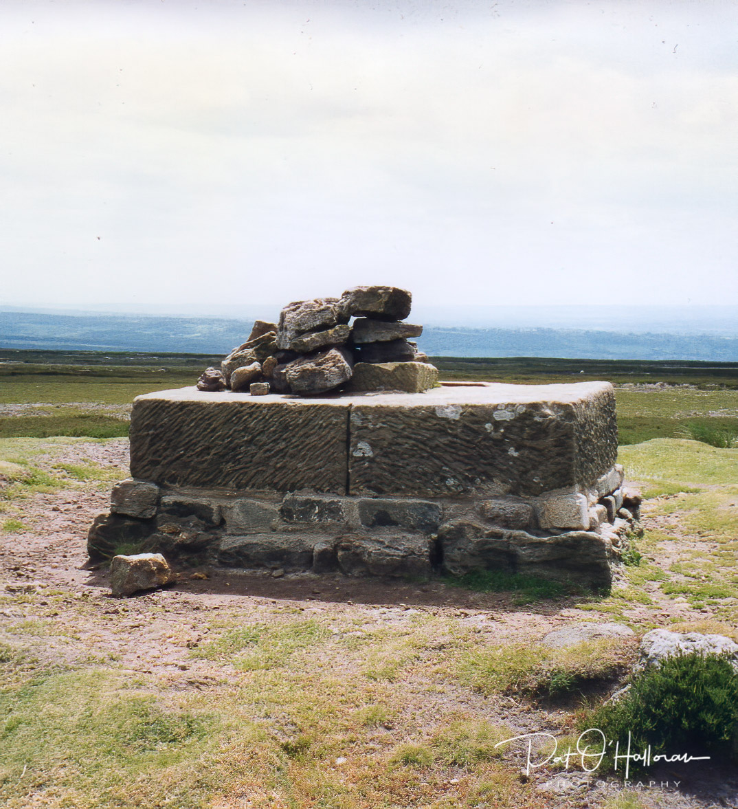
I have long been interested in the wayside crosses of the North York Moors and their environs. I found them fascinating even before I came to live in this area and over the years have driven and walked through many miles of the countryside searching out examples. Some of them are fine upstanding specimens of a cross while others are mere bases on the roadside, long forgotten in the grass and hedgerows. In this short post I hope to show you a few of those I have found and maybe inspire you to go out and find them for yourselves.

Initially I must address the issue of what these crosses are and what they were for. Most of them are medieval in origin and date from around a thousand years ago up to five hundred years ago. Many of them were waymarkers, signposts along tracks through the moors to enable travellers to move along the pathways knowing they are heading in the right direction. The choice of the cross shape is probably to reinforce Christianity to the travellers, especially on routes of religious importance. Some ‘crosses’ do not have the cross shape and are plain upright pieces of stone. They may have originally had the cross head and this has either been broken and lost or deliberately damaged and then replaced with a plain stone. Crosses were also used as boundary markers between parishes, advising travellers they were moving from one district to another. Rumour and superstition are also linked to many of the crosses, with often fanciful tales of how or why the crosses are situated as they are.

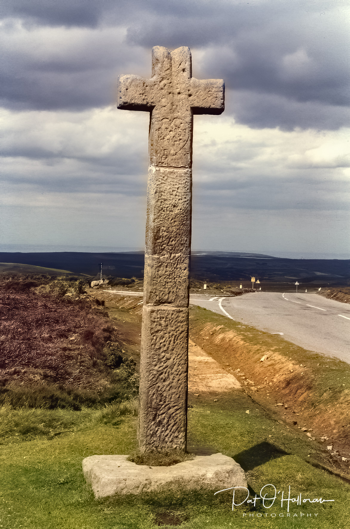
One of the most well-known crosses in the area is Young Ralph, firstly because it sits close to the roadside as you travel between Hutton-le-Hole and Castleton but mainly because it has been adopted by the North York Moors National Park as their emblem and features on many signs and notices throughout the area.

Young Ralph

Many visitors stop at the roadside to see Young Ralph and there is an old tradition that coins can be left on top of the cross for those in need. If you found coins up there you could take what you needed but always made sure there were some remaining, or if it was empty you should leave some. Unfortunately, this has meant decades of people scrambling up the cross shaft to check the indentation at the top and this has led to significant damage. The cross has needed repair more than once. This activity is now discouraged, so please don’t try.

This tradition may stem from the legend that the cross was erected by a local farmer named Ralph after he found a traveller in that spot who had died from exhaustion and exposure, the cross was to mark the spot and guide future travellers along the track.

My favourite cross lies about 400 metres from Young Ralph but is hidden from the road by a rise in the ground and is often missed completely by visitors, it goes by the name of Old Ralph.

Old Ralph

Old Ralph is about a thousand years old and has been sitting up on the hill watching all this time. I like the proportions of the cross and the fact you can sit there and look at the view for miles around, even seeing the sea off Whitby on a good day.

Old Ralph was mentioned in a Guisborough charter of around 1200 and was referred to as “crucem Radulphi”. The shaft has a date of 1708 and the initials CD carved into it leading some to believe it is of that date. However, this is just the repurposing of the cross as a boundary marker by Charles Duncombe, the landowner at that time.

Fat Betty
Fat Betty

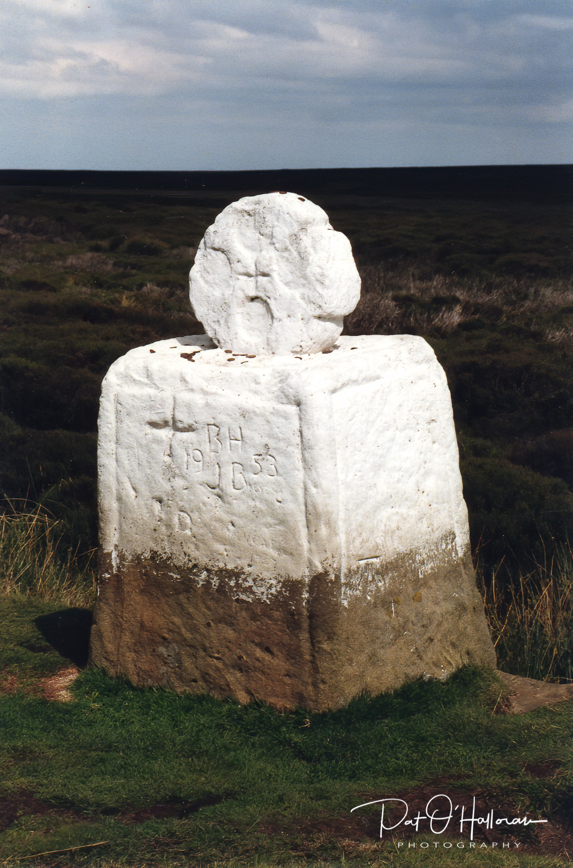
A little to the east of Young Ralph is another well-loved cross on the moors, Fat Betty or White Cross. Although called a cross she has a round, wheel-shaped head. It dates from the 10th or 11th century and the round head would almost certainly once have been on top of a shaft, making it unusual and a rarity in this area. This cross is both a waymarker standing at the side of an old road into Rosedale and also a boundary marker as it sits on the meeting point of Danby, Westerdale and Rosedale parishes.

Lilla Cross on Lilla Howe

The final cross in this post is thought to be the oldest cross on the moors. Legend has it that it marks the spot on which Lilla forfeited his life in order to save King Deira by putting himself in the path of an assassin’s dagger. However, the cross is believed to date from the 10th century and Lilla and his compatriots date from the 7th or 8th century. The cross stands on a Bronze Age bowl barrow that has been reused for Anglo-Saxon burials.

The cross sits tucked away behind RAF Fylingdales BMEWS site and is at the junction of two medieval trackways, one of which is the Old Salt Road mentioned in my post on the Saltergate Inn, which runs down to Pickering, the other being the Pannierman’s Way. The cross is important in that it also marks the boundaries of four parishes – Allerston, Fylngdales Moor, Goathland and Lockton. It also marks the boundary of the lands belonging to Whitby Abbey.

I hope to continue this theme and present a few more crosses of the North York Moors in a post in the near future.

References

Mead, H., (1994) Inside The North Yorks Moors. Otley: Smith Settle

Ogilvie, E., Sleightholme A, (1994) An Illustrated Guide To The Crosses On The North Yorkshire Moors, York: The Village Green Press

Peach, H., (2004) Curious Tales Of Old North Yorkshire. Wilmslow: Sigma Leisure.

White, S., (1987) Standing Stones & Earthworks On The North Yorkshire Moors. Scarborough: S. White.

The Workhouse

It has been some time since I last posted anything, mainly due to holidays but also because I wanted to gather as much information as possible about this topic.

As with most towns Pickering used to have a workhouse and although there is no evidence of it left today I thought it would be interesting to look into the history. Unfortunately, I have not been able to discover as much as I would have liked but I thought it best to put pen to paper, as it were, and publish something.

Pickering had a workhouse of sorts in the late eighteenth century. Its location is usually given as Undercliff. This area of town still remains and is mostly a row of cottages tucked under the cliff below the castle and opposite the train line heading north to Whitby. I’ve tried searching old maps for clues as to where the workhouse was but I’ve been unsuccessful. I am assuming it may have stood on land to the west of the road which is now occupied by the train station and its associated yards, lines etc. Undercliffe now refers to the stretch of road from the junction of Park Street and Castle Road stretching north out of the town. However, names do change. I have discovered that what we now know as Park Street (no idea why it is called this) was once Bakehouse Lane. Little is known of the inhabitants of this workhouse (or poorhouse) but it was probably quite small.

A Poor Law Union was established in Pickering at the beginning of the reign of Queen Victoria and a new building was erected to the north-east of the town on Whitby Road. It was officially opened in 1838 and if we look at the census of 1841 we find that Richard (from Pickering) and Ann Spaven were the master and matron of the workhouse and they had an assistant called Elizabeth Lyth. They appeared to have just forty-four residents at that time ranging from infants to a man of 90 years of age. The Spavens remained there for some time but by 1861 George (from Marton) and Sarah Ward had taken their place. There are now only twenty-four ‘inmates’ listed on the census, age range four months to 79 years.

Moving on a further twenty years and Francis (from Birdsall) and Mary Maul are in charge of fifty-two inmates with ages ranging from five months to 83 years. Just ten years later and Robert (from Pickering) and Mary Simpson are ensconced there. Sixty-nine inmates reside there too (one month to 87 years). Our final peek at the census, in 1911, shows Burton (from Osmotherley) and Mary Holmes in charge of sixty-eight inmates with ages ranging from three months to 93 years.

The majority of the inmates throughout this period are from Pickering and its immediate area though there are some from as far away as Scotland. Many of the surnames are familiar and no doubt it is their descendants that still live in the town.

Whilst the workhouses were meant for those that could not afford to support themselves financially it appears they were often used as a convenient place to keep people for a variety of reasons. Most workhouses had an infirmary wing, Pickering included, and these were sometimes used by local doctors in place of a hospital (which would have been few and far between and expensive).  A report in the Whitby Gazette on Saturday, 25th December 1886, gives an example of the workhouse being used in place of a hospital.

Singular Affair.

A man named John Charles, a labourer, of Thornton, is now lying at the Pickering Workhouse in a serious condition, brought about by peculiar and suspicious circumstances. The poor fellow, it seems, was suffering from an infectious skin disease, and he applied to a local chemist and druggist, who sold him box of ointment. The application not proving efficacious, Charles says he went again and was supplied with some medicine. He, however, became so much worse that Dr. Robertson, of Thornton was called in, and recommended the sufferer’s immediate removal to the Pickering Workhouse. Since his reception there his condition has become so serious that his deposition was taken before Major Scoby, and Captain Mitchelson—the Guardians, the Superintendent of Police, and the chemist’s assistant being also present, and the latter cross-examined the expected dying man. Charles was in an extraordinary condition at the time, his skin having peeled off his body, some portions of which were enormously swollen.

A further article in Shields Daily Gazette reports that Mr Charles died on 11th January 1887. The attending doctors told the coroner that they were unaware of any drug or combination of drugs that could cause this effect so he returned a verdict of death by natural causes.

The other use of the workhouse was in place of a prison or place of detention. Another newspaper article, York Herald, Wednesday, 10th February 1892, tells a tale of a young man.

An Incorrigible Pickering Youth Liberated.

The Pickering police have recently had some trouble with a lad named Bointon, aged 11 years, who, after being charged with stealing certain moneys from the shop of a local confectioner, was remanded to the Pickering Workhouse, and while there he proved incorrigible and succeeded in effecting his escape. After recapture he was lodged in the custody of the police. On being brought up on remand the magistrates ordered Bointon’s removal to the York Industrial School for a period of three years. Strange to say, however, before the expiration of a week the lad has been brought back to Pickering with the message that he was incurable, and so James, instead of receiving the punishment ordered by the justices, is once more enjoying the company of his old comrades.

It seems the workhouse could be used for anything the community required.

In the 1930s the workhouse finally closed and became a children’s home.

There were several advertisements for workers in the children’s home, one appeared in the Yorkshire Post and Leeds Intelligencer on Friday 22nd March 1935 and ran as below:

CHILDREN’S HOME. PICKERING.

Applications are invited for the following appointments

(a) SUPERINTENDENT and MATRON.

(b) MATRON.

(c) BOYS’ ATTENDANT (resident or nonresident).

The Committee require two officers for duty at the Pickering Children’s Home, but have not yet determined whether the Male Officer shall be the Superintendent or the Boys’ Attendant. They therefore invite applications from married couples for the positions of (a) Superintendent and Matron. They also invite applications from single persons for the posts of (b) Matron and (c) Boys’ Attendant. It is not yet decided whether the latter officer shall live on the premises.

The salaries attached to the appointments are:

SUPERINTENDENT and MATRON Up to £250 per annum for the Joint appointment, according to qualifications

MATRON Up £125 per annum, according to qualifications

BOYS’ ATTENDANT (resident): £60-£80 per annum.

BOYS’ ATTENDANT (non-resident): £125 per annum.

The resident officers will be allowed board and lodging, and all are superannuable.

Applications, in applicants’ own handwriting, stating age, present and previous occupation and experience, and when able to commence duty, accompanied by copies of not more than three recent testimonials, must be sent to the undersigned not later than 30th March, 1935. Previous Poor Law experience not essential. Application forms are not provided. Applicants will be required to undergo such medical examination as the County Council may direct. HUBERT G. THORNLEY. Clerk of the County Council, County Hall, Northallerton. 6th March.

In the 1939 register the matron is listed as Blanche Parnaby with her assistant Kathleen Broadbent and two childrens’ attendants, Margaret McLoughlan and Dora Teasdale. Due to the privacy laws relating to this register it is impossible to tell how many children were living there at the time.

Later still the workhouse was demolished and in its place there is now an older people’s home.

It is difficult to imagine what it was like living in an institution in those times but we can be assured it was generally grim. If you want to visit a workhouse museum to perhaps get a better idea of life there I can recommend two that I have visited.

Ripon Workhouse Museum

The Workhouse, Southwell (National Trust)

Smugglers’ Repose

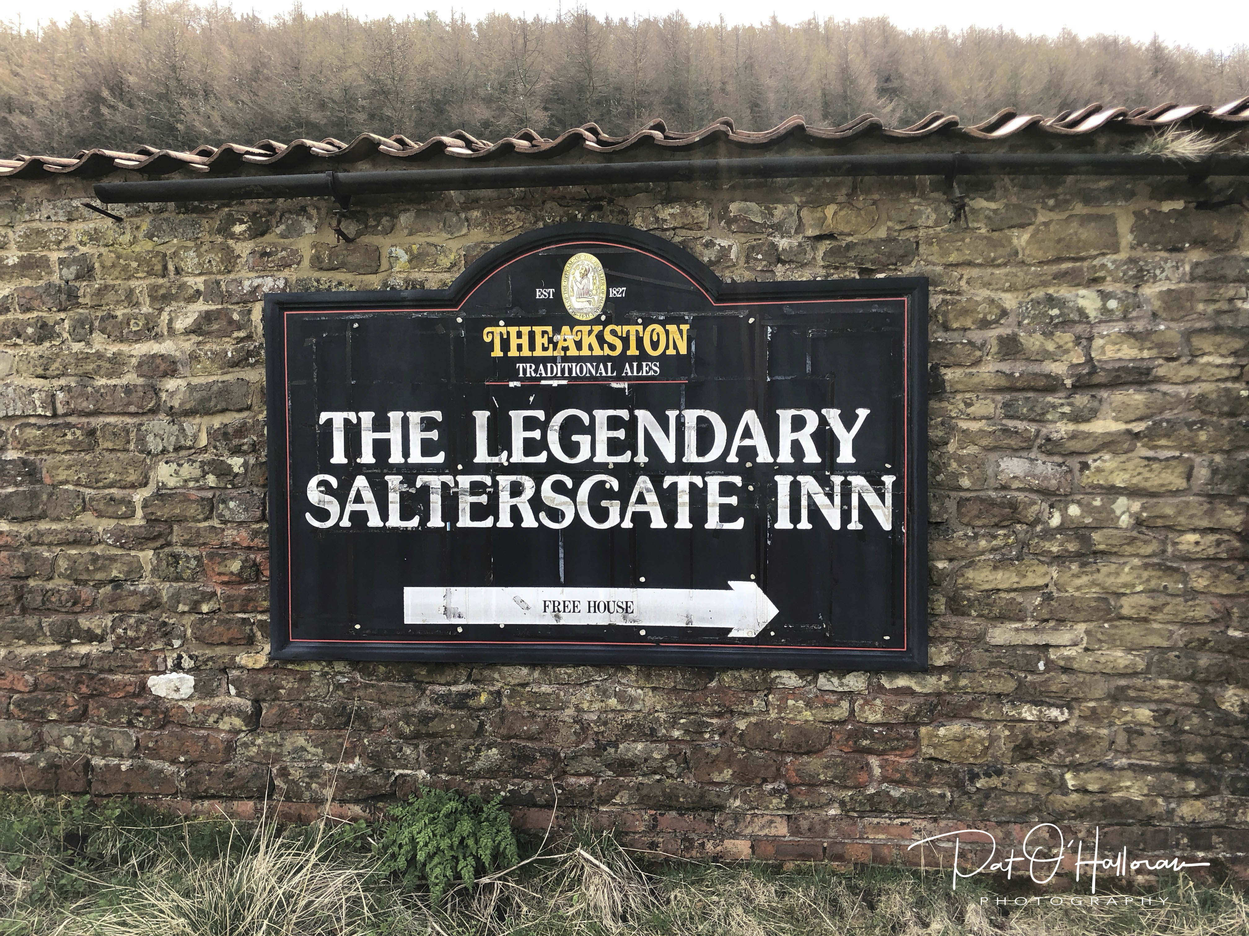
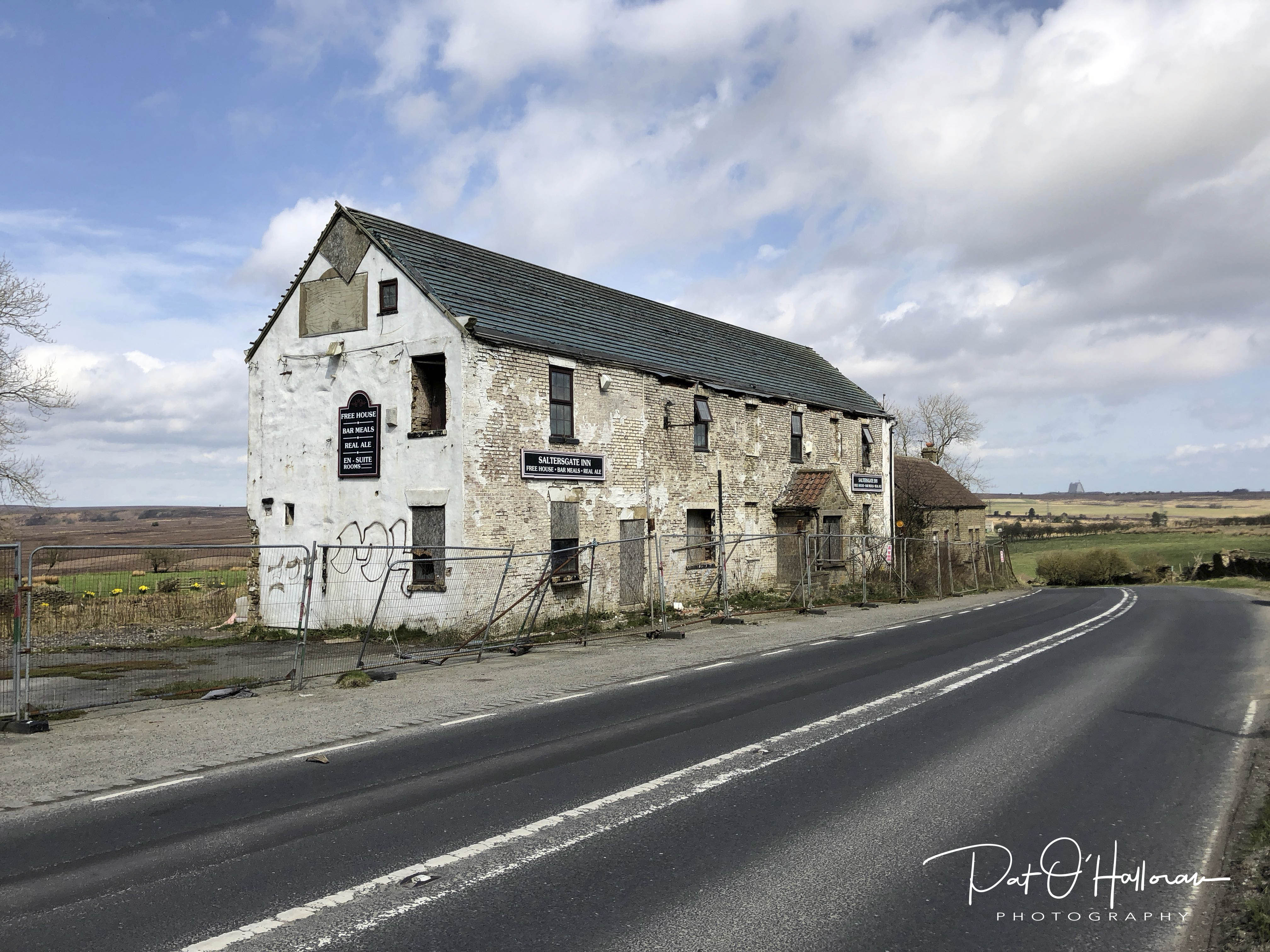
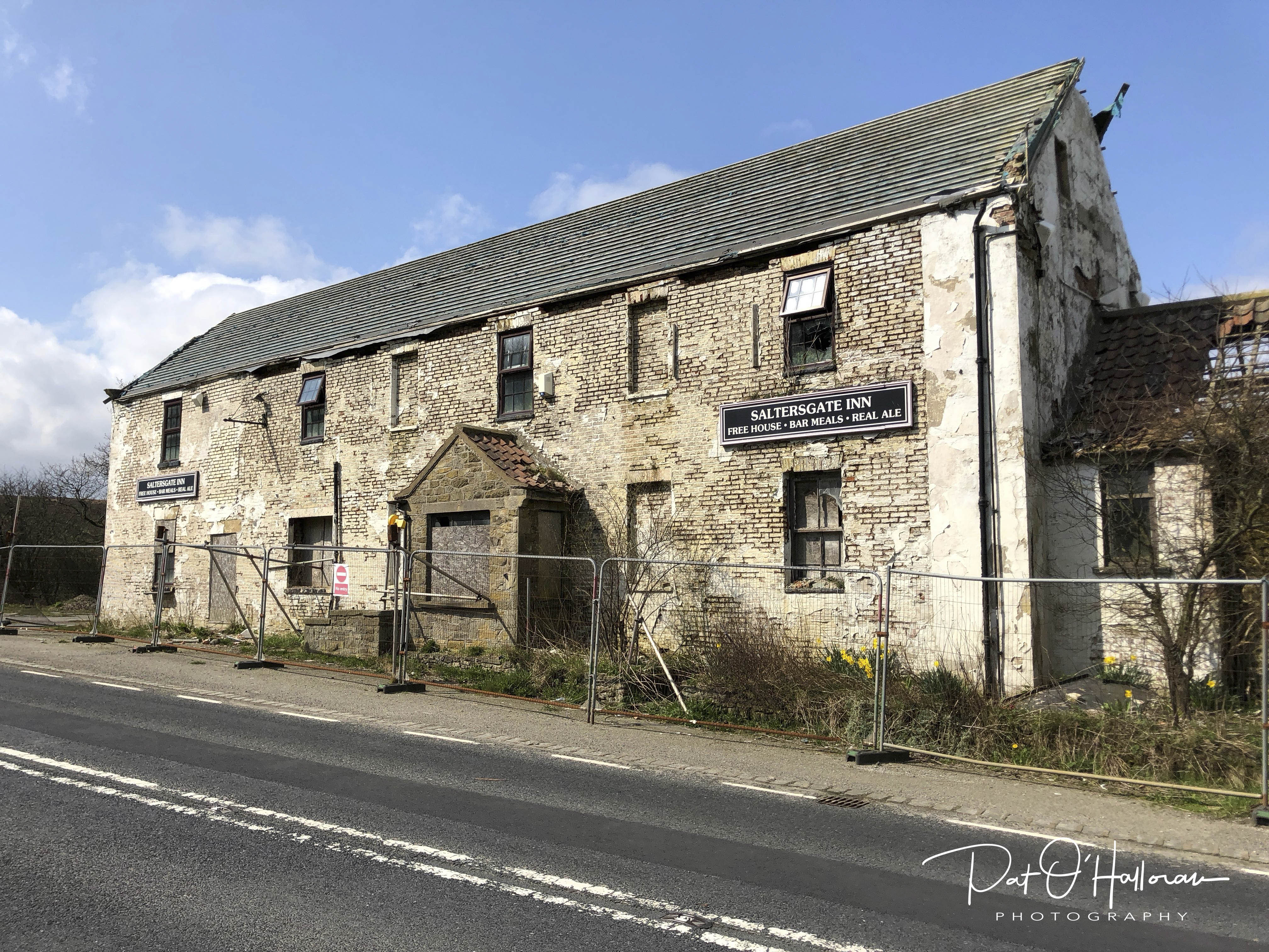
untitled_shoot-186A recent trip to Robin Hoods Bay meant me travelling north from Pickering along the Whitby road. About halfway between Pickering and Sleights the road circles the Hole of Horcum before dipping down Saltergate bank, around the Devil’s Elbow, and heading on past RAF Fylingdales. At the bottom of the bank stands a building now known as the Saltersgate Inn, a place I have drank in a number of times and which has several stories attached to it. Unfortunately, on this trip, it was evident that the building was derelict.
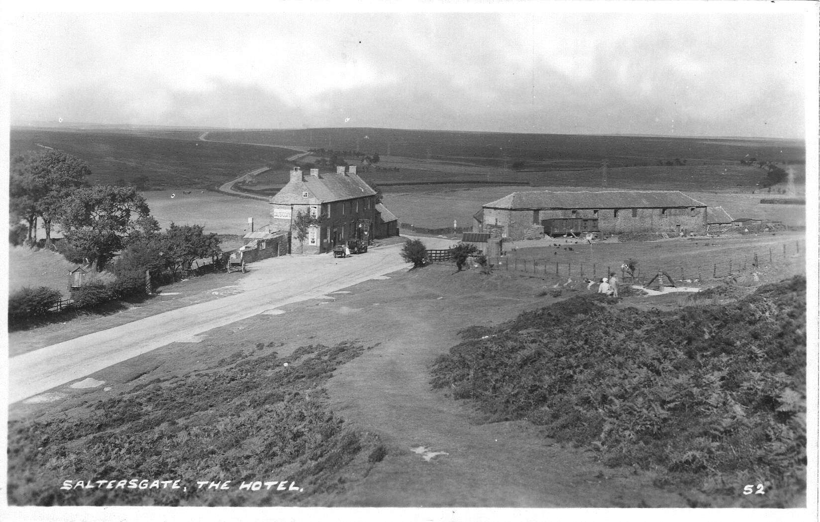
The original building was erected in 1648 and converted to an inn in the early eighteenth century. At that time it was called the Waggon and Horses and soon became a popular haunt of travellers along the old salt road between Whitby and Pickering. (I originally thought that at some point along the way it changed its name to the Saltersgate Inn, however, it appears that it has probably been known by both names for many years. The earliest record I can find of it being called the Saltersgate Inn is in 1869 while the latest record I have, at present, of it being called the Waggon and Horses is 1939).

2018-04-20 - saltersgate
The inn around 1935

The moors and routes across them were pretty wild at this time and it wasn’t unknown for travellers across the moors to update their wills before setting out. Highwaymen existed to some degree and travellers were not safe unless well escorted. The inn stands upon one of the few roads across the moors at that time, it ran from Whitby to Pickering and was often known as the fish track as catches from the coast were the most often carted items along the road to Pickering. The original road did not follow the current route through Sleights but headed off across the moor (near to where RAF Fylingdales now stands) in a direct line to the coast.  In addition to fish it is not hard to imagine that other commodities such as illicit rum and brandy were also hauled for sale inland. The inn’s position gives it a good view of the road and any approaching customs officers could be seen long before they reached the inn allowing occupants time to hide anything that ought not be seen.

Written records from those early times are scarce and we rely on the tales told by word of mouth. As these are passed down, probably sat around the fire in the inn, they are embellished and exaggerated to sound more appealing. There are many accounts extant of the history of the inn but on further investigation it seems many of them are incorrect, or maybe just plain fabricated. It is said in some records that in the reign of Queen Anne (1702-1707) a tax on the sale and use of salt was imposed upon the population (and indeed across much of the empire). As salt was a vital component of life the tax hit everyone hard.  It is easy to understand why smuggling salt became popular. However, the tax was introduced before Queen Anne came to the throne and was in place by 1693 and fishery salt was either exempt or taxed at a much lower level. I suppose, though, any tax is worse than no tax so the fishermen may well have sought to escape it.

The stories say that to avoid paying the salt tax many fishermen would trek their raw catches across the moor to the inn where they would find a supply of illicit salt waiting for them. The fish were duly salted and then dispatched on to their final destinations. It is said that in the cellars of the inn there remained for many years the beams upon which fish were hung and there are some earth mounds, known as sidings, to the rear of the inn still visible to this day that were thought to be used for unloading the fish from ponies.

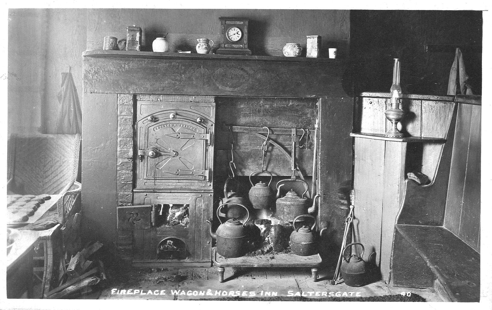
Legend has it that one day when the fishermen were about their business at the inn a customs man sneaked up on them unawares. Some stories tell that a group of customs men had visited the inn and finding nothing amiss had left but one of their number returned secretly. Whichever is true it seems one of them surprised the smugglers and was hit soundly across the head, killing him instantly. Not wanting to face the gallows it was decided the body must be hidden. The landlord lifted the stone flags that lay under the fire and they buried the unfortunate officer under them. The fire was returned to its place and lit to deter anyone from exploring in that area too closely. Stories surrounding the inn say that this fire was never allowed to go out from that point onwards and it is thought to have burned continuously for over two hundred years. Many of the landlords since that time swore that they never let the fire die in their time. Certainly, on my visits to the inn, the fire was always burning but I can’t vouch for the truth in the tale. There is once again a problem with these accounts. The salt tax was collected by the Excise Office when it was first introduced but it proved unworkable and a Salt Office was established as part of the Treasury in 1702. Under this office the country was divided into sections each with its own collection officers. If it truly were a customs officer that was murdered, and he was investigating salt smuggling, it must have been between 1693 and 1702.


2018-04-23 - saltersgatefire
The fireplace under which the body is said to have been hidden


There is an alternative tale that states the Devil was once seen in the inn and was attacked by a priest and the landlord. He either stepped backwards and was caught in the flames or the smoke enveloped him, but he disappeared never to return. The fire has been kept burning ever since to ensure the Devil does not appear for his revenge.

I think the former tale is a possibility but I’m sure if the fireplace is excavated now it is unlikely any remains of the customs officer will be found.

We can first start to see the history of the inn appearing in records from the late eighteenth century. The first recorded landlord that I have been able to find was Robert Dunn. He was born about 1786 in nearby Lockton and married Jane Moon on 28th September 1812. He is recorded as the publican for the inn on the 1841 census but it seems he had probably been living there for some time with his wife and daughter, Sarah. They took in lodgers, as many places at that time would have done, and one of these was a John Foster. John and Sarah obviously got on well as they married on 20th September 1837 in Lockton. They continued to live at the inn and had had two sons by 1841, William Moon and Marmaduke.

By 1851 the family was extended as John and Sarah had added daughters Anne, Mary and Lizzie. Unfortunately, young Marmaduke did not survive his first year.

Robert Dunn died in 1858 at the age of 73 and John and Sarah took over the inn. In the 1861 census John and Sarah were living there with Anne, Lizzy, new daughter Sarah and a son, John. Sarah senior’s Mum, Jane Dunn, was also living with them. William had moved out and can be found living as a farmer on nearby Whinny Nab and his sister, Mary, was living with him as a servant.

By 1871 the Foster family had moved out of the inn to a nearby cottage. Mary was back living with her parents as was John but Sarah junior had married and moved out, so too had Lizzy who had children of her own. Jane Dunn was still living with them.

The occupant of the inn was now listed as Thomas Hick. Thomas was born and baptised in Lockton in 1824 and in 1868 he married Mary Readman who was born in Pickering in 1822. He was living at the inn with Mary and their daughter-in-law. In 1881 they are living at the inn with a lodger and a couple of servants. They also list a Thomas Redman as living there and identify him as a grandson, four years of age. I think this implies Mary had been married before and this was the son of one of her sons.

It gets a little confusing from then on. In 1891 Thomas is listed as the head of the household but widowed though I can’t find a date for Mary’s death that makes sense. He is living with the Hoggard family, the head of which, David, is listed as Thomas’ son-in-law. It seems that Thomas had a daughter, Mary Ann, in 1857 but her mother’s maiden name is given as Newby, not Readman. There are obviously several marriages involved in this family and I don’t have the desire to delve deeper to find out where the links meet. Anyway, David Hoggard married Mary Ann in 1883. Young Thomas Redman is now listed as a servant. On to 1901 where Thomas is still there with the Hoggard family but he dies in 1906.

In 1911 David Hoggard is still in Saltersgate with his family but it doesn’t say for definite if it is at the inn though I suspect it is. His occupation is listed as a farmer but this is not unusual as several times on census returns the innkeeper has also been listed as such. I’m sure they tended a farm in addition to the inn as custom cannot have been brisk.

From then onwards the public records are limited as the next census is not yet 100 years old. However, in 1939 the register taken at the beginning of the war lists the occupant as Charles Thistle, born 1898, living there with his wife Anne Elizabeth and their son, Thomas. Some indications are that the Thistle family remained as the innkeepers until the 1960s. Interestingly Charles is said to have been a member of the Observer Corps.

The inn appears regularly in newspaper reports but with no great story to relate. The pub closed in 2007 and was bought the following year by a local builder with the intention of bringing it back to life. It seems that with the recession and the scope of work required being more than anticipated it was abandoned. It has been up for auction at least once since then but with no buyer. Now it seems that it is to be razed to the ground and a new hotel and restaurant built on the site. It probably is beyond saving now, I hope any new build acknowledges the history of this old building and becomes a local attraction in its own right.

untitled_shoot-187


untitled_shoot-185
The inn as it appears in 2018


Painting the church

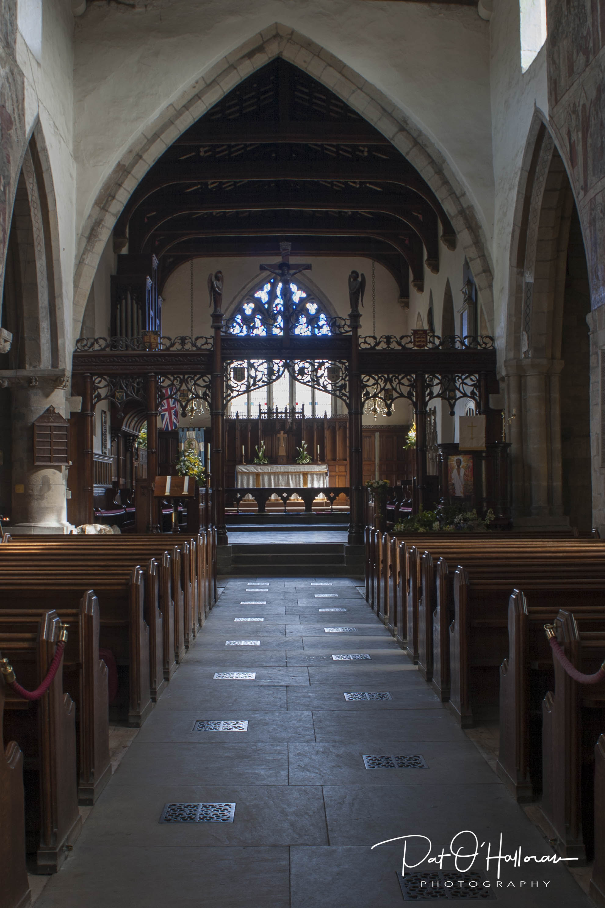
Pickering_church-03There has been a church on the rise at the top of the market place for a very long time. It was probably first built by the Saxons though little evidence of that still remains – the top part of the font probably comes from that time and a carved cross shaft is also from the same period. Like most churches it was added to, rebuilt, ‘modernised’ and pulled around over the years until we have what we see today. Some of these alterations were needed, for example, when the tower collapsed around 1200 destroying part of the church. Others were, in my opinion, unnecessary tinkering which did nothing to improve the building. I have a particular dislike for most of the ‘improvements’ the Victorians imposed upon our churches.
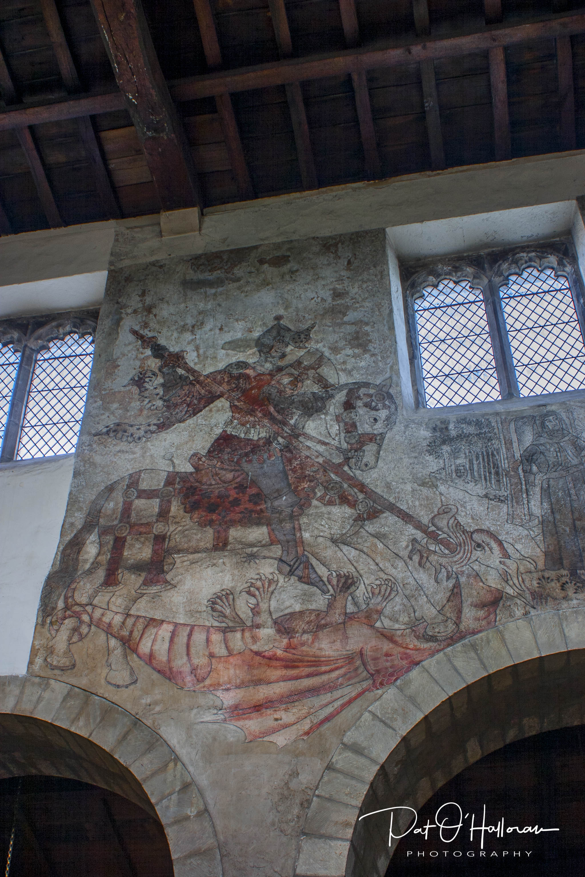
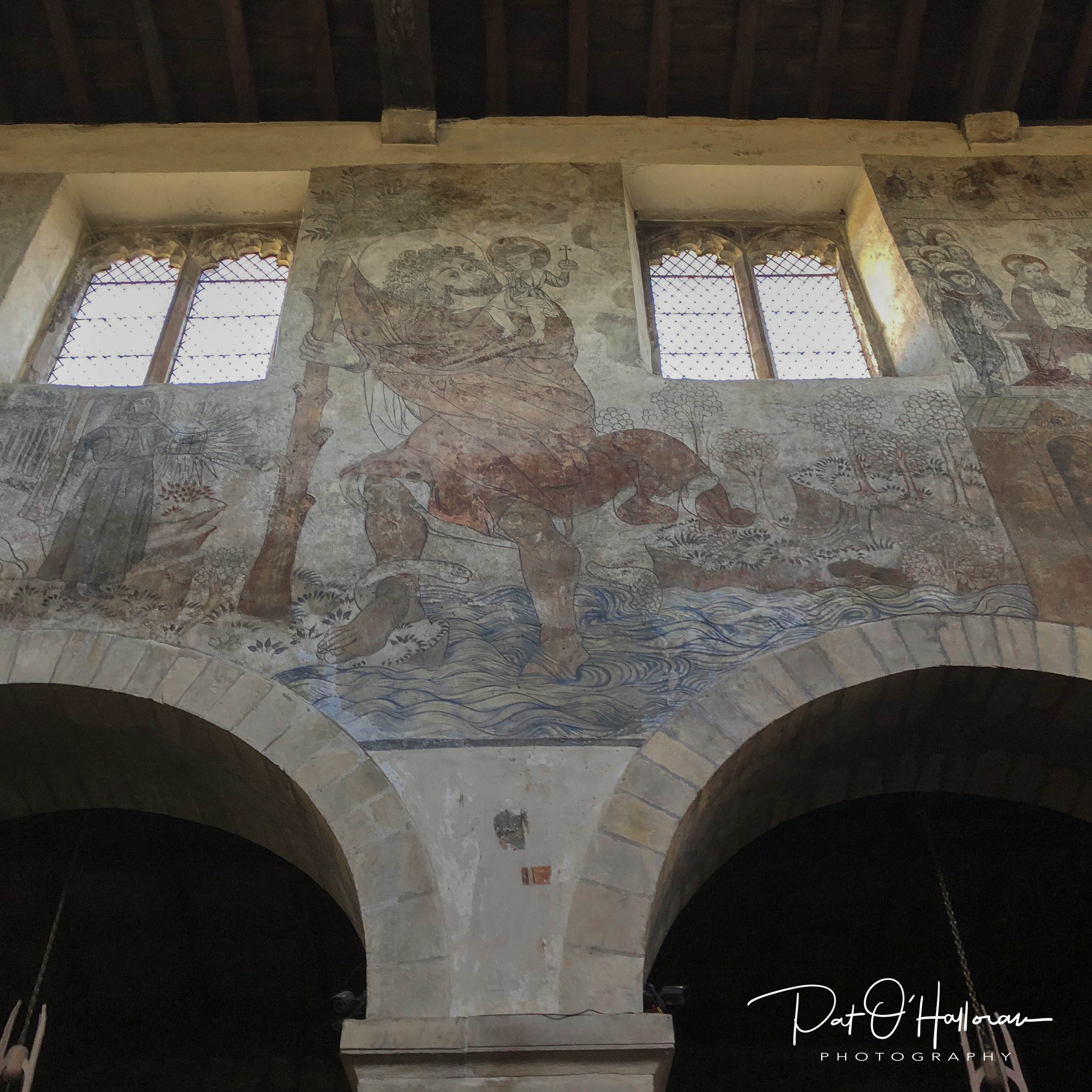
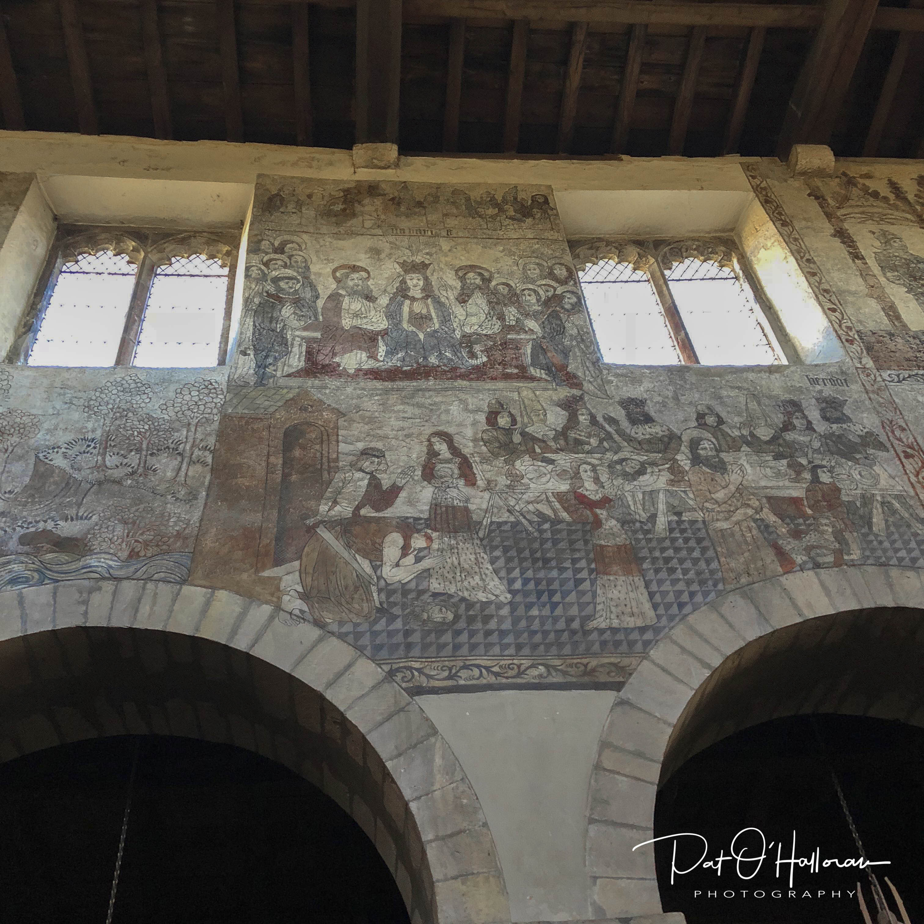
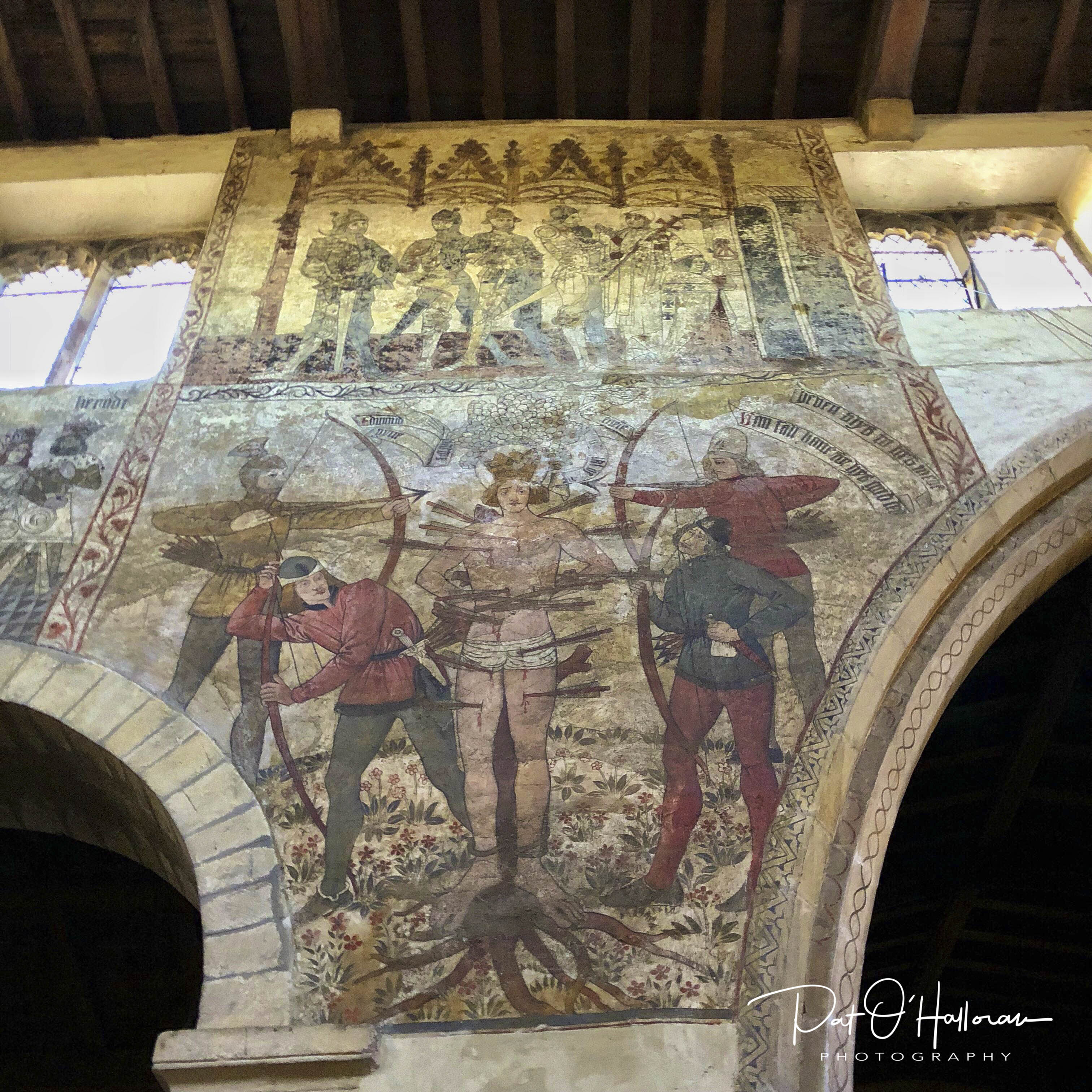
Around 1450 this fine church commissioned a series of wall paintings, paintings in fine colour decorating the north and south walls of the nave above the arches and around the clerestory. A hundred years or so later, with the coming of the Reformation, these were covered over with plaster. There they remained, forgotten about, until 1852 when they were discovered during restoration work. Despite the wonder the paintings aroused at that time they were again covered as the vicar at the time didn’t like them: out came the whitewash brush. Thankfully, the vicar of 1876 decided to once again uncover them for all to see and since that time they have been on display to anyone entering the church, they have had some restoration over the years.

Pickering_church-04


One of the most dramatic paintings is immediately to view on entering the church by the south door. Here you will see St George, mounted on his horse and wielding a lance, killing the dragon.


Pickering_church_ios-004


Next to St George is St Christopher, carrying the Christ-child on his left shoulder as he wades through serpents and sea monsters towards an Abbot lighting his way.


Pickering_church_ios-003


The beheading of John the Baptist is the subject of the next painting. In fact it is a series of paintings in one as John is seen kneeling, headless, on the left while his head appears on the salver in the centre and on the right he is a very much alive figure talking to King Herod.


The scene above this image is the Coronation of the Virgin Mary.


Pickering_church_ios-001


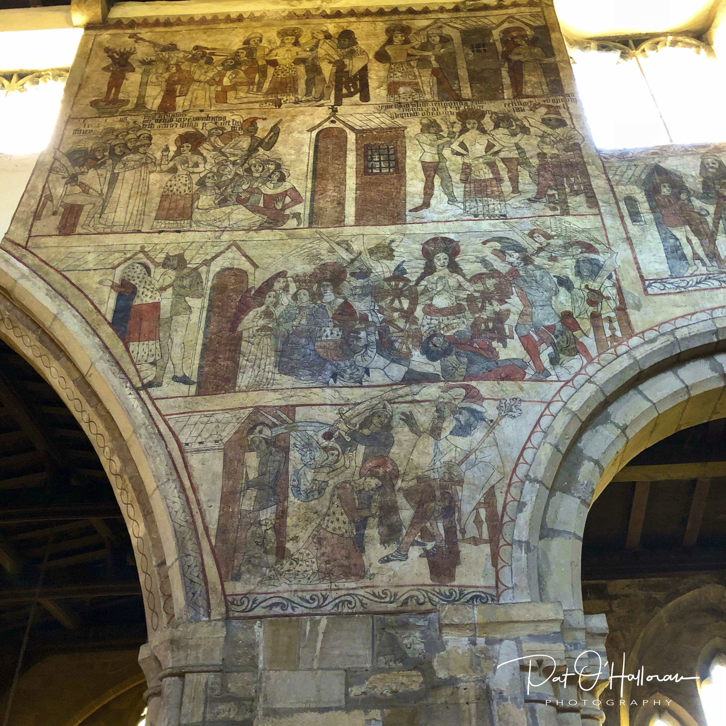
The martyrdom of St Edmund is next for viewing, he was killed by the Vikings for refusing to renounce his religion.


The scene at the top is the martyrdom of St Thomas Becket.


Pickering_church_ios-002


On the south wall opposite the martyrdom scenes is the story of St Catherine, of the wheel fame. You can make out the wheel just below centre of the photograph.


Pickering_church_ios-007


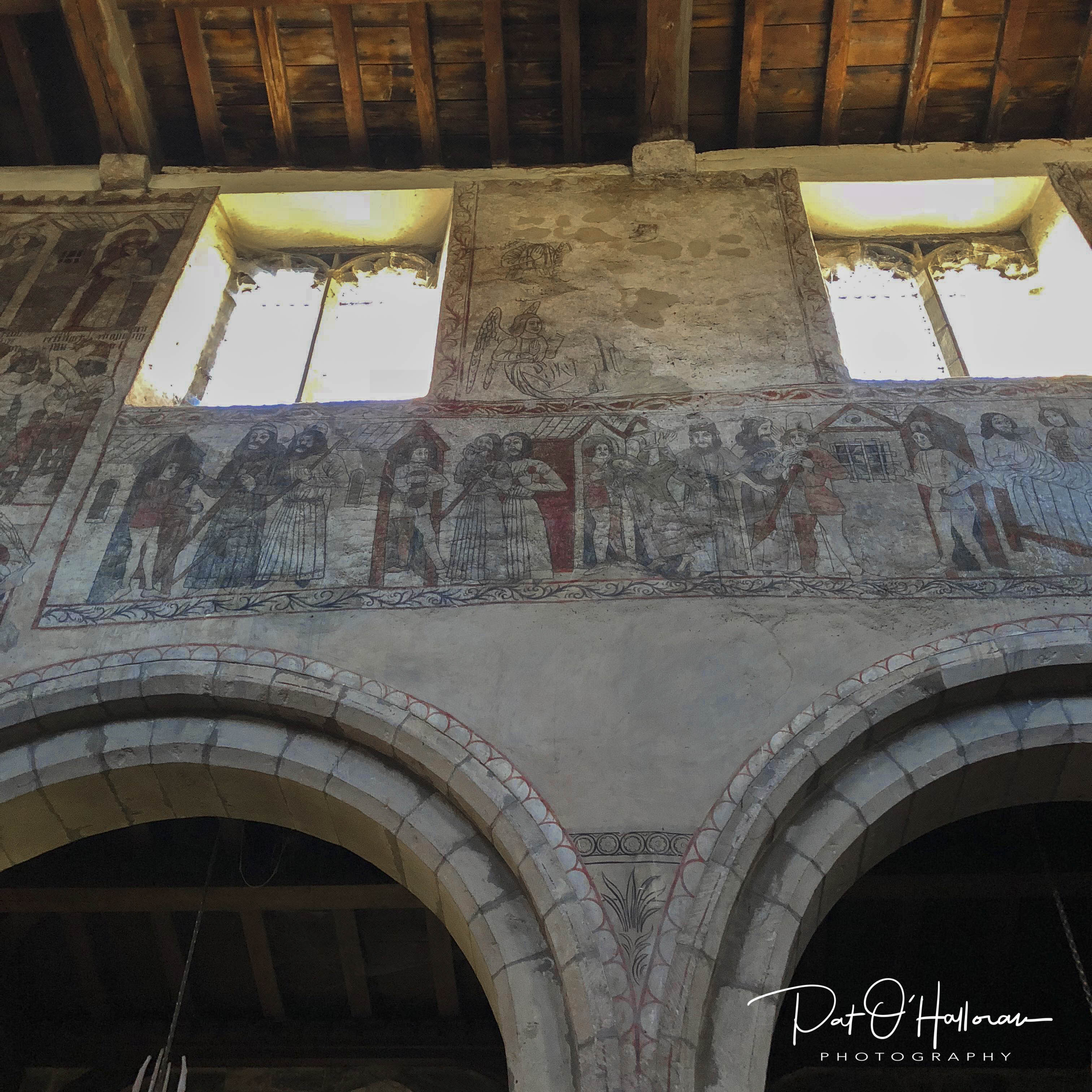
The next photograph shows the seven Corporal Acts of Mercy.

You can actually only see six on this picture but the seventh (To bury the dead) is on the left of the next photograph.


Pickering_church_ios-005


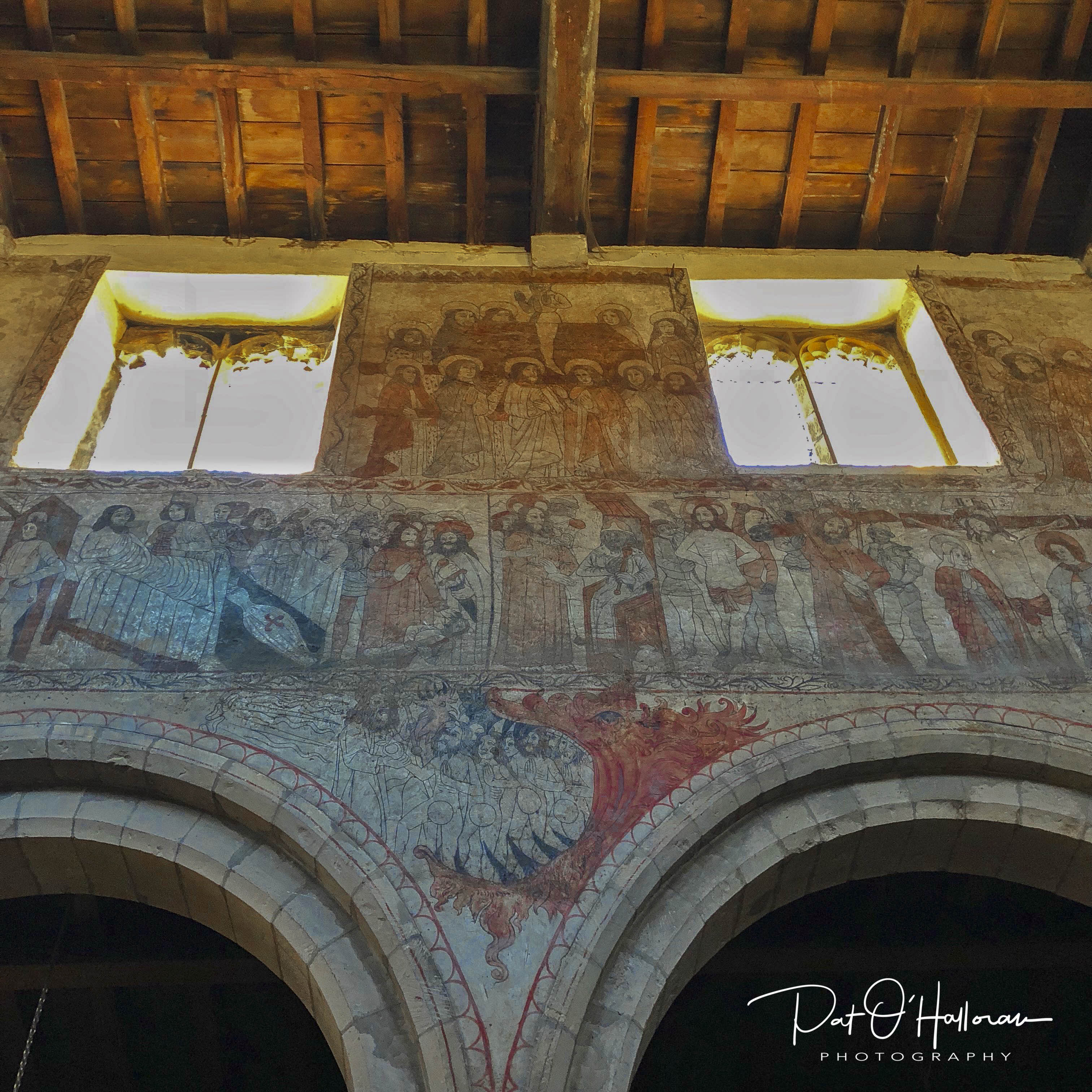
Here, after the seventh act of mercy, is the Passion and Crucifixion of Christ (up to the crucifixion itself). Below is the descent into hell. The image between the clerestory windows depicts the burial of Mary.


Pickering_church_ios-006


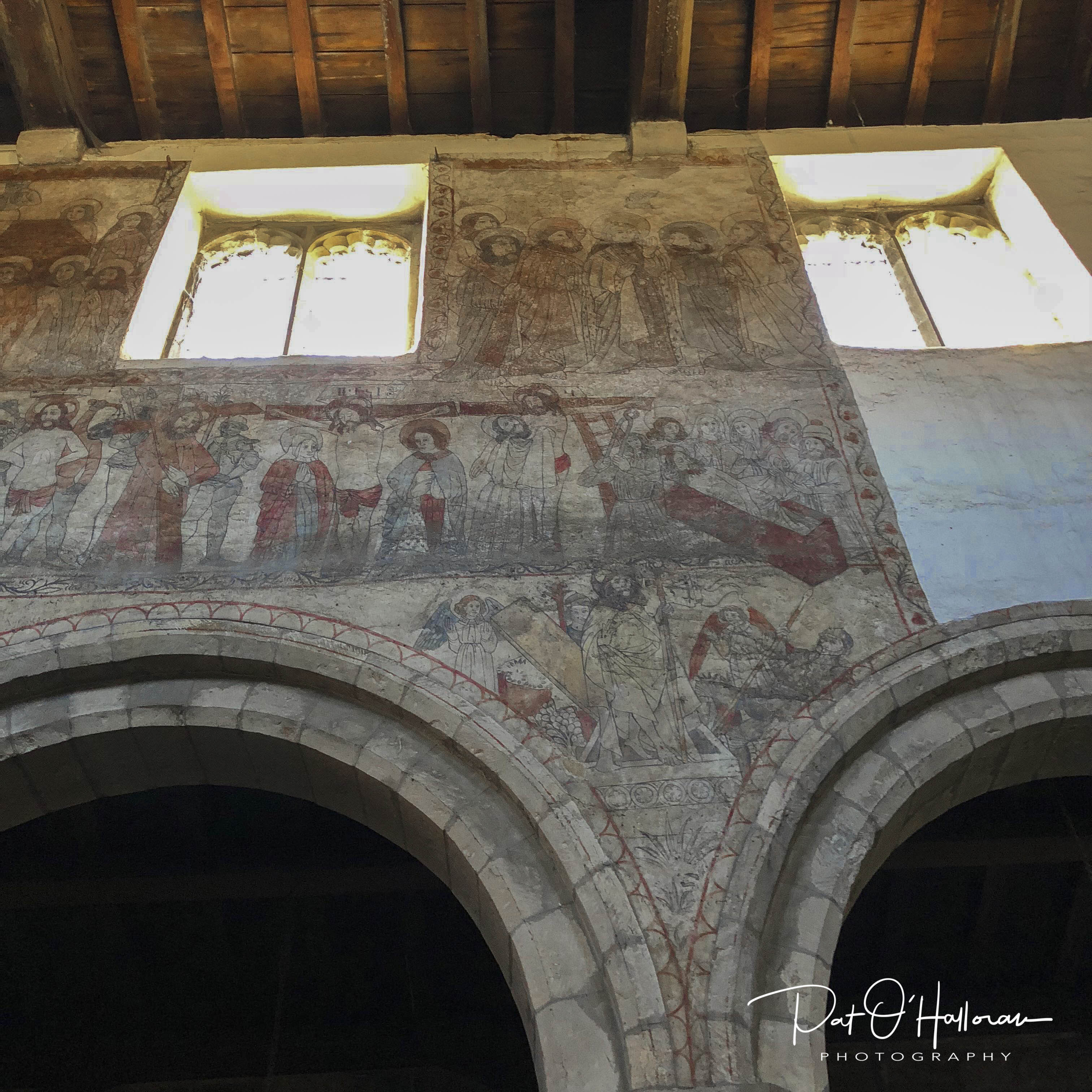
The final picture I have of the paintings shows the descent from the cross and the burial of Jesus above an image of Christs’ resurrection. The upper image is probable Mary’s Assumption.


Pickering_church-05

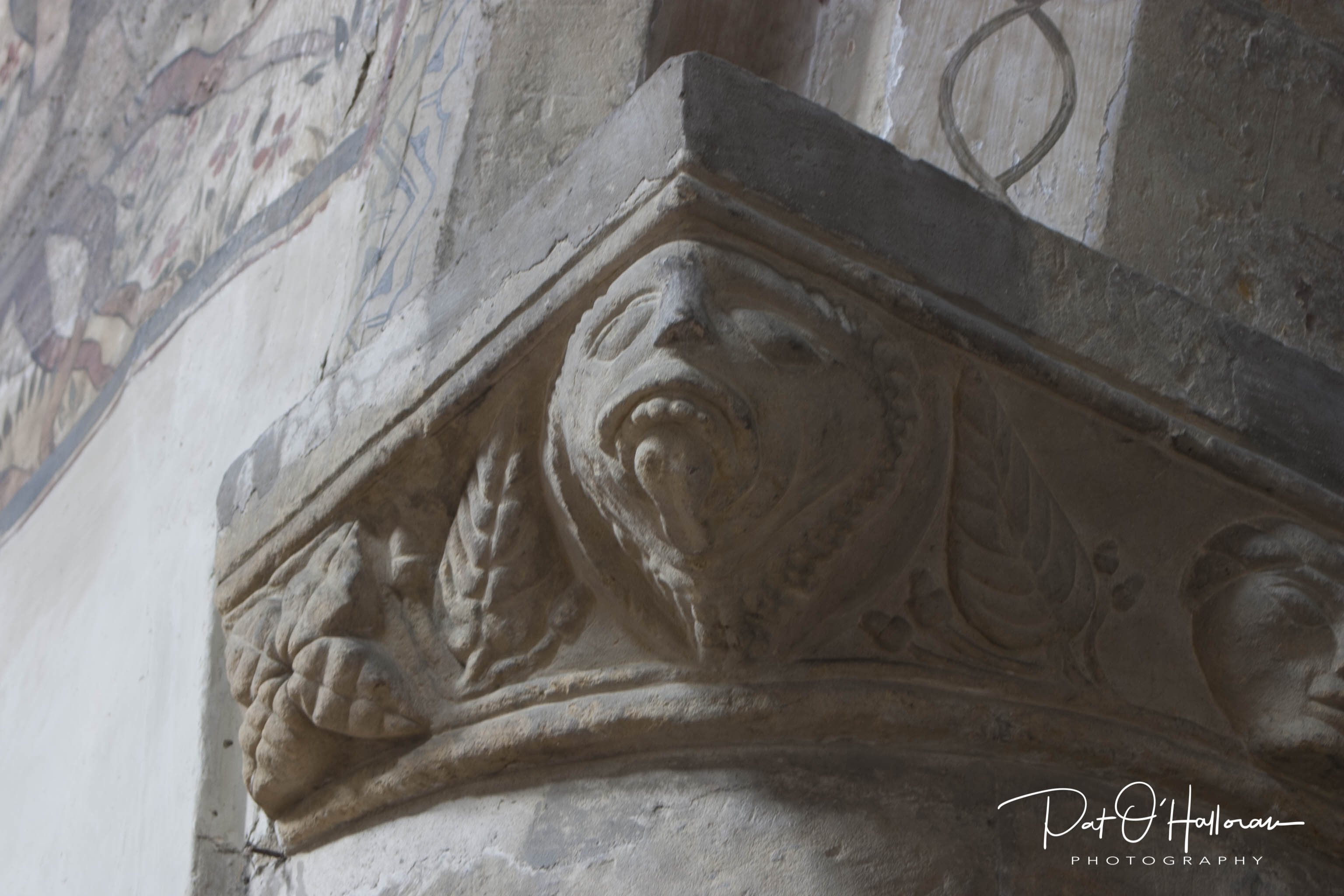
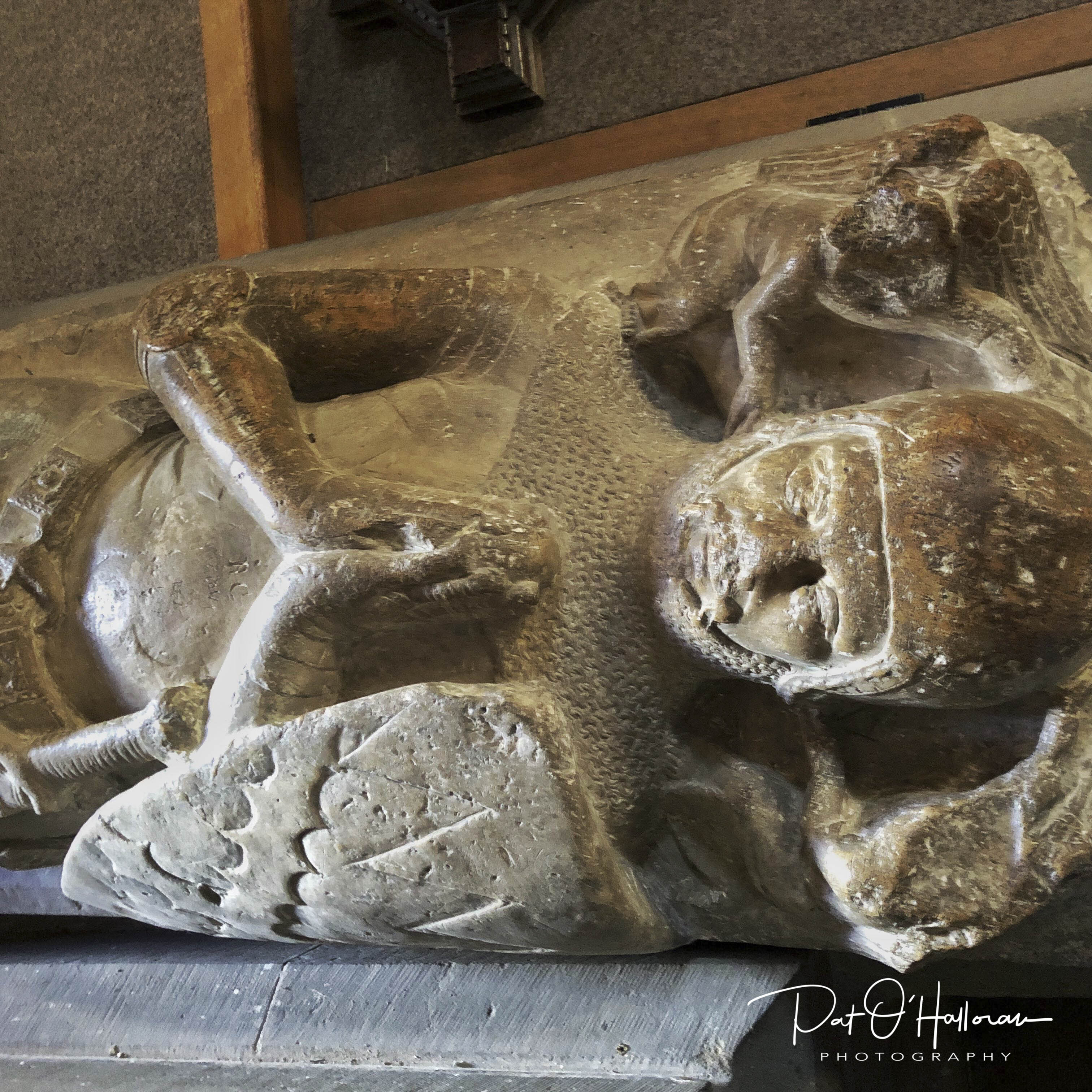
The church has some fine carvings and monuments too such as this grotesque on a capital and the tomb of Sir William Bruce, below.


Pickering_church_ios-008

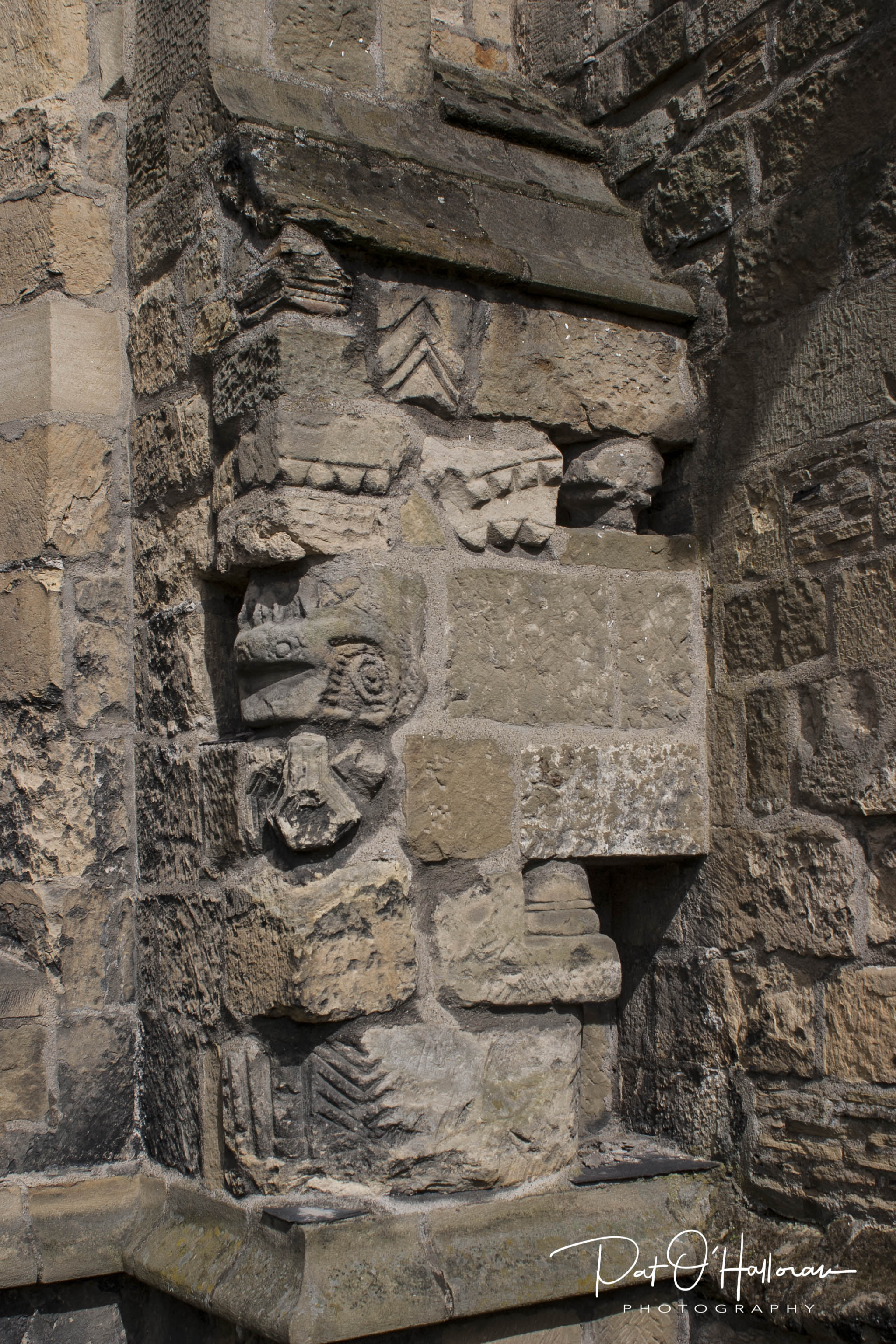
A walk around the church will reveal many other pieces of carved stone built into the fabric of the church such as this interesting collection to the west of the south door.

Pickering_church-02

In Pickering we have a church well worth visiting regardless of your religious beliefs.