Firstly, apologies for the long hiatus between posts. There are many reasons, not all valid.
I have long been interested in the wayside crosses of the North York Moors and their environs. I found them fascinating even before I came to live in this area and over the years have driven and walked through many miles of the countryside searching out examples. Some of them are fine upstanding specimens of a cross while others are mere bases on the roadside, long forgotten in the grass and hedgerows. In this short post I hope to show you a few of those I have found and maybe inspire you to go out and find them for yourselves.
Initially I must address the issue of what these crosses are and what they were for. Most of them are medieval in origin and date from around a thousand years ago up to five hundred years ago. Many of them were waymarkers, signposts along tracks through the moors to enable travellers to move along the pathways knowing they are heading in the right direction. The choice of the cross shape is probably to reinforce Christianity to the travellers, especially on routes of religious importance. Some ‘crosses’ do not have the cross shape and are plain upright pieces of stone. They may have originally had the cross head and this has either been broken and lost or deliberately damaged and then replaced with a plain stone. Crosses were also used as boundary markers between parishes, advising travellers they were moving from one district to another. Rumour and superstition are also linked to many of the crosses, with often fanciful tales of how or why the crosses are situated as they are.
One of the most well-known crosses in the area is Young Ralph, firstly because it sits close to the roadside as you travel between Hutton-le-Hole and Castleton but mainly because it has been adopted by the North York Moors National Park as their emblem and features on many signs and notices throughout the area.
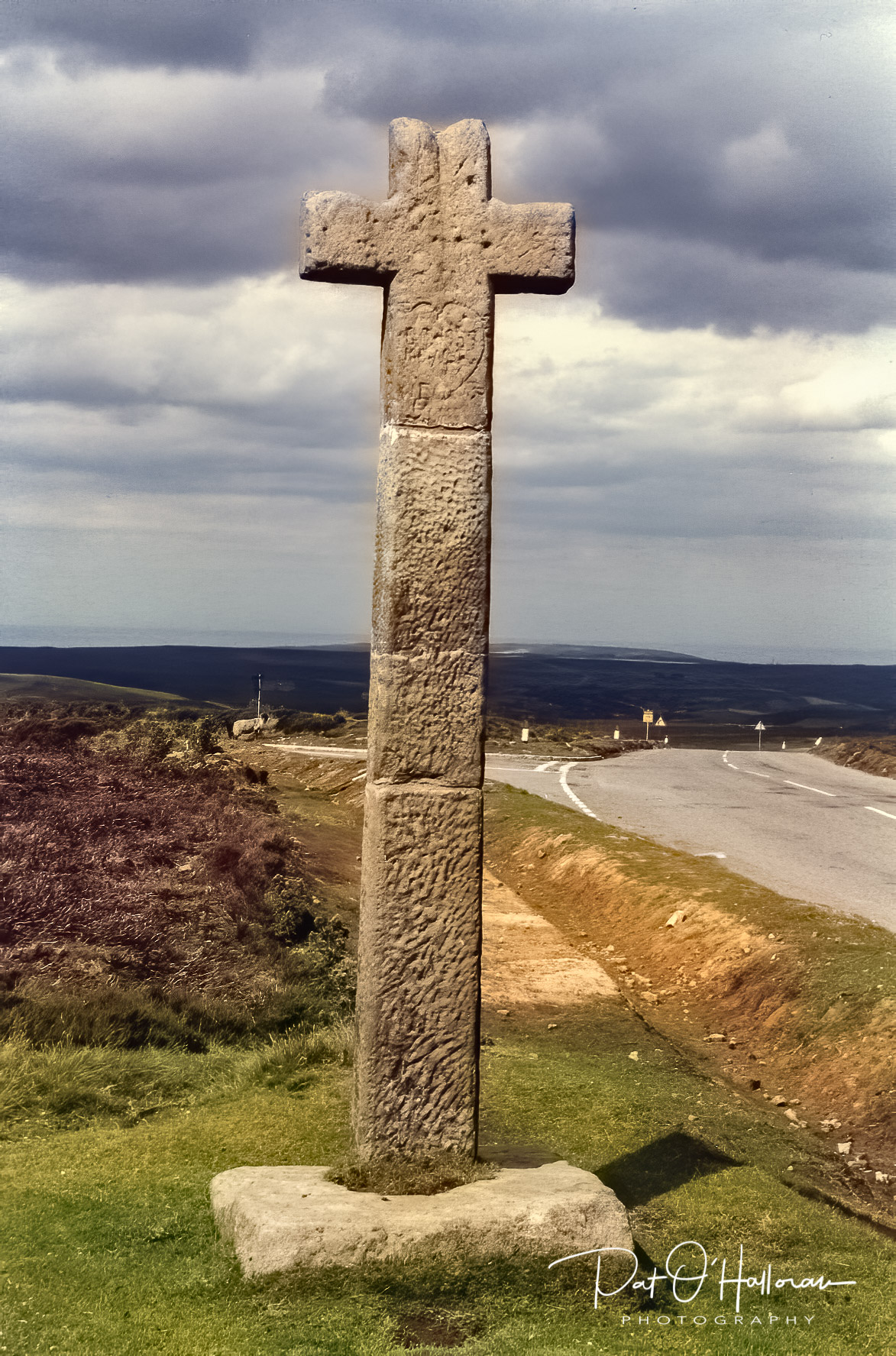
This tradition may stem from the legend that the cross was erected by a local farmer named Ralph after he found a traveller in that spot who had died from exhaustion and exposure, the cross was to mark the spot and guide future travellers along the track.
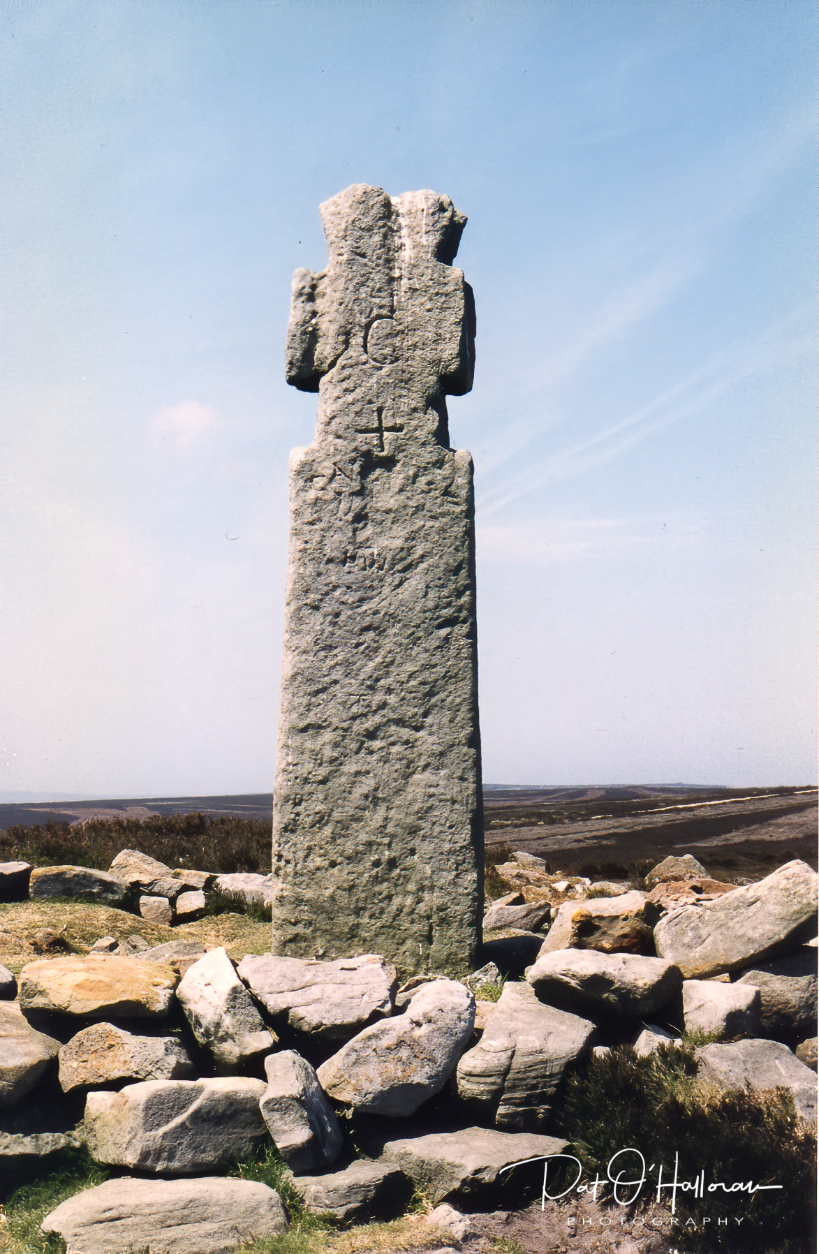
My favourite cross lies about 400 metres from Young Ralph but is hidden from the road by a rise in the ground and is often missed completely by visitors, it goes by the name of Old Ralph.
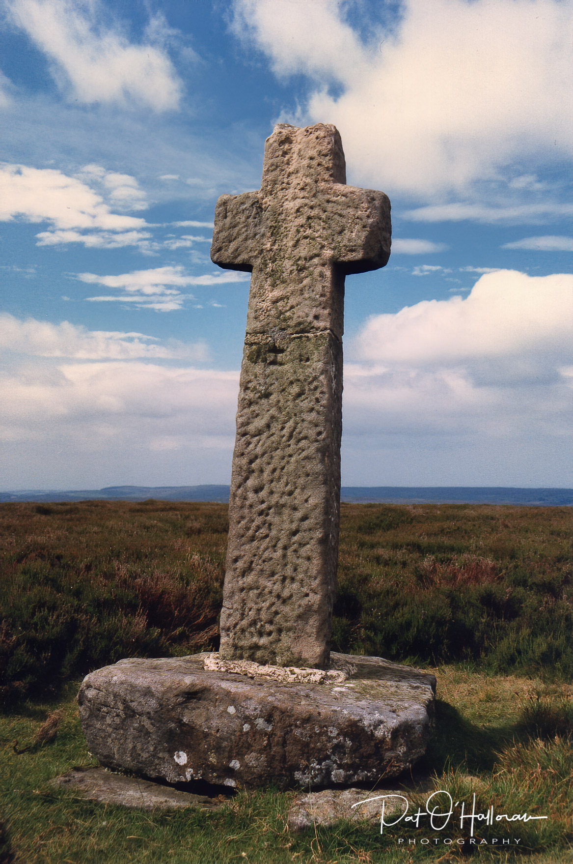
Old Ralph is about a thousand years old and has been sitting up on the hill watching all this time. I like the proportions of the cross and the fact you can sit there and look at the view for miles around, even seeing the sea off Whitby on a good day.
Old Ralph was mentioned in a Guisborough charter of around 1200 and was referred to as “crucem Radulphi”. The shaft has a date of 1708 and the initials CD carved into it leading some to believe it is of that date. However, this is just the repurposing of the cross as a boundary marker by Charles Duncombe, the landowner at that time.
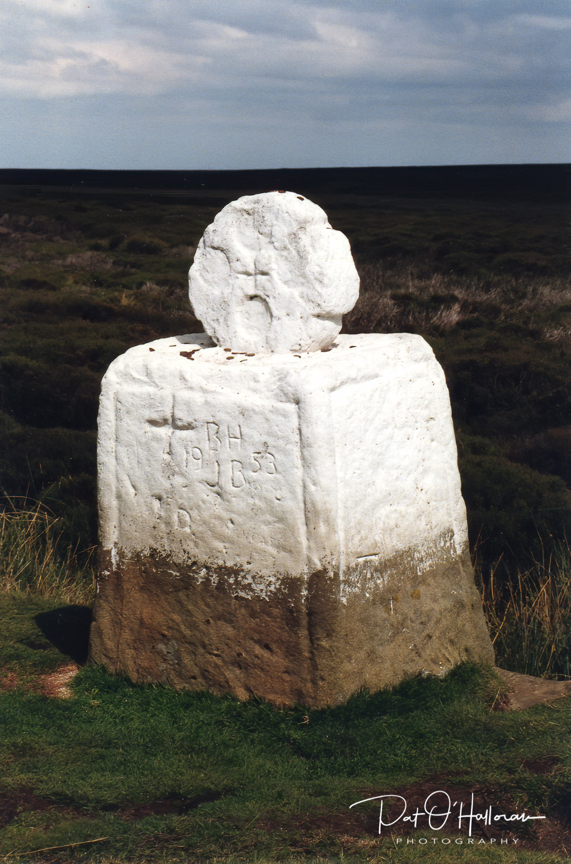
A little to the east of Young Ralph is another well-loved cross on the moors, Fat Betty or White Cross. Although called a cross she has a round, wheel-shaped head. It dates from the 10th or 11th century and the round head would almost certainly once have been on top of a shaft, making it unusual and a rarity in this area. This cross is both a waymarker standing at the side of an old road into Rosedale and also a boundary marker as it sits on the meeting point of Danby, Westerdale and Rosedale parishes.
The final cross in this post is thought to be the oldest cross on the moors. Legend has it that it marks the spot on which Lilla forfeited his life in order to save King Deira by putting himself in the path of an assassin’s dagger. However, the cross is believed to date from the 10th century and Lilla and his compatriots date from the 7th or 8th century. The cross stands on a Bronze Age bowl barrow that has been reused for Anglo-Saxon burials.
The cross sits tucked away behind RAF Fylingdales BMEWS site and is at the junction of two medieval trackways, one of which is the Old Salt Road mentioned in my post on the Saltergate Inn, which runs down to Pickering, the other being the Pannierman’s Way. The cross is important in that it also marks the boundaries of four parishes – Allerston, Fylngdales Moor, Goathland and Lockton. It also marks the boundary of the lands belonging to Whitby Abbey.
I hope to continue this theme and present a few more crosses of the North York Moors in a post in the near future.
References
Mead, H., (1994) Inside The North Yorks Moors. Otley: Smith Settle
Ogilvie, E., Sleightholme A, (1994) An Illustrated Guide To The Crosses On The North Yorkshire Moors, York: The Village Green Press
Peach, H., (2004) Curious Tales Of Old North Yorkshire. Wilmslow: Sigma Leisure.
White, S., (1987) Standing Stones & Earthworks On The North Yorkshire Moors. Scarborough: S. White.